
386 Total Views
Matheran sits at about 800 metres in the Western Ghats of Raigad district, roughly 90 to 105 km from Mumbai by road, and it bans motor vehicles. That single rule shapes everything about a Matheran trek: the paths are red laterite, the only wheels are on a narrow-gauge toy train, and every route eventually ends at a lookout. There is no single trail called the Matheran trek. Instead there are several, from an easy walk up from Neral to a two-day Karjat route and waterfall gullies that count as scrambling. This guide compares the best routes, then covers distances, difficulty, height, camps, jungle trails, the best time to go and how to reach the hill. One timely point: the toy train’s monsoon suspension was scheduled to end on October 15, 2026, and a resumption date has not been confirmed, so check before you plan around it.
Best Matheran Trek Routes
These five routes cover most needs. Distances and times come from operator pages and travel stories, and they vary, so treat them as approximate.
1. Neral to Matheran via Dasturi Naka
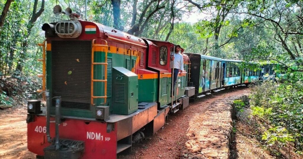
The classic approach is from Neral, where the toy train starts. A travel story from 2013 describes walking about 11 km from Dasturi Naka down to Neral on the descent, or taking a shorter postman’s shortcut. Going up, a shared cab covers the 11 km road from Neral to Dasturi Point, and from there it is a short walk of about 20 to 30 minutes along the railway line to town, according to Wikivoyage, although another account gives 3.5 km and Outlook Traveller puts Dasturi about 2 km short of town. Outlook Traveller also describes a trek up from Neral through forested slopes, but the sources do not give a single distance for that walk.
2. Ambewadi to One Tree Hill Point
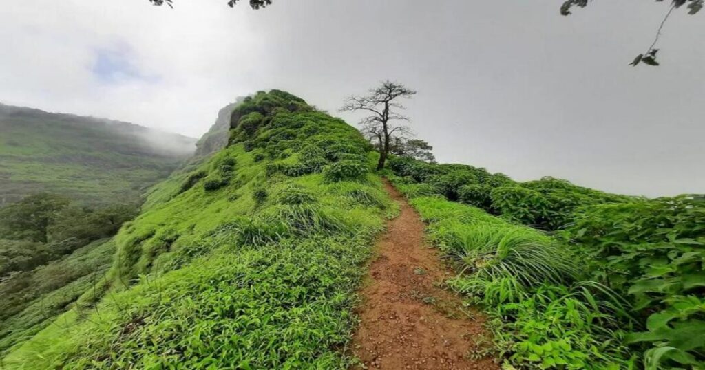
This is the route most often described as a beginner’s trek. It starts at two wells in the village of Ambewadi, about 45 minutes by road from Karjat station, and climbs a long ridge with views of Morbe Dam. After a first plateau and a walk through jungle past the Pisarnath temple, the path climbs the Shivaji ladder, a waterfall section where a flowing stream can cover the path in the monsoon. A blogger puts the climb at about 2.5 hours for a fast trekker, with about an hour on foot from One Tree Hill to Dasturi Naka. Big Chowk Point is about five minutes beyond. The writer recommends carrying your own food and water, because there is little on the route.
3. Karjat to Matheran via Ambewadi: The Two-Day Option
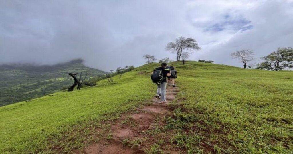
A 2013 travelogue by a local outdoor guide describes a two-day loop: day one from Karjat through Bhorgaon and Ambewadi to Matheran, about 10 to 11 km and 4 to 5 hours, and day two back via Ram Bagh Point and Little Chowk Point to Bhorgaon and Karjat, also about 10 to 11 km. The story warns that the last place to refill water is at Ambewadi. It describes the Shivaji steps as rocky and said to be where Shivaji rode up on horseback, a legend and not a verified fact. The distances date from 2013, and the story is published on a booking platform, so confirm conditions before you go.
4. Garbett Plateau Trek
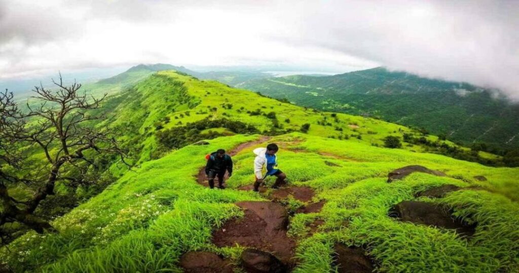
An operator page lists this as a one-day, roughly 8 to 10 km trek of easy to moderate difficulty, running from Bhivpuri Road across Garbett Plateau to Garbett Point and on to Dasturi Naka, with a maximum altitude of about 2,625 feet. The 2013 travelogue gives a longer 12 to 14 km figure for a Bhivpuri to Garbett Plateau route and mentions an 18 to 20 km route from Vangani station. The operator page markets it as ideal for beginners, which sits awkwardly with its easy to moderate rating and stream crossings, so read the label with care. Its figures are self-reported.
5. Waterfall Gullies and Cliff Routes
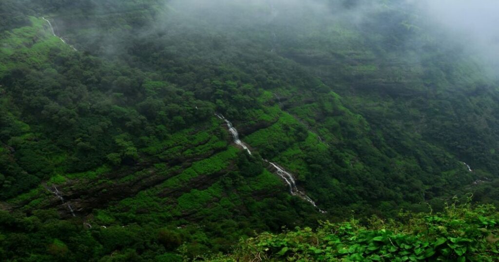
For experienced trekkers, one trekking site groups routes such as Beatrice Cliff, Myra Point, Koltyachi Naal, Kadam Naal, Malet Spring and Vetaleshwar Naal under “difficult,” with rock climbing needed in places. The same page calls waterfall scrambles intermediate in one section and difficult in another, and it says these routes are not suitable in the monsoon, while also praising the waterfalls in the rain. These are not routes for a first visit.
Matheran Trekking: What You See on the Trail?
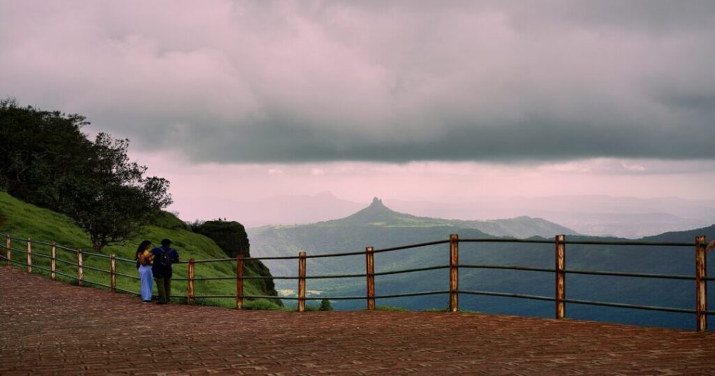
Part of the appeal of Matheran trekking is that every trail ends at a viewpoint. Outlook Traveller counts 38 lookouts and Wikipedia says 40, while Walkopedia says about 33, so there is no agreed total. Named ones include Panorama Point, Porcupine (Sunset) Point, One Tree Hill, Louisa Point, Rambagh Point and Alexander Point. Charlotte Lake is a lake that supplies water to the town, and it overflows during the monsoon.
Wikivoyage says the weeks after the monsoon are the time for wildflowers and butterflies, and that golden langurs, snakes and the Matheran giant squirrel are sometimes seen. Names also vary between sources, so Panorama Point is also called Sunrise Point and Louisa is sometimes spelt Luisa. Maps are available from the MTDC office at Dasturi Naka, according to Outlook Traveller, and the trails interconnect, so a map helps.
Matheran Trekking Distance: How Far Is Each Route?
There is no official Matheran trekking distance, because the answer depends on where you start. The figures below are from the sources above and are not surveyed measurements.
- Dasturi Naka to town: About 2 to 3.5 km, roughly 20 to 30 minutes on the railway line, per different sources.
- Neral to Dasturi: About 11 km by road and about 11 km on foot, per the travelogue.
- Karjat to Matheran via Ambewadi: About 10 to 11 km each way, 4 to 5 hours.
- Garbett Plateau: About 8 to 10 km (operator) or 12 to 14 km from Bhivpuri (travelogue).
- Vangani route: About 18 to 20 km, per the travelogue.
The toy train line itself is 21 km according to Wikipedia’s article on the railway and the Outlook Traveller report, although Wikipedia’s page on Matheran says 20 km. One trekking site gives no distances for any of its routes.
Matheran Trek Difficulty Level: Easy Paths and Hard Gullies
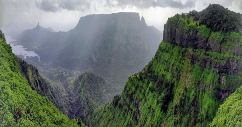
The Matheran trek difficulty level runs from a gentle walk to a scramble. Walkopedia rates walking around Matheran as straightforward, and the 2013 Karjat route is described as easy. The Ambewadi to One Tree Hill route is called a perfect beginner trek by one blogger, with the Shivaji ladder as its main challenge, while Wikivoyage calls One Tree Hill steep and somewhat risky. Most named point treks on one trekking site are grouped as simple, and the waterfall gullies are grouped as difficult. Operator labels can be generous, so the safest reading is easy on the main paths and hard on the gullies, and wet in the monsoon everywhere. Wikivoyage advises thick-soled shoes and a walking stick because the trails are rubbly.
Matheran Trek Height: How High Is the Climb?
The Matheran trek height is usually quoted as the hill station’s elevation: about 800 metres, or 2,625 feet, according to Wikipedia and Britannica (the infobox of Wikipedia’s page says 2,600 feet). The Garbett Plateau operator page gives a maximum altitude of about 2,625 feet, the same figure. None of the sources gives the elevation gain from the starting village, such as Ambewadi or Neral, so the climb itself cannot be stated from them. Distance to the town from the starting point is the better planning figure.
Matheran Trekking Camp: Overnight Options
Camping is sold by tour operators. A Matheran trekking camp run by one operator is listed as near Neral and about 1.5 km from Matheran railway station, with shared tents, mats, vegetarian meals, a campfire and weekend midnight and sunrise treks. It runs as a single overnight stay, with check-in at noon and check-out at 10 AM. The page is a sales page, and its rules, including its cancellation terms, are the operator’s own and not government regulations. It also contains outdated details, such as a toy-train reconstruction expected by December 2022. Official camping rules, permits and fire rules were not found, so check with local authorities and the operator before booking. Prices are not given here.
Matheran Hill Station Trekking: Why It Feels Different
With Matheran hill station trekking, the vehicle ban is the main difference. Automobiles are not allowed, apart from municipal ambulances and e-rickshaws, which were banned until December 6, 2022. Horses and hand-pulled rickshaws are used beyond Aman Lodge, and the Union Environment Ministry declared the area an eco-sensitive zone on February 4, 2003. The town was also briefly shut by a local protest in March 2025, after horse operators at the Dasturi entry were accused of overcharging. Outlook Traveller reported it as indefinite, while a Curly Tales headline says the protest ended after two days, a single-source detail. The history of the place goes back to 1850, when the district collector Hugh Poyntz Malet identified the site, and Lord Elphinstone, then Governor of Bombay, laid the foundations for its development as a hill station.
Also Read: Best Treks Near Mumbai: Top Trails for Adventure Lovers
Matheran Jungle Trek: Forest Paths and Safety
A Matheran jungle trek is mostly a matter of the first plateau on the Ambewadi route, where the path crosses jungle before the climb to One Tree Hill. Wikipedia says the area has a large monkey population and occasional leopard sightings with no reported attacks. Wikivoyage warns that monkeys can snatch belongings, especially food, and advises avoiding forest walks after dark. The 2013 travelogue adds that the forest holds giant red squirrels and many snake species. Start early so you finish before sunset, and do not feed the monkeys.
Also Read: Kalavantin Durg Trek: Complete Guide to Maharashtra’s Peak
What is the Best Time to Visit Matheran for a Trek?
Wikipedia gives temperatures of 16 to 32 degrees Celsius, with March to May above 35 degrees on some days. Rainfall is heavy: about 774 mm in June, 2,036 mm in July, 1,461 mm in August and 659 mm in September, for an annual total of about 5,168 mm. Wikivoyage calls the post-monsoon weeks the best time, with lush greenery, waterfalls and a full lake, while Outlook Traveller says April to June and October are the peak months, when hotel rates rise. One operator lists the Garbett trek for June to September, and the Karjat travelogue says all year, with higher stream crossings in the monsoon, so there is no single answer. The toy train is the catch this year. Central Railway announced that regular Neral to Aman Lodge services would stay suspended from June 15 to October 15, 2026, with a daily shuttle between Aman Lodge and Matheran in the meantime. A resumption date after October 15 was not found. In 2025 the service resumed on November 6, and in 2022 on October 22, so do not assume it is running today.
How to Reach Matheran?
The nearest railhead is Neral, reached on the Mumbai line, and shared cabs run from Neral to Dasturi Point, about 11 km, according to Wikivoyage. Cars cannot enter the town and park at Dasturi. The toy train from Neral to Matheran covers about 21 km and takes about two and a half hours. Distances from Mumbai conflict across sources: Wikipedia gives about 90 km in one place and 100 km in another, Outlook Traveller gives 105 km, Walkopedia says 100 km, and Britannica says about 45 km east of Mumbai, which does not match the road figures. From Pune the distance is about 120 km. Entry fees exist, but the amounts quoted online are dated, so they are not given here.
Also Read: Peb Fort Trek: Vikatgad’s Rock Patch, Caves, and an Easier Climb Nearby at Sondai
Conclusion: Match the Route to Your Legs
A good Matheran Trek depends on the route you pick: the Neral approach and the Karjat loop for an easy day or two, Ambewadi for the Shivaji ladder, and the gullies only for experienced trekkers. Check the toy train, carry water and finish before dark.
Looking for company on your next Western Ghats walk? Open the Explurger app to find travelers heading to Matheran and share the route, the cab and the camp.
FAQs About Matheran Trek
Q2. How difficult is the Matheran trek?
The main paths are rated easy to moderate, and the waterfall gullies are rated difficult. The monsoon makes every route wetter and harder.
Q3. What is the height of Matheran?
About 800 metres, or 2,625 feet, above sea level according to Wikipedia and Britannica. The elevation gain from a trek's starting village is not given in the sources.
Q4. Can you trek from Neral to Matheran?
Yes. Outlook Traveller describes a trek up from Neral through forested slopes, and a 2013 travelogue mentions walking about 11 km from Dasturi Naka down to Neral. Shared cabs also run from Neral to Dasturi.
Q5. Is camping allowed in Matheran?
Tour operators run overnight camps near Neral and Matheran. Official camping rules were not found, so confirm with local authorities and the operator.
Q6. Is the Matheran toy train running?
Regular Neral to Aman Lodge services were suspended from June 15 to October 15, 2026, with a shuttle between Aman Lodge and Matheran. A restart date was not found, so check with Central Railway before you travel.