“I’ve felt the pulse of the earth beneath my wheels and the rush of the wind as my constant companion. This journey was more than a ride; it was a pilgrimage to the altar of thrill, and I’ve returned a changed rider.” – Bhagwan Rawat(Creator of Explurger)
It took me 3 years, multiple hurdles, and a lot of planning to make this trip. But I endured it all for the experience that has changed me. Sach Pass bike ride was a dream come true, a challenging terrain that has been crowned as “one of the deadliest roads in the world”. It was my first expedition with Explurger, where I had connected with some of the people of the Rider community and we took off on our trusted RE machines. The real ride was far different from what Google said it would be, and planning ahead saved us a lot of trouble.
So, this is my attempt to help out the members of the Rider community worldwide if they ever want to take on this daring expedition to Sach Pass.
KEY HIGHLIGHTS OF THE SACH PASS BIKE RIDE: WORLD’S MOST DANGEROUS ROAD
Total Duration: 7 Days (7th – 13th September 2025)
Bike: Royal Enfield Himalayan
Distance Covered: Approx. 2000 km (From Delhi to Delhi).
Terrain: 50% off-road; extremely rugged and covered with snow.
Route: Delhi-Manali-(Atal Tunnel)-Jispa-Killar-Sach Pass-Killar-(Cliffhanger Road)-Kishtwar-Sinthan Top-Pathankot-Delhi.
Let’s talk about the trip
➡️Delhi to Manali: September 7th, 2025 (520 Kms)

2 am and we kicked off from Delhi. We covered a distance of 520 km and were greeted with the view of the Greater Himalayan ranges at about 4 in the evening. The crisp, cool air and the beautiful atmosphere were absolutely worth the 14-hour ride. Manali, at an elevation of 6,730 ft, was our first stop and it acted not only as a resting place but a reviving one. We shared a hot meal and had good conversations about our rides before we had connected on Explurger, and what Sach Pass ride meant to us.

➡️Manali to Jispa: September 8th, 2025 (95 Kms)

A shorter yet thrilling 93-kilometer stretch. Going along the Leh-Manali Highway and passing through the famous Atal Tunnel, the world’s longest highway tunnel at an altitude of 10,000 feet, was exhilarating. The weather here was mercurial—clear skies quickly gave way to mist as we ascended. We left after a good breakfast at around 11.30 am, and by the time we reached Jispa at 3.30 PM, the air was thinner and cooler at 10,500 ft. We spent the chilly night (°C) camping by the banks of the Bhaga River, gathered around a bonfire under the stars, enjoying hearty dhaba-cooked meals.

On the way to Jispa, we had the pleasure of going to Solang Valley. Our pit stops for food and rest. The local hospitality was something that I’ll never forget. We also connected with locals using Explurger’s Explore Your City feature (which lets you check out those who are in and around your city so you can explore more).

➡️Jispa to Killar: September 9th, 2025 (150 Kms)

The third day saw us cover a more challenging 150 kilometers to Killar, a remote village nestled in the Pangi Valley at an altitude of 11,000 feet. The road was rugged, the terrain wild, and nature unyielding. The Tandi-Kishtwar Road tested my riding skills with its narrow, winding paths. Waterfalls gushed down from the cliffs above, turning the trail into a muddy, slippery challenge. By the time we reached Killar around 5 PM (we left Jispa at 10 am), exhaustion mixed with exhilaration.
➡️Killar to Sach Pass and then back to Killar: September 10, 2025 (80 Kms)
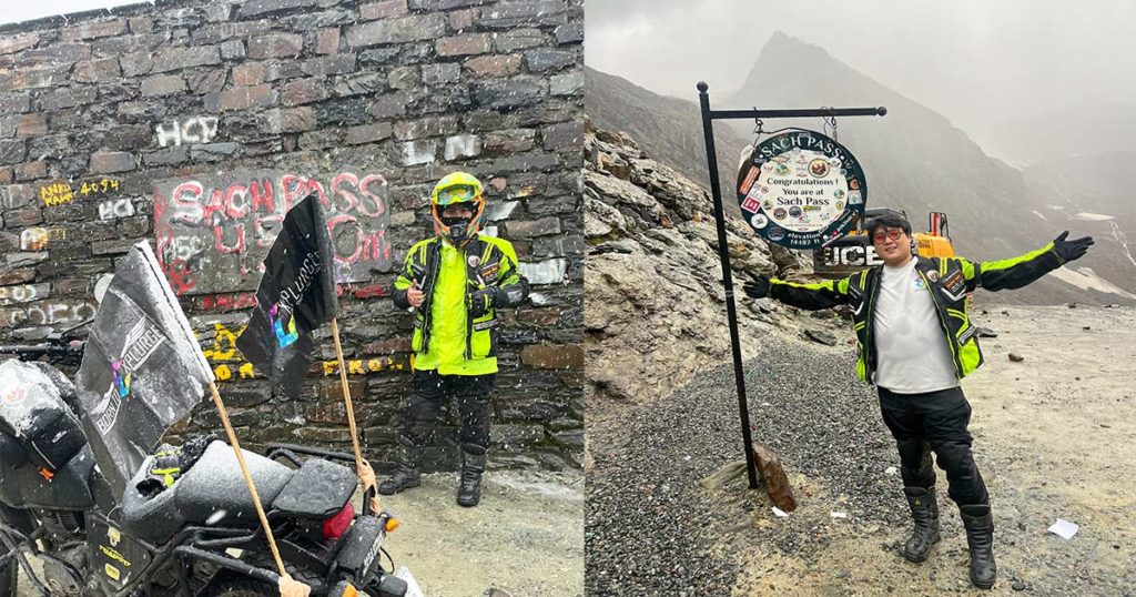
This day, our fourth was the crown jewel of the trip. The ride to Sach Pass, at a staggering altitude of 14,482 ft, was as treacherous as it was awe-inspiring. This was no ordinary road. Google may claim the 40 km towards Sach Pass is a 4-hour round trip, but with the rain, slush, and even snowfall along the way, it took nearly double the time (we left Killar at 9 am and reached Sach Pass at 12.15 pm). The weather kept shifting—rain soaked us as we started, and snowflakes greeted us as we ascended higher. The roads were almost non-existent in some places, with only narrow ledges separating us from deep valleys.

After exploring Sach Pass as best as we could amidst the snowstorm, we left back for Killar at 1 pm and reached at 4 pm. In the entire stretch from Killar to Sach Pass, there is only one joint that serves food and acts as a shelter amidst the ever-changing weather. Despite wearing rain liners, all our riding gear and clothes got soaked from the continuous heavy rain. Thankfully, the cook at the shelter helped us dry them to some extent by using a bonfire that was also keeping them warm in the chilly weather. We enjoyed a hearty and delicious Maggie, Rajma rice meal and a hot tea that energized us for the journey ahead.
➡️Killar to Kishtwar via Cliff Hanger Road: September 11, 2025 (120 Kms)

On the fifth day, the infamous Cliffhanger Road awaited us. We left from Killar at 9 am.
The 120-kilometer stretch from Killar to Kishtwar is known to be one of the most dangerous roads in the world and it took us 7 hrs to reach Kishtwar at 4 pm. Narrow, winding, and cut into the mountainside, this road gives the impression of riding on the edge of a precipice, with nothing but sheer drops on one side. The recent rains had turned the already precarious path into a muddy, slushy ordeal. We faced a very tricky situation when a sudden landslide halted us all. The locals, as well as the Border Roads Organisation (BRO) paved the way for the riders to pass through, and we left after 15 minutes. At times, we had to help each other lift fallen bikes—another reminder of the camaraderie that had formed among us. As we finally descended into Kishtwar, the sight of the small town felt like a hard-earned victory.
➡️Kishtwar to Sinthan Top: September 12, 2025 (158 Kms)


The penultimate leg of the journey (Day 6) took us from Kishtwar to Sinthan Top, a high-altitude pass at 12,500 ft, before heading down to Pathankot. Leaving at 9 am from Kishtwar, the 79 kilometers to Sinthan Top was smooth at first but turned tricky as we ascended and finally reached 12 pm. Once again, the weather played its role, with rain making parts of the road slick. But the view from the top was worth every slippery turn.

We made our way back to Kishtwar and it took us two hours. After a short rest, we bade our farewell and left for Pathankot at 3 pm (reached at 11 pm).
➡️Pathankot to Delhi: September 13, 2025 (487 Kms)

The final leg, 487 kilometers from Pathankot to Delhi, brought us full circle. Traveling for around 12 hours, the straight highways of NH44 felt like a breeze after the rollercoaster of the last few days. This was a day of reflection, of savoring the memories of the adventure that had just unfolded.
Important Facts One Must Know Before Planning a Sach Pass Bike Ride
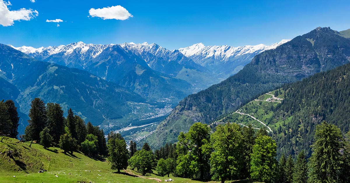
- It is nestled in the Pir Panjal range of the Himalayas and connects the remote Pangi Valley in Himachal Pradesh to the more accessible regions of Chamba and Dalhousie.
- At the top of Sach Pass, there is a small temple dedicated to Lord Shiva, known as Mahadev Temple.
- Sach Pass is in a remote part of the Himalayas, far removed from civilization.
- The weather at Sach Pass is famously unpredictable. Even in the summer months, the pass can see rain, hail, or snowstorms, making it a challenge for travelers. The road is open for only a few months each year (usually between June and October), and the pass is often closed due to heavy snowfall in the winter months.
Two Different Terrains For Reaching Sach Pass On A Bike Trip:
- From Killar(via Pangi Valley) – The Adventurous Route:
Route: Killar → Sach Pass
Distance: 40 km (one way)
Terrain: This is the more challenging and adventurous route, known for its narrow roads and sharp inclines.
- From Bairagarh(via Chamba/Dalhousie) – The Easier Route:
Route: Dalhousie → Bairagarh → Sach Pass
Distance: 150 km (from Dalhousie to Sach Pass) & 40 Km (from Bairagarh to Sach Pass)
Terrain: This route is slightly easier compared to the Killer route, but still challenging due to the steep ascents and sharp hairpin turns.
The Cliffhanger Road- World’s Most Dangerous Road (A Bike Ride to Remember)

- The Cliffhanger Road, stretching from Killar in Pangi Valley (Himachal Pradesh) to Kishtwar in Jammu and Kashmir, is one of the most thrilling and dangerous roads in the world that spans 114 km.
- It ascends from 5,374 feet in Kishtwar to 8,091 feet in Killar.
- The road is incredibly narrow, often no more than a single vehicle’s width, with no barriers to protect you from the sheer drops that plunge hundreds of meters down.
- Unlike well-maintained mountain highways, the Cliffhanger Road is a raw, unpaved trail of dirt, loose rocks, and mud. There’s no tarmac here—just rough gravel paths that are prone to landslides and rockfalls, especially after rain. The uneven terrain requires constant focus and careful navigation, adding to the danger.

Looking back, it wasn’t just the thrill of riding through the world’s most dangerous roads that made this journey special—it was the people, the connections, and the shared passion for exploration. Thanks to Explurger, I found fellow travelers who not only shared my love for adventure but also helped make the Sach Pass ride more fulfilling. Through the platform, I’ve built friendships that will last beyond this trip, and I’m already planning my next adventure, knowing I won’t have to ride it alone.
FAQ’s about Sach Pass Bike Ride
What is the altitude of Sach Pass?
The altitude of Sach Pass is 14,482 ft (4414.1136 meters) above sea level.
What are the different routes one can take to reach Sach Pass?
-Via Killar (more adventurous and difficult): From Manali → Killar → Sach Pass
-Via Bairagarh/Dalhousie (slightly easier): From Dalhousie → Bairagarh → Sach Pass
What is the best season to visit Sach Pass?
The best time to visit Sach Pass is from June to mid-October. The pass is snow-covered the rest of the year, making it impassable.
Do you get network connectivity throughout the journey?
Network connectivity is sparse. Jio Postpaid is generally available, except at the top of Sach Pass, where connectivity drops off.
What all things to carry on a Sach Pass Bike Trip?
1. Riding Gear (Armour Jacket, Riding pants with knee guard & riding boots)
2. A full-face Helmet & Riding gloves
3. Balaclava / Buff / Dust mask
4. Saddlebags/ Magnetic tank bag/ Luggage carrier- To keep your handy valuables like Cameras, Batteries, Chargers, Wallets, Documents & Energy bars, etc.
5. Comfortable clothes: tracks, rain liners, tee-shirts, etc as per the itinerary.
6. Medical Kit(Crocin, Pain Relief Spray, Bandages, Diamox, Ointment etc)
7. Gumboots or Waterproof Socks, a pair of slippers for the night, an extra pair of socks, etc.
8. Sunglasses, caps or hats, sunscreen lotion and insect repellents
9. Toiletries(Tooth Brush, Soap, Shampoo, Lotion, Deodorant etc)
10. Hydration Bags or Water bottles etc.
What are all the documents to keep in a Sach Pass ride?
1. Driving License, Bike Insurance, and PUC Certificate along with hard copies.
2. Medical Insurance, and Travel Insurance.
3. You should carry an ID such as your Aadhaar card or passport along with hard copies.
