
50 Total Views
At 1,403 metres, Torna is the highest hill fort in Pune district, and it holds a place in Maratha history to match its height — this was the very first fort Shivaji Maharaj captured, at just sixteen years old, the opening move of what would become the Maratha empire. The torna fort trek is popular with Pune’s weekend trekking crowd for exactly that combination: a genuinely testing climb through Sahyadri forest and rocky fort walls, topped with sweeping views and centuries of history at the summit. This guide covers the distance and time from the base village, the route and difficulty, the best season to go, and how to reach the start point from Pune.
Best Torna Fort Trek Guide
Before the logistics, it helps to know what makes Torna worth the climb in the first place — its history and what’s still standing at the top.
History of Torna Fort
Torna’s original name was Prachandagad, from the Marathi “prachanda,” meaning huge or massive — a fitting name for a fort built across a steep, sprawling hilltop in the Sahyadri range. In 1646, a sixteen-year-old Shivaji Maharaj captured it, taking advantage of internal confusion within the Bijapur Sultanate at the time, and it became his first fort — the starting point of a campaign that would eventually build the Maratha empire. Shivaji renamed it Torna, and during repairs to the fort he is said to have discovered a large quantity of buried gold, wealth that went on to fund the construction of other forts, including nearby Rajgad, which later served as the Maratha capital for over two decades. That history is a large part of why Torna draws as many trekkers as it does — it isn’t just a viewpoint, it’s the place the Maratha story effectively begins.
Architecture and Structures
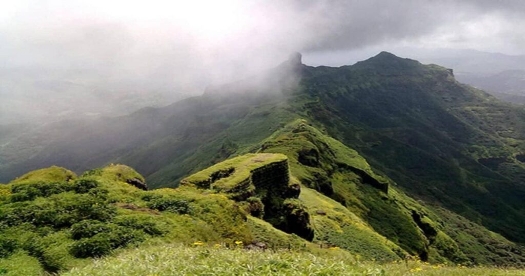
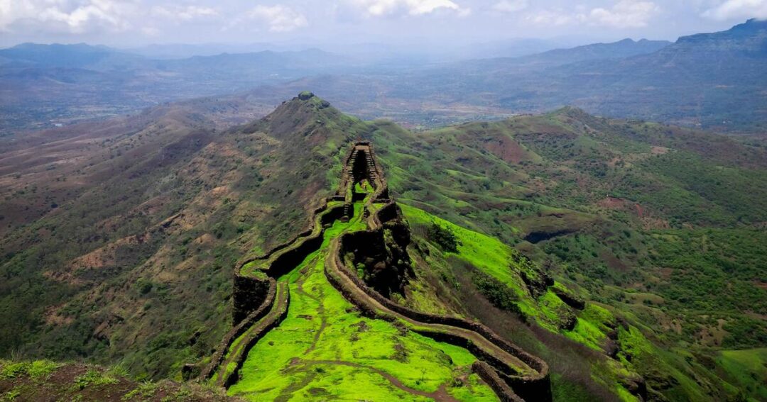
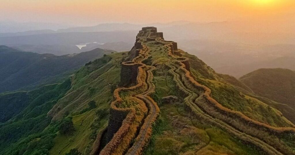
Torna’s defenses are built around its two main promontories, known locally as machis — Zunjar Machi and Budhla Machi — long fortified ridges extending off the main hilltop that would have let defenders watch approaches from multiple directions at once. Bini Darwaja, the fort’s first gate, and Kothi Darwaja, its main entrance, are reached only after climbing a stretch of fort wall pitched at roughly 60 to 70 degrees, with rock-cut steps and railings installed for trekkers today. Inside, the fort holds the Menghai Devi temple — also known as the Tornaji temple, after which the fort takes its popular name — along with the remains of watchtowers and bastions built up during Shivaji’s rule. Overnight stays on the fort are currently prohibited by district administration order, so visitors are expected to be back down, or off the plateau, by 5 PM.
Torna Fort Trek Distance: Full Breakdown
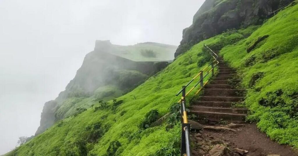
The torna fort trek distance — and the torna fort trek distance in km specifically, since both phrasings turn up in the same searches — comes out to roughly 3.4 km of actual trekking one-way from the base village of Velhe to the fort entrance, broken into two distinct stretches:
- Velhe to the plateau: About 1 km, a comparatively gentle opening stretch that gains height gradually before the trail steepens.
- Plateau to the fort entrance: About 2.4 km, the section that does most of the climbing — a ridge walk followed by the steep, rock-cut final approach to Bini Darwaja.
Altogether, trekkers gain roughly 2,500 feet of elevation from the base to the fort, which is a meaningful climb packed into a relatively short horizontal distance — a large part of why Torna feels tougher underfoot than its total kilometre count would suggest.
Torna Fort Trek Time: How Long Does It Take?
Budget five to eight hours for the full torna fort trek time, door to door — this includes the climb up, time spent exploring the fort itself, and the descent back to Velhe. A rough breakdown looks like about 20 minutes for the first stretch to the plateau, roughly two hours to two hours fifteen minutes for the steeper climb from the plateau to the fort entrance, and another three to four hours if you want to properly explore both machis, the temple, and the bastions before heading back down. Most groups start early, aiming to reach Velhe by 6 to 7 AM, both to beat the heat on the exposed upper sections and to comfortably finish before the fort’s 5 PM cutoff.
Torna Fort Trek Map and Route
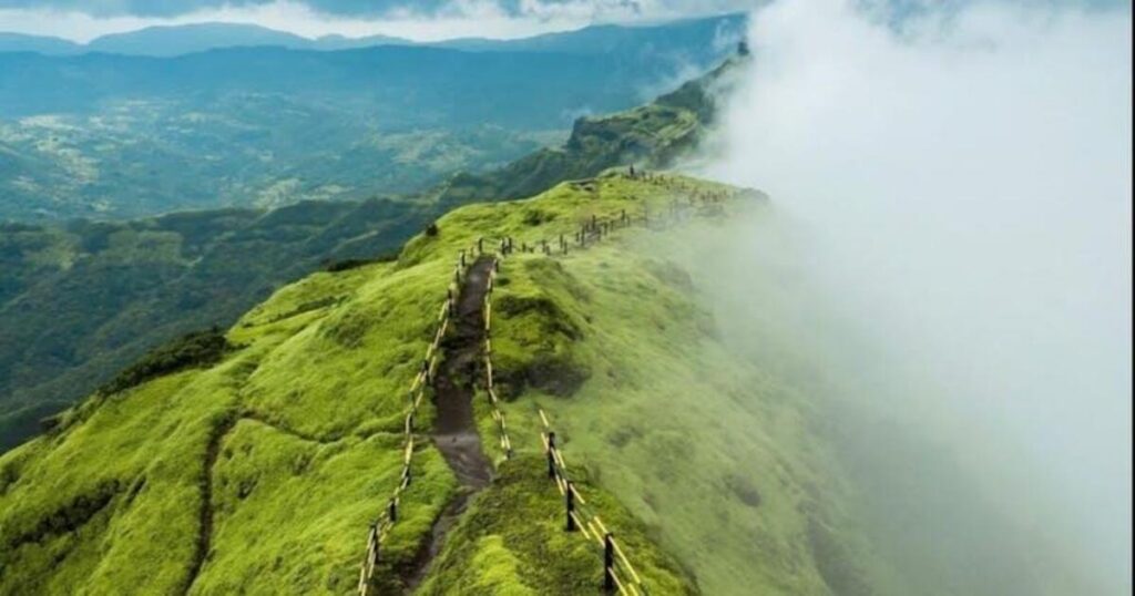
The torna fort trek map is straightforward in outline even though the trail itself is demanding: the route begins at Velhe Police Station, where most trekkers park or get dropped off, and heads out through open flower beds before entering a dense forest of Karvi plants that flowers in a rare mass bloom every seven to eight years. The trail crosses a stream, then climbs a ridge that opens into views back over the Velhe valley, before reaching the base of the fort’s summit wall. From there, the final push is the steepest part of the whole route — a 60 to 70 degree rock face fitted with cut steps and iron railings — which leads up to Bini Darwaja and then Kothi Darwaja, the fort’s main entrance. On a clear day, the summit offers views toward several other forts in the region, including Rajgad, which sits along a connecting ridge that experienced trekkers sometimes use as a longer, multi-hour extension between the two forts.
Is the Torna Fort Trek Easy or Hard?
Whether the Torna Fort trek is easy or hard really depends on what you’re comparing it to: it’s rated moderate on most trekking guides, but that rating undersells the final approach. The lower stretch through the Karvi forest and up to the plateau is manageable for most reasonably fit first-timers, but the climb from the plateau to Bini Darwaja is steep, rocky, and exposed in a few places, with the rock-cut steps and railings there specifically because the incline is too sharp to manage safely without them. Compared with an easier introductory trek like nearby Tikona Fort, Torna is a clear step up—sturdy trekking shoes, enough water for a full day, and reasonable fitness all matter more here than they would on a beginner trail, and it’s not the best choice for a first-ever trek or for young children.
Torna Fort Trek Start Point
The torna fort trek start point is Velhe village, roughly 65 km southwest of Pune, and specifically the area around Velhe Police Station, where the trail head begins. Velhe is a small village with a handful of basic homestays and food stalls, making it a workable spot to fuel up or refill water before setting out, and it also serves as the base village for treks to nearby Rajgad Fort, so it sees a steady stream of trekkers heading in both directions through the trekking season.
Also Read: Things to Do in Pune: 20 Best Experiences for Every Kind of Traveller
What is the Best Time to Visit Torna Fort?
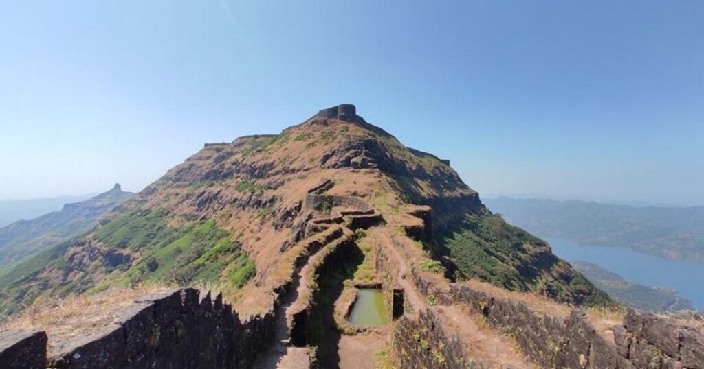
September through February is the trekking window for Torna, with two distinct highlights inside it: September and October bring the tail end of the monsoon greenery and wildflowers along the lower slopes, while November through February offers the clearest skies and the best long-range views from the summit. The monsoon months from June to August turn the steep upper sections slick and are best avoided, and the peak of summer from March to May brings harsh, exposed heat on a trail with very little shade, which makes the climb considerably tougher than it needs to be.
How to Reach Torna Fort?
From Pune, the most direct route to Velhe runs via NH48 toward Nasrapur, crossing the toll and turning onto State Highway 65, which leads straight into the village — a drive of roughly 65 km that takes about two hours depending on traffic. A more scenic alternative runs via Khadakwasla and Sinhagad Fort, continuing through Ranjane and over Pabe Ghat before dropping into Velhe, a longer but more rewarding drive for anyone with a vehicle. Public buses run from Pune to Velhe, though with limited frequency, and Nasrapur junction is a reliable fallback, with local taxis available from there for the last stretch when a direct bus isn’t running on schedule.
Also Read: Rajgad Fort Trek: The Complete Guide to Shivaji’s Mountain Capital
Conclusion: Earning the View at Torna
Torna rewards the effort it demands — a steep final climb up rock-cut steps to a fort that quite literally started the Maratha empire, with views across the Sahyadris to match. Whether the torna fort trek is your first serious hill fort or one of many, going early, carrying enough water, and respecting the 5 PM descent cutoff will make the difference between a good day and a rushed one.
Planning a Sahyadri fort trek? Let the Explurger app help you map the route, timing, and travel details before you set out.
FAQs About Torna Fort Trek
2. What is the distance of the Torna Fort trek?
The trek covers roughly 3.4 km one-way from Velhe village to the fort entrance — about 1 km to the plateau, then 2.4 km of steeper climbing from the plateau up to Bini Darwaja — with a total elevation gain of around 2,500 feet.
3. How long does the Torna Fort trek take?
Most trekkers take five to eight hours round-trip, including the climb, time exploring the fort's machis and temple, and the descent, which usually means starting from Velhe by 6 or 7 AM.
4. Where does the Torna Fort trek start?
The trek starts at Velhe village, about 65 km southwest of Pune, specifically from the area around Velhe Police Station where the trail head begins.
5. Why is Torna Fort historically important?
It was the first fort Shivaji Maharaj captured, in 1646 at age sixteen, marking the start of the campaigns that built the Maratha empire; gold discovered during repairs is also said to have funded the construction of Rajgad Fort nearby.
6. What is the best time to do the Torna Fort trek?
September through February is best, with September-October offering post-monsoon greenery and wildflowers, and November-February giving the clearest views; the monsoon and peak summer months are best avoided for safety and comfort.