
195 Total Views
Few Himalayan treks pack forest, meadow and a 360-degree ridge view into six days with an easy-to-moderate grade, and the Phulara Ridge Trek is one of them. It starts from Sankri in Uttarakhand’s Uttarkashi district, climbs through forest to high campsites, crosses a ridge at about 3,700 m and drops to the village of Taluka. This guide covers five highlights, the best time to go, location, height, distance, a day-by-day itinerary and difficulty. Almost every figure comes from trek operators, and they disagree, so the numbers below are ranges, and the post notes where they conflict.
Best of the Phulara Ridge Trek
These five highlights explain why trekkers choose this route over its better-known neighbours.
1. The 360-Degree Ridge Panorama
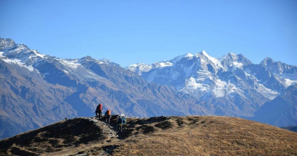
The ridge is the reason to come. One operator says it gives a 360-degree view that includes Swargarohini (6,252 m) and Kala Nag (6,387 m). The same page warns that parts of the ridge are narrow and scree-covered, and that strong uphill winds are common at the top, so hold on to caps and phones.
2. Forests, Meadows and a Village Stretch
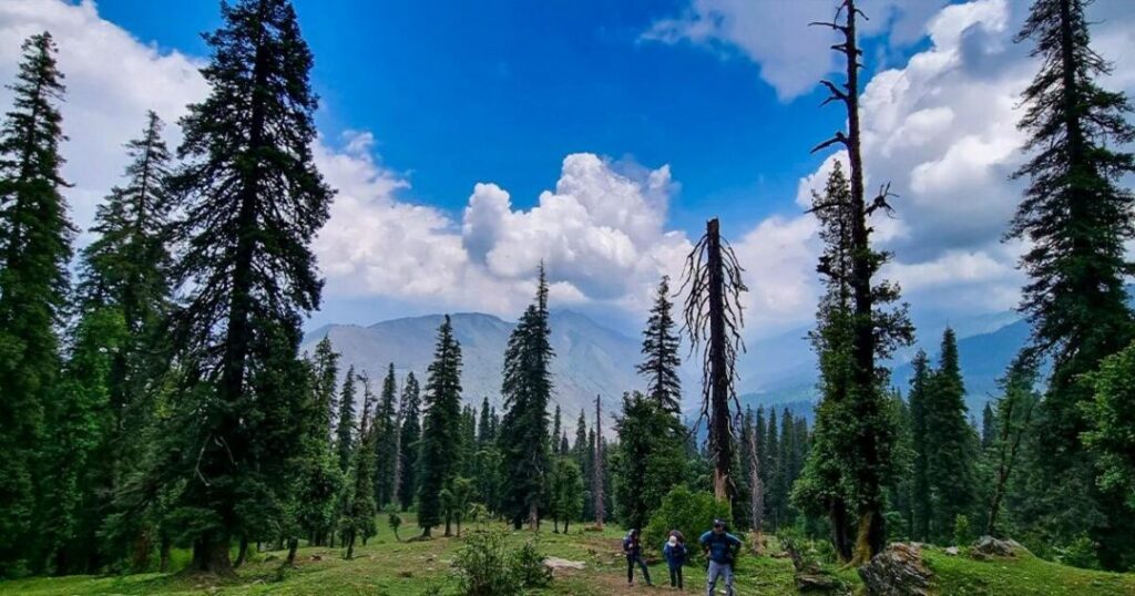
Operators describe dense forest, open meadows and a village on the route, with summer wildflowers on the higher slopes. A trekker who walked it with a group in spring describes a pine forest on the acclimatisation walk and rolling grasslands on the way down.
3. Juda Ka Talab Camp
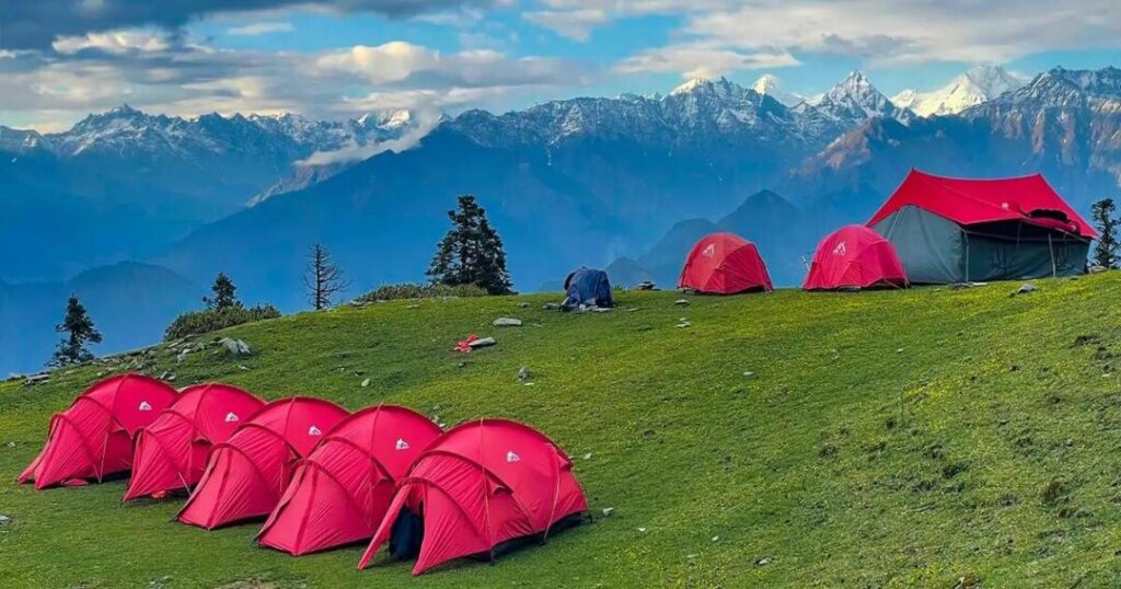
The first night on the trail is at Juda Ka Talab, a campsite in the Govind sanctuary. A trekker’s account places the camp at about 2,900 m (9,500 ft) after a steady climb from Sankri.
4. Bhoj Gadi and the Kedarkantha View
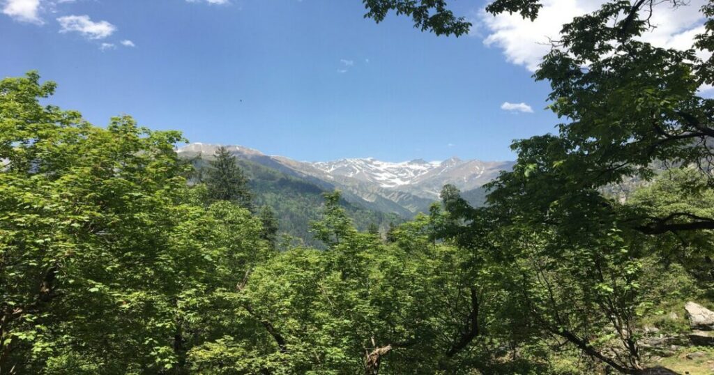
Bhoj Gadi is the high camp below the ridge, at about 3,400 m. One operator says Kedarkantha peak is visible during the ascent to it. The camp is exposed to cold winds, so layers matter.
5. A Different Way Down to Taluka
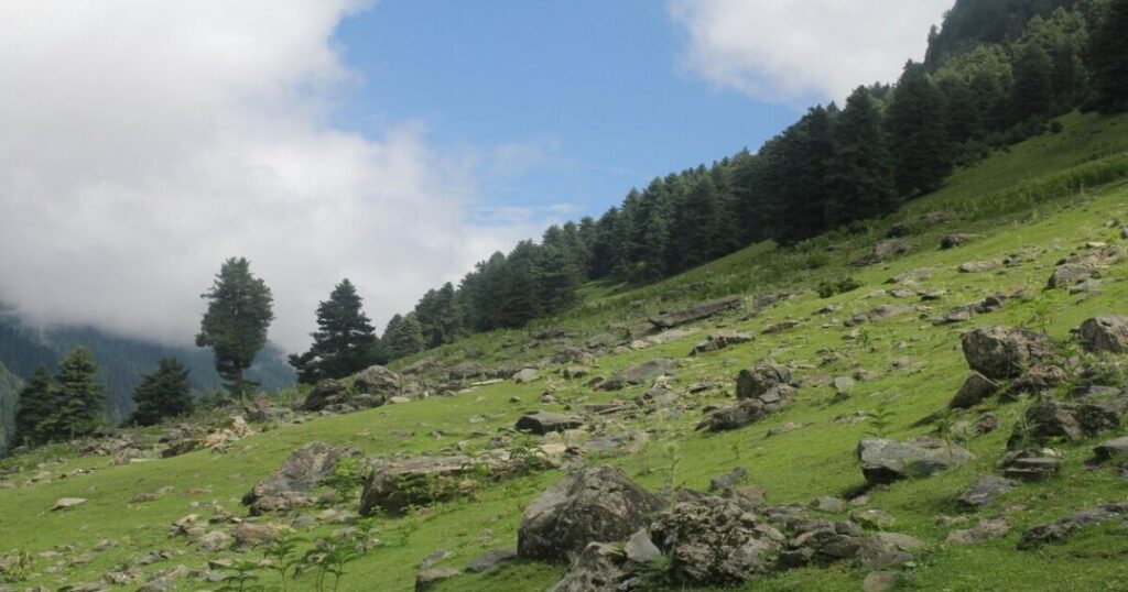
Most itineraries end by dropping to Pushtara and then Taluka, so you do not retrace your steps. That makes the trek a circuit that starts and ends in Sankri, with a short drive from Taluka at the finish.
Phulara Ridge Trek Best Time: Month by Month
Sources agree on two seasons and disagree on the exact edges. Anyone choosing the Phulara Ridge Trek best time should look at these windows.
- Late April to June (summer): Operators give anything from late April to June, or just May and June. Summer brings meadow flowers and clear views, but a group that trekked from April 28 to May 3 met snow and hail, and turned back from the ridge because heavy snow blocked the traverse.
- July and August (monsoon): One operator says to avoid these months because heavy rain can make the trek challenging and dangerous. Lower slopes of the Govind park get about 1,500 mm of rain in July and August, according to the Wildlife Institute of India.
- September to mid-November (autumn): Operators describe stable weather and good visibility. Some list September to November, others mid-September to mid-November.
- December to March (winter): Operators say the trek is not allowed or not recommended because of snow and icy roads. Sankri itself gets snowfall in January and February, according to Wikipedia.
Season note: As of late October 2026, the autumn window is closing. Nights can drop below freezing at the high camps, and no source gives month-by-month temperatures. Ask your operator whether the trek is still running late in the season.
Phulara Ridge Trek Location: Where It Is
The Phulara Ridge Trek Location is the Govind Pashu Vihar area of Uttarkashi district in Uttarakhand, in the Garhwal Himalaya. The Wildlife Institute of India describes Govind National Park and the Govind Pashu Vihar sanctuary as covering about 958 km², with part of the Upper Tons Valley notified as a sanctuary in 1955 and the national park notified in 1991. The base village is Sankri, at about 1,950 m in Mori tehsil, about 200 km from Dehradun by road, and Wikipedia calls it the last road point in the sanctuary. Sankri is also the starting point for Har Ki Dun and Kedarkantha.
Phulara Ridge Trek Height: Altitudes Compared
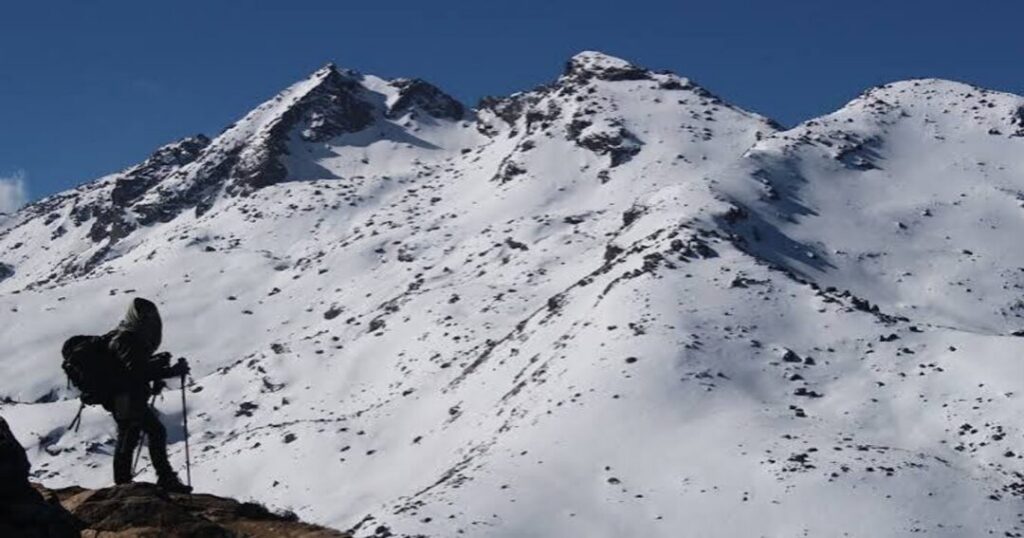
Sources do not agree on the Phulara Ridge Trek Height. The ridge top is given as about 3,700 to 3,750 m (roughly 12,100 to 12,350 ft), with figures of 12,127 ft, 12,150 ft, 12,172 ft, 3,700 m, 3,710 m and 12,345 ft appearing on different pages. One operator blog says about 3,800 m. These are the altitudes by stop, shown as ranges because operators differ:
- Sankri: About 1,950 m (6,400 ft).
- Juda Ka Talab: About 2,700 to 2,900 m (8,800 to 9,500 ft).
- Bhoj Gadi: About 3,400 m (11,100 to 11,200 ft), although one page also lists 2,800 m.
- Phulara Ridge: About 3,700 to 3,750 m, as above.
- Pushtara and Taluka: Taluka is given as about 2,100 m (6,900 ft). Pushtara is given as 2,800 m, 9,500 ft or 11,155 ft, so confirm it with your operator.
Phulara Ridge Trek Distance: How Far You Walk
The Phulara Ridge Trek Distance is given as 25 km, 26 km, 29 km or about 30 km depending on the operator. One page’s own daily distances add up to about 27.5 km, and a spring group that turned back from the ridge estimated 46 km for their out-and-back trek. The difference comes from route variants and whether the final day’s walk to Taluka is counted. The ridge walk itself is described as about 8 to 9 km in one place and about 4 km in another, so treat per-day figures as approximate.
Phulara Ridge Trek Itinerary: Six Days
A typical Phulara Ridge Trek Itinerary runs six days from Dehradun. Ranges show where operators differ.
- Day 1, Dehradun to Sankri: A drive of about 185 to 231 km, taking 7 to 11 hours depending on the source and the road.
- Day 2, Sankri to Juda Ka Talab: About 4 to 7 km, taking 4 to 5 hours. One operator inserts a stop at Sikolta.
- Day 3, Juda Ka Talab to Bhoj Gadi: About 5 to 7 km, taking 4 to 6 hours, with the steepest climb of the trek. One operator describes about 500 m of ascent at a gradient close to 50 degrees.
- Day 4, Bhoj Gadi over the ridge to Pushtara: About 8.4 to 11 km, taking 6 to 7 hours, and the main day. One operator advises carrying at least 2 litres of water because there is no source on the ridge.
- Day 5, Pushtara to Taluka: About 8 to 12 km, taking 5 to 7 hours, followed by a 12 km drive to Sankri.
- Day 6, Sankri to Dehradun: A drive of 9 to 10 hours.
Also Read: Treks in Meghalaya: Best Trails, Routes, Difficulty & Best Time
Phulara Ridge Trek Difficulty: How Hard Is It?
The Phulara Ridge Trek Difficulty is rated easy by one operator, easy to moderate by two and moderate by another. Beginners with basic fitness can manage it, but the page that rates it easy also warns that without standard fitness an easy trek can turn difficult. The trekker who walked it in spring described steep, boulder-strewn climbs, breathlessness and slippery descents, and found a walking stick essential. These points matter most:
- Day 3 climb: The steepest ascent, to Bhoj Gadi.
- The ridge: Narrow, scree-covered sections and strong winds, so stay close to your guide.
- Weather: Snow, hail and rain forced a change of plan on the spring trek.
- Fitness and health: One operator lists health screening rules and says trekkers with heart, lung or neurological conditions are not eligible. Another advises against the trek for severe knee or back problems or a fear of heights.
- Medical access: One operator says the nearest hospital is in Mori, about 21 km from Sankri.
Also Read: Vasota Fort Trek: A Complete Guide to Maharashtra’s Boat-and-Jungle Fort
What is the Best Time to Visit Phulara Ridge?
Summer (late April to June) offers wildflowers and clear views but can bring snow early in the season, while autumn (September to mid-November) is described as stable with good visibility. Monsoon and winter are best avoided. Choose May and June or mid-September to October if you want the most reliable window.
How to Reach Phulara Ridge?
Most trekkers reach Dehradun first. Jolly Grant Airport is about 25 km from the city, and Dehradun Railway Station has trains from Delhi and other cities. Delhi to Dehradun is about 248 km and 6 to 8 hours by road, according to one operator. Operators typically pick up at Prince Chowk near the railway station between about 6:00 and 7:30 am on Day 1, then drive to Sankri. Return drop-offs are listed between 6:30 and 7:30 pm, and one operator advises planning onward travel after 8 pm and keeping a buffer day. There is no road beyond Sankri.
Booking note: Operators list prices of about Rs 9,500 to Rs 11,500 per person plus 5 percent GST, with transport, offloading and insurance often extra. One operator says forest entry charges for Indian nationals are included, and international visitors pay more. Compare inclusions before you book, and confirm permits with the operator.
Also Read: Matheran Trek: Routes, Difficulty, Distance and Camps
Conclusion: A Gentle Introduction to Ridge Trekking
The Phulara Ridge Trek suits beginners who want a Himalayan ridge without a very high pass: forest, meadow, a view of Swargarohini and a circuit that starts and ends at Sankri. Go in May, June or autumn, carry layers and water, and confirm distances and altitudes with your operator, because published figures vary.
Planning a Garhwal trek? Open the Explurger app to find trekkers heading to Sankri on the same dates.
FAQs About Phulara Ridge Trek
2. How difficult is the Phulara Ridge trek?
Operators rate it easy, easy to moderate or moderate. The steepest climb is on Day 3 to Bhoj Gadi, and the ridge has narrow, scree-covered sections and strong winds. Basic fitness is needed, and weather can change the plan.
3. What is the best time for the Phulara Ridge trek?
Late April to June and September to mid-November are the usual seasons. Early-season groups can meet snow, monsoon is best avoided and operators describe winter as closed or not recommended.
4. How long is the Phulara Ridge trek?
It is usually six days from Dehradun, including two driving days, and about 25 to 30 km of walking according to operators. The route is a circuit from Sankri via Juda Ka Talab, Bhoj Gadi, the ridge, Pushtara and Taluka.
5. Where is the Phulara Ridge trek?
In the Govind Pashu Vihar area of Uttarkashi district, Uttarakhand. The base village is Sankri, about 200 km from Dehradun, which is also the base for Har Ki Dun and Kedarkantha.
6. Is the Phulara Ridge trek good for beginners?
Operators market it to first-time trekkers and fit families, with one rating it easy. It still involves steep climbs, altitude above 3,000 m and changeable weather, so prepare with regular walking and follow your guide.