
151 Total Views
You’ve done the popular Himalayan treks, and the crowded trails no longer feel like an adventure. Long queues at campsites and littered paths take the wildness out of the mountains.
Meanwhile, one of India’s most remote high-pass routes sees only a handful of groups each season. The Bailey Trail trek in Arunachal Pradesh crosses four high passes, empty alpine valleys and Monpa grazing lands, with hardly another trekker in sight.
This guide covers everything you need: the route map, distance, cost, packages, permits and the best season to go.
Best Bailey Trail Trek Highlights You Shouldn’t Miss
Bailey Trail Trek Arunachal Pradesh Location
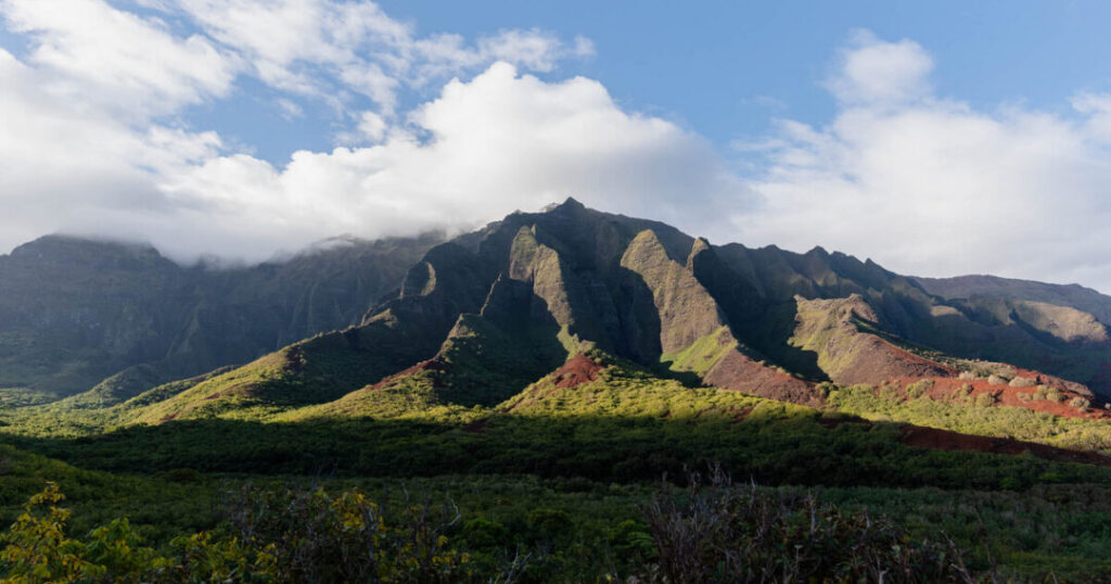
The trail runs through the West Kameng and Tawang districts of western Arunachal Pradesh, close to the borders with Bhutan and Tibet.
- Start point: Lagaam village, near Dirang in West Kameng
- End point: Thingbu (Thimbu) Hydel, near Mago in Tawang district
- Exit town: Tawang, about a 2-hour drive from the trail’s end
- Base town for most groups: Guwahati, Assam, with road transfers via Tezpur or Bomdila
Also Read: Tawang War Memorial: Complete Guide to History, Timings, Light Show & Photos
A Trail Shaped by History
The route takes its name from Lt. Col. F. M. Bailey and Capt. H. T. Morshead, British officers who explored and surveyed the eastern Himalaya in 1913. Their survey work fed into the frontier maps that later shaped the McMahon Line.
Before that, Monpa herders and traders used these passes for centuries. Today, old army bunkers near Thungri remind you of the trail’s strategic past.
Four High Passes in One Trek
Few treks in India pack this many high crossings into six walking days:
- Poshing La — about 3,950 m
- Pangi La — about 4,200 m
- Tse La — the high point, roughly 4,900–4,980 m
- Sela Pass — about 4,170 m, crossed by road on the way out
Remote Monpa Villages and Mago
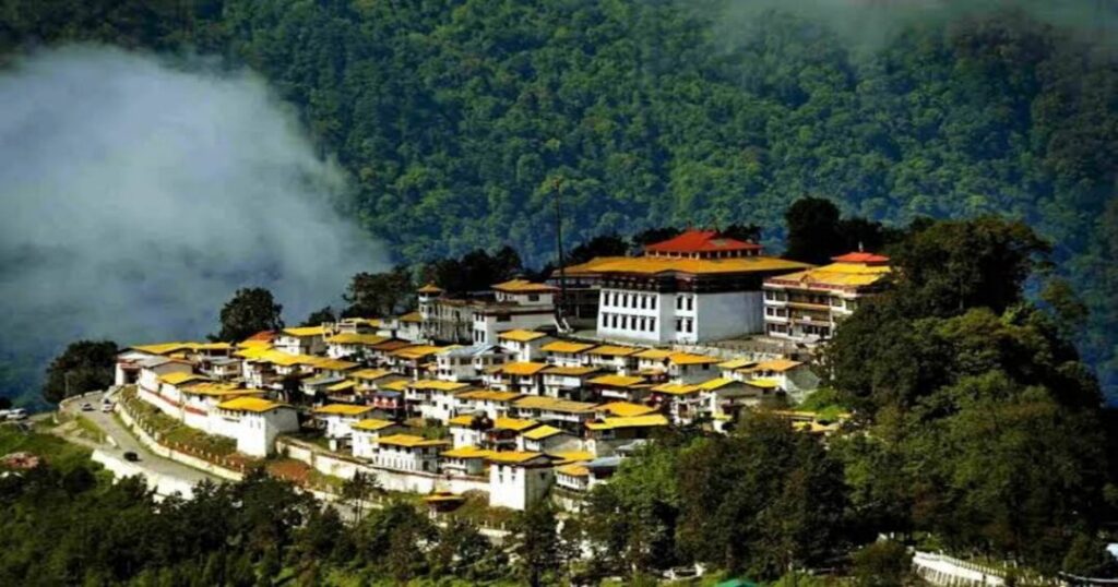
On the descent you reach Mago, a remote Monpa village near the Tibet border. Expect yak pastures, prayer flags, simple homestays and warm hospitality after days of camping.
Also Read: Best Winter Treks in Arunachal Pradesh for Mountain Lovers
Bailey Trail Trek Map: Stage-by-Stage Route
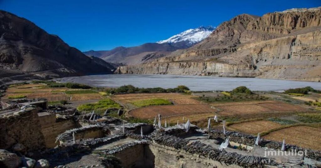
Use this route breakdown as your text-based Bailey Trail trek map. Distances and altitudes follow a commonly used 6-day operator itinerary and vary by group.
| Day | Stage | Distance | Camp altitude |
|---|---|---|---|
| 1 | Lagaam → Thungri | ~12 km | ~3,200 m |
| 2 | Thungri → Changla | ~14 km | ~3,760 m |
| 3 | Changla → Nyang/Potok via Poshing La and Pangi La | ~15 km | ~4,500–4,640 m |
| 4 | Potok → Lurthim via Tse La | ~17 km | ~4,350 m |
| 5 | Lurthim → Mago | ~17 km | ~3,600 m |
| 6 | Mago → Thingbu Hydel, drive to Tawang | ~15 km | Tawang ~2,670 m |
Bailey Trail Trek Distance and Altitude
- Total walking distance: roughly 90 km over about 6 trekking days
- Daily walking time: 6–9 hours
- Highest point: Tse La, at roughly 4,900–4,980 m (sources differ)
- Full trip length: 10–14 days including drives from and back to Guwahati
Bailey Trail Trek Cost and Package Options
The Bailey Trail trek cost depends on group size, trip length and how much support you want. Published prices from operators range widely:
- Budget fixed-departure groups: from about ₹32,500 per person for a 12-day trip
- Premium private expeditions: about ₹51,000–₹71,000 per person (plus 5% GST) for 14 days, with lower rates for larger groups
- Extra costs to budget for: travel to Guwahati, backpack offloading, insurance, tips and Tawang sightseeing
What a Bailey Trail Trek Package Includes?
Most Bailey Trail trek package options include:
- Road transfers from Guwahati and back
- Camping gear: tents, sleeping bags, mats, kitchen and toilet tents
- Vegetarian meals throughout the trek
- Trek leader, local guides, cooks, porters or mules
- Forest and camping permits; some operators also handle your ILP
- Safety kit: first aid, oxygen cylinders and pulse oximeters
Always confirm which items are excluded before you pay the advance.
Permits You Need
- Indian citizens: an Inner Line Permit (ILP) for Arunachal Pradesh, available online
- Foreign nationals: a Protected Area Permit (PAP); some operators run a modified route for foreigners
- Carry a government ID and photocopies for checkpoints such as Bhalukpong
Difficulty and Fitness Prep for Experienced Trekkers
Operators grade this route anywhere from moderate to challenging. However, long days above 4,000 m, steep pass crossings and an often unmarked trail make it best for trekkers who already have high-altitude experience.
- Have at least one 4,000 m+ trek behind you
- Train for 6–8 weeks: stair climbs, loaded hikes and 5 km runs
- Hire a local guide; the trail is remote and poorly marked
- Plan an extra buffer day for weather or acclimatisation
Also Read: Himalayan Treks for Beginners: Top 10 Easy Treks in India
A trekker from a recent spring batch summed it up: the Tse La day was “the longest of my life, and the most beautiful.”
What is the Best Time to Visit Bailey Trail?
- Spring (April–June): rhododendrons bloom across the lower valleys; snow may linger on the passes
- Autumn (September–November): clear skies and the best mountain views
- Avoid: the monsoon (July–August) for slippery trails and landslides, and winter for heavy snow
How to Reach the Bailey Trail?
- By air: Tezpur Airport is the closest, about 190 km from Dirang. Guwahati Airport, about 300 km from Bomdila, has far more flights and is where most groups meet.
- By rail: Rangapara North is the nearest major railway station. Guwahati Railway Station is the more common starting point.
- By road: Drive Guwahati → Tezpur → Bhalukpong → Bomdila → Dirang, then about 1–2 hours to Lagaam. Shared taxis run up to Dirang; book a private vehicle for Lagaam.
Conclusion: About the Bailey Trail Trek
- A roughly 90 km route across four high passes in western Arunachal Pradesh
- Best done in April–June or September–November
- Package costs start around ₹32,500 per person
- You need an ILP (Indians) or PAP (foreigners), plus solid high-altitude experience
If you want solitude, history and big Himalayan passes without the crowds, the Bailey Trail trek is one of the best wild routes left in India.
Track every pass you cross — download the Explurger app before you head to Arunachal.
Pick your season, compare operator packages and lock in your permits early.
FAQs About Bailey Trail Trek
2. How long is the Bailey Trail trek?
The walking section covers roughly 90 km over about six trekking days, with daily walks of 6 to 9 hours. Including road transfers from Guwahati and back, a full trip usually takes 10 to 14 days. Many operators add a buffer day for weather, since snow on Tse La or Poshing La can force delays on the passes.
3. How much does the Bailey Trail trek cost?
Published packages range from about ₹32,500 per person for budget fixed departures to around ₹51,000–₹71,000 per person plus GST for premium private trips. The price changes with group size, trip length and inclusions. Budget extra for travel to Guwahati, insurance, backpack offloading and sightseeing in Tawang.
4. Is the Bailey Trail trek difficult?
Yes, it suits experienced trekkers best. You cross four high passes, the highest being Tse La at roughly 4,900 m, and walk long days through remote terrain that is often unmarked. Some operators grade it moderate, but you should have at least one previous trek above 4,000 m and good cardio fitness before you attempt it.
5. Do I need a permit for the Bailey Trail trek?
Yes. Indian citizens need an Inner Line Permit (ILP) for Arunachal Pradesh, which you can apply for online. Foreign nationals need a Protected Area Permit (PAP), and some operators use a modified route for them. Carry government ID and photocopies, because your papers are checked at gates such as Bhalukpong.
6. What is the highest point on the Bailey Trail trek?
The highest point is Tse La pass, with operators listing heights between about 4,900 m and 4,980 m. You cross it on the fourth trekking day, usually after camping at Nyang or Potok. It is the hardest and longest day of the trek, so expect an early start, cold winds and up to nine long hours of walking.