

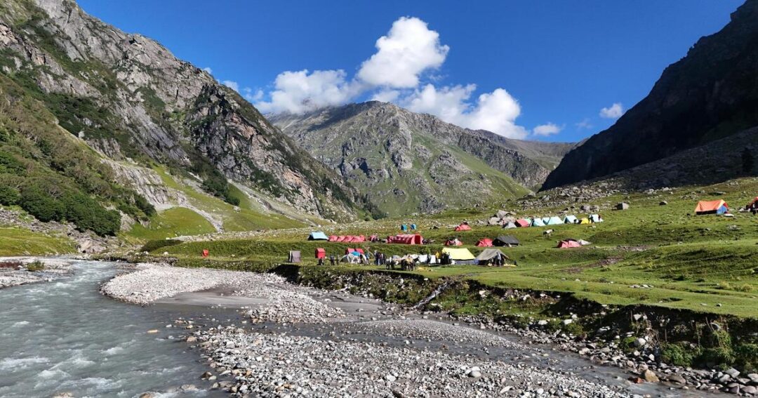
15 Total Views
The Pin Bhaba Pass trek crosses a Himalayan pass at roughly 4,900 m, moving from the green Bhaba Valley in Kinnaur to the barren, high-altitude Pin Valley in Spiti, with the scenery changing completely from one side to the other. It is usually walked from Kafnu to Mudh in about five or six trekking days and rated moderate to difficult. This guide covers five highlights, the pass and its valleys, difficulty and permits, the best time, the distance, a day-by-day itinerary and what we could find on a map. A timing note: the sources put the season at about June to September, so for this year the window has closed and the details below are for planning 2027.
Best Pin Bhaba Pass Trek Highlights: Five Stages of the Crossing
These five are our own selection of stages from the sources. Altitudes and hours vary between operators, and the ranges are given.
1. Kafnu to Mulling: Forest and the Bhaba River
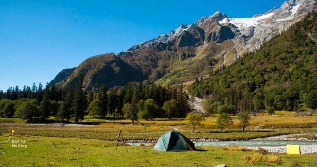
The trek starts at Kafnu, about 2,400 m, and follows a glacier-fed stream, the Bhaba River, according to Wikipedia. Operators give about 11 km for this day, taking 6 to 9 hours, with Mulling at 3,200 to 3,500 m. Moxtain describes a rise from 7,900 ft to 10,700 ft.
2. Kara: Meadows and the Acclimatisation Question
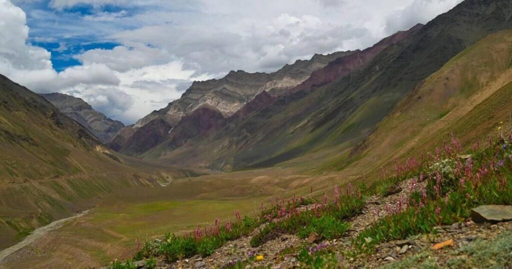
Mulling to Kara is a short day of about 6 km and 4 to 5 hours, to about 3,550 m. JustWravel adds an acclimatisation rest day here, while WanderOn places its rest day after the trek, so check what your operator includes.
3. Phutsirang: The High Camp
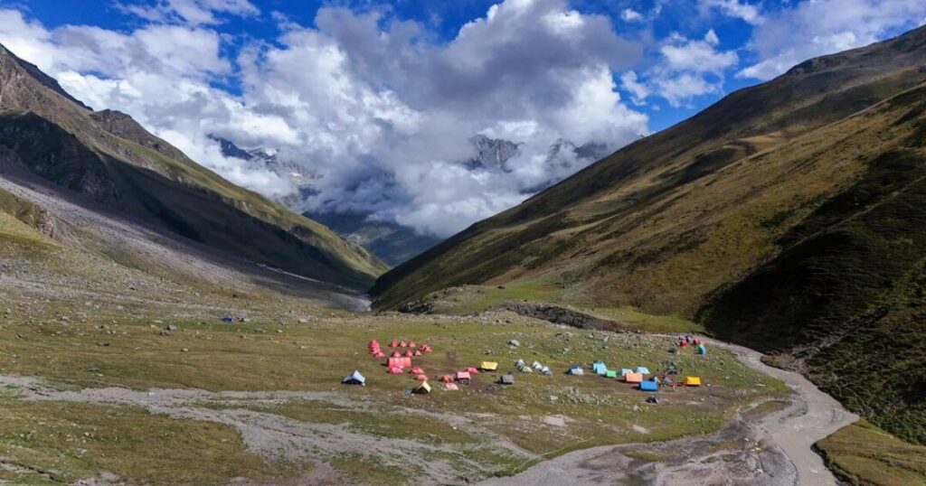
Kara to Phutsirang is about 5 km and 3 to 5 hours, to roughly 4,100 to 4,200 m, per Discover with Dheeraj, JustWravel and WanderOn. Moxtain says the day includes crossing icy streams barefoot to keep boots dry.
4. The Pass Crossing
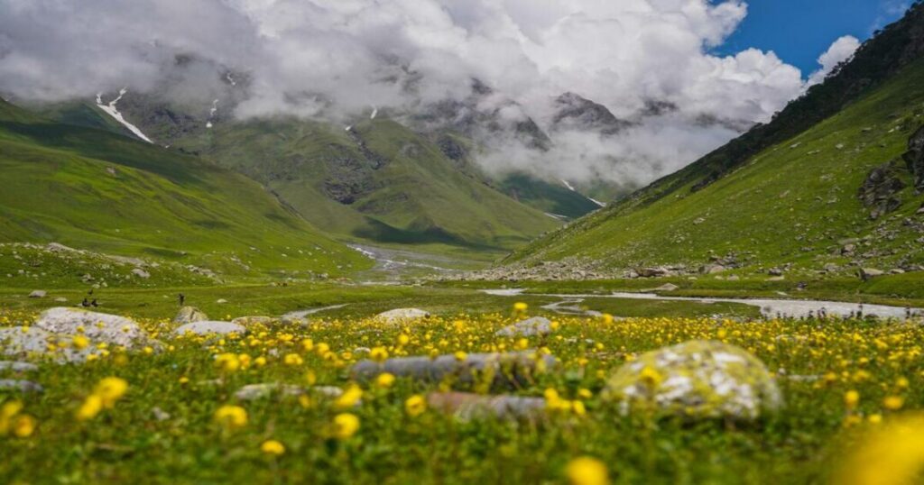
Day 5 or 6 is the hard one: about 12 km and 10 to 12 hours over the pass at about 4,890 to 4,915 m. Discover with Dheeraj advises starting around 3 to 4 AM to cross before afternoon clouds, and Moxtain mentions scree, moraine and glacier terrain with helmets and crampons needed.
5. The Descent Into Pin Valley and Mudh
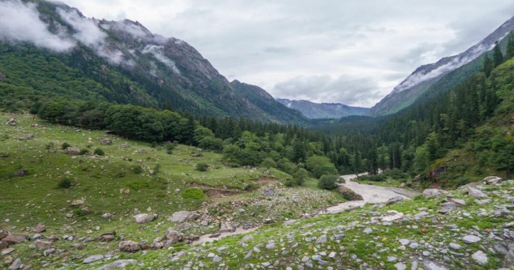
After the pass, the route descends to a Spiti-side camp, named Baldar, Bwaldar or Mangrungse by different operators, then to Mudh village at about 3,750 to 3,810 m. Wikipedia says Mudh is the first village on the Spiti side. Moxtain mentions a suspension bridge over the Pin River, while WanderOn mentions makeshift bridges, so conditions may vary.
The Pass and Its Valleys: Bhaba Valley to Pin Valley
A Bhaba Pass Trek is defined by the two landscapes it links. What the sources say:
- The pass: Wikipedia gives 4,890 m (16,040 ft) on the border of Kinnaur and Lahaul and Spiti districts, at 31°47′13″N 77°59′46″E. Operators give 4,865 m to 4,915 m, including 16,105 ft.
- Kinnaur side: Wikipedia calls the Bhaba Valley green and fertile. It says the Wangyur River forms the valley and that Kafnu is one of six panchayats, while most of the population lives in Katgaon.
- Spiti side: The Pin Valley is barren and high-altitude, bordering Pin Valley National Park and the Rupi-Bhaba Wildlife Sanctuary per Wikipedia.
- The national park: Discover with Dheeraj, citing Wikipedia, gives a core zone of about 675 sq km and about 1,150 sq km with the buffer, established in 1987. It says ibex and bharal are the animals most commonly seen in summer and that summer snow leopard sightings are very rare.
- A different crossing: Wikipedia says a separate trek heading west from the pass leads into the Parvati Valley near Kullu, which is not this route.
Pin Bhaba Trek: Difficulty, Permits and Costs
Before booking a Pin Bhaba Trek, here is what the sources say about who it suits and what it costs. Most are trek-operator pages, so treat them as promotional:
- Difficulty: Wikipedia calls the climb moderate but the crossing a challenging adventure. JustWravel, Himalayan Hikers, Moxtain and MadTrek rate it moderate to difficult, and WanderOn says a bit challenging.
- Experience: Himalayan Hikers recommends prior trekking above 13,000 ft, and JustWravel recommends high-altitude experience and 4 to 6 weeks of fitness training. Both advise against it for beginners.
- Permits: Discover with Dheeraj says a forest or wildlife permit is needed on the Spiti side, plus registration at Kafnu. Himalayan Hikers includes forest permits in its price, asks for original government photo ID with two copies, and charges foreign nationals ₹2,400 extra. Discover with Dheeraj says Pin Valley National Park has charged an entry fee since June 2025 but does not give the amount.
- Operator prices: Himalayan Hikers lists ₹20,500 plus 5% GST, MadTrek lists ₹17,999 trek-only, Himalaya Shelter lists ₹23,000 for 8 days, and Discover with Dheeraj gives a range of ₹12,000 to ₹25,000 in its page description. These are not comparable without checking inclusions.
- Health and insurance: Himalayan Hikers requires a medical certificate and insurance, and says there is no mobile network from Kafnu until Mudh or Kaza.
Best Time to Do Pin Bhaba Trek: Month by Month
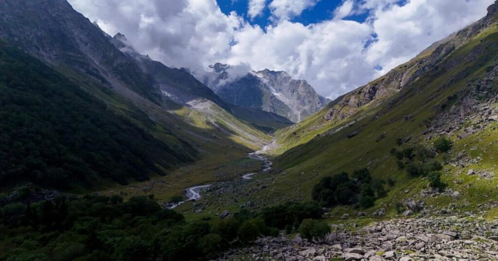
The best time to do Pin Bhaba Trek is broadly June to September, but the sources disagree on the edges:
- Late June to mid-September: Discover with Dheeraj. MadTrek says mid-June to mid-September and JustWravel mid-June to late September.
- June to September: WanderOn and Moxtain, with Moxtain also calling mid-May to June trek-friendly and saying the trek closes after October because of snow.
- From July: Indiahikes calls it an excellent trek from July onward and notes that most of it is in Spiti, which is rarely touched by rains.
- Snow near the pass: Himalayan Hikers says there is snow in June and early July, melting mostly by August and September. It lists 2027 departures from July 2 to August 29.
- To avoid: JustWravel advises avoiding May and October onward for snow conditions, and Himalaya Shelter says the trail closes after mid-October. Himalayan Hikers’ own page gives conflicting windows, so we do not rely on it for season dates.
Our own suggestion is to plan for July to early September, which the most sources have in common.
Bhaba Pass Trek Distance: How Far Is It?
The Bhaba Pass Trek distance is about 50 to 60 km depending on the source:
- About 50 to 52 km: Discover with Dheeraj says about 50 km, and the day figures in JustWravel, WanderOn and Moxtain sum to about 51 km. Nomadic Indian’s 2018 itinerary sums to about 52 km, and MadTrek says 50 to 55 km.
- About 60 km: JustWravel’s introduction says nearly 60 km, and Himalayan Hikers says 60 km on foot.
- Per day: About 11 km (Kafnu to Mulling), 6 km (Mulling to Kara), 5 km (Kara to Phutsirang), 12 km (pass day) and 17 km (down to Mudh). Himalayan Hikers gives 13 km for the last day, so the day splits differ.
- Drives: About 200 km from Shimla to Kafnu, and about 50 km from Mudh to Kaza.
Bhaba Pass Trek Itinerary: Day by Day
A typical Bhaba Pass Trek itinerary runs as below, combining Discover with Dheeraj, JustWravel, WanderOn and Moxtain. Camp names and altitudes differ slightly between operators:
- Day 1, Shimla to Kafnu: A drive of about 200 km taking 7 to 10 hours, to about 2,400 m.
- Day 2, Kafnu to Mulling: About 11 km, 6 to 9 hours, to 3,200 to 3,500 m.
- Day 3, Mulling to Kara: About 6 km, 4 to 5 hours, to about 3,550 m.
- Day 4, Kara to Phutsirang: About 5 km, 3 to 5 hours, to about 4,100 to 4,200 m. JustWravel inserts a rest day at Kara before this.
- Day 5, Phutsirang over the pass: About 12 km, 10 to 12 hours, over about 4,890 to 4,915 m and down to a camp at about 4,150 m.
- Day 6, camp to Mudh: About 17 km, 7 to 8 hours, to about 3,750 to 3,810 m.
- Day 7, Mudh to Kaza: About 50 km by road in 2 to 3 hours. JustWravel and WanderOn then run Kaza to Manali, about 180 to 200 km, taking 9 to 11 hours.
Also Read: Sar Pass Trek: The Complete Guide to Parvati Valley’s Most Popular Himalayan Adventure
Bhaba Pass Trek Map: Route and Access Notes
We could not verify a trail map to reproduce, so this Bhaba Pass Trek map section describes the route in words from the sources:
- Start and end: Kafnu in Kinnaur, about 2,400 m, to Mudh in the Pin Valley, about 3,800 m, a foot-only passage per Discover with Dheeraj.
- Camp sequence: Kafnu, Mulling, Kara, Phutsirang, the Spiti-side camp, Mudh.
- Coordinates: Wikipedia gives the pass at 31°47′13″N 77°59′46″E.
- Approach road: Wikipedia says access follows the highway along the Sutlej to Wangtu, then a narrow road to Katgaon and Kafnu. It gives Shimla at 203 km, Chandigarh at 315 km and Delhi at 545 km.
- Planned road and tunnel: Wikipedia mentions a planned 72 km road from Kafnu to Mud, approved in early 2022, and a tunnel between the Bhaba Valley and Mud. A headline from The Week dated April 12, 2025 says Himachal’s chief minister asked the BRO to take over the Wangtu–Attargoo–Mudh–Bhawa Pass route, which we did not read in full.
- Our own suggestion: Use your operator’s route plan, offline GPS and a guide, since we found no verified map.
Also Read: Jalori Pass Trek: The Easy Himalayan Hike Guide
What is the Best Time to Visit the Pin Bhaba Pass?
Most sources place the window between about June and September, with July to early September the overlap. Himalayan Hikers lists 2027 departures from July 2 to August 29, and several sources say the trail closes after October. A trek in mid-November, as of this writing, would be out of season, so plan for 2027.
How to Reach Kafnu and Mudh?
Kafnu is about 200 km from Shimla by road, taking 7 to 10 hours in the sources, along the highway beside the Sutlej to Wangtu. Wikipedia gives Shimla at 203 km, while its Bhaba Valley page puts the Wangtu bridge at 235 km from Shimla, so figures vary. After the trek, Mudh is about 50 km from Kaza, and the onward road to Manali is about 180 to 200 km. Discover with Dheeraj says the Spiti road is generally open from about June to early October.
Timing note: We found no report of a closure or incident this season. The sources describe the season as June to September with closing after October, so check weather, permit rules and the Pin Valley National Park fee with your operator before booking a 2027 departure.
Must Read: Pin Parvati Pass Trek: Itinerary, Altitude & Cost Guide
Conclusion: A Serious Crossing Worth Preparing For
The Pin Bhaba Pass trek is about 50 to 60 km of walking, a long pass day at nearly 4,900 m and a dramatic change from the green Bhaba Valley to Spiti’s high desert. Plan for July to early September, get proper acclimatisation and fitness, confirm permits with your operator, and treat every distance and altitude here as approximate.
Planning a Pin Bhaba trek for next summer? Open the Explurger app to find trekkers heading to Kinnaur and Spiti and share a cab from Shimla.
FAQs About Pin Bhaba Pass trek
2. What is the best time for the Pin Bhaba Pass trek?
About June to September, with July to early September the overlap among sources. The trail closes after October because of snow.
3. How high is Pin Bhaba Pass?
Wikipedia gives 4,890 m (16,040 ft), and operators give 4,865 to 4,915 m, including 16,105 ft.
4. How difficult is the Pin Bhaba Pass trek?
Most operators rate it moderate to difficult, with a 10 to 12 hour pass day, glacier terrain and river crossings. Himalayan Hikers recommends prior trekking above 13,000 ft.
5. Where does the Pin Bhaba Pass trek start and end?
It starts at Kafnu in Kinnaur and ends at Mudh in the Pin Valley of Spiti. Kaza is about 50 km from Mudh by road.
6. Do I need a permit for the Pin Bhaba Pass trek?
Operators describe a forest or wildlife permit on the Spiti side and registration at Kafnu, and carrying government photo ID. Foreign nationals face extra requirements. Confirm with your operator.