
1,175 Total Views
The Pin Parvati Pass trek crosses from the forests and hot springs of Himachal’s Parvati Valley to the barren, Buddhist high desert of Spiti’s Pin Valley, over a glaciated pass above 17,000 feet. Trek The Himalayas calls it outright the toughest trek in India; IndiaHikes documents it as a 12-day expedition with no exit points once you’re committed. Here’s what that actually looks like, day by day.
Quick Facts: Pin Parvati Pass Trek
Get essential Pin Parvati Pass Trek details, including altitude, distance, duration, difficulty, route, best season, experience requirements, and key travel information for planning this challenging Himalayan crossover trek.
| Detail | Info |
| Pin Parvati Pass altitude | ~17,450-17,500 ft (5,300-5,321 m) |
| Total distance | ~110 km |
| Duration | 11-12 days (varies by operator, includes buffer/acclimatization days) |
| Difficulty | Challenging / difficult to very difficult |
| Trail type | Cross-over trek—starts in one valley, ends in another |
| Starts/ends | Barshaini (Parvati Valley, Kullu) and Kaza/Mudh (Pin Valley, Spiti)—direction varies by operator |
| Best season | Mid-July to mid-August (monsoon) |
| Minimum experience | At least 2 prior high-altitude treks in the 4,500-5,000m range |
| Age guidelines | Under 15 with a guardian; 15-18 solo with a signed disclaimer; 60+ allowed with fitness clearance |
| Exit points | None—the only way out is to continue to Kaza or Barshaini |
| Nearest railhead | Chandigarh |
| Nearest airport | Bhuntar (~52 km from Manali) |
Pin Parvati Valley: Where the Trek Begins?
The Pin Parvati Valley side of the trek starts at Barshaini, the last motorable point in Kullu’s Parvati Valley, roughly 4-5 hours by road from Manali. This is the same trailhead used for the much shorter Kheerganga trek, but Pin Parvati continues well past it—through Tunda Bhuj, Odi Thach, and the marshy source of the Parvati River at Mantalai, before the glacier sections begin in earnest.
Also read: Jalori Pass Trek: The Easy Himalayan Hike Guide
Pin Parvati Pass: What Makes This Trek a Different Tier?
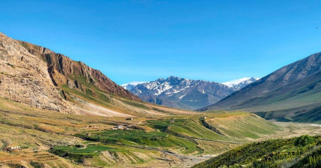
The Pin Parvati Pass itself sits above 17,400 feet, and one operator, Trek The Himalayas, names it directly as the toughest trek in India, ranking it alongside Auden’s Col, Kalindi Khal, and Panpatia Col as the hardest routes attempted in the Indian Himalaya. The technical sections are real: ropes, harnesses, crampons, and spikes are used to cross glacier and rocky sections safely, and operators generally require trekkers to have completed at least two prior high-altitude treks in the 4,500-5,000m range before attempting this one. [STAT: Trek The Himalayas requires trekkers to have completed at least two prior treks between 4,500 m and 5,000 m before attempting Pin Parvati Pass.] Perhaps the single most important safety detail: there are no exit points along the route. Once you’re past the early days, the only way out—in either direction—is to keep going until you reach Kaza or Barshaini.
Pin Parvati Trek Route: Two Valleys, Two Directions
The Pin Parvati trek connects Kullu’s green Parvati Valley to Spiti’s stark Pin Valley, and—worth knowing before you book—different operators run it in opposite directions. Trek The Himalayas starts at Barshaini and finishes in Kaza; IndiaHikes starts at Kaza and finishes at Barshaini. Both are legitimate versions of the same crossing, and the choice mostly comes down to which end you’d rather begin acclimatizing from. Along the way, the cultural shift is as dramatic as the landscape: the trek starts among traditional Himachali wooden homes in Kalga, passes shepherds grazing flocks in the high meadows, and ends among Bhotiya and Tibetan Buddhist communities in Spiti’s villages.
Also read: Chandrakhani Pass Trek: Complete Guide to Route, Distance & YHAI Itinerary
Pin Parvati Valley Trek Itinerary: Day-by-Day (Barshaini to Kaza)
This is the day-by-day breakdown for the Barshaini-to-Kaza direction, based on Trek. The Himalayas’ documented itinerary:
| Day | Route | Altitude | Distance/Time |
| 1 | Manali to Barishalai, trek to Kalga | Kalga: 2,300 m / 7,600 ft | Drive 4-5 hrs; trek 1 km, 30 min |
| 2 | Kalga to Kheerganga | Kheerganga: 2,800 m / 9,200 ft | 10 km, 6-7 hrs |
| 3 | Kheerganga to Tunda Bhuj | Tunda Bhuj: 3,350 m / 11,000 ft | 13 km, 7-8 hrs |
| 4 | Tunda Bhuj to Thakur Kuan | Thakur Kuan: 3,550 m / 11,650 ft | 11 km, 6-7 hrs |
| 5 | Thakur Kuan to Odi Thach | Odi Thach: 3,800 m / 12,400 ft | 9 km, 5-6 hrs |
| 6 | Odi Thach to Mantalai Lake | Mantalai: 4,150 m / 13,600 ft | 12 km, 7-8 hrs |
| 7 | Mantalai Lake to Summit Camp | Summit Camp: 4,950 m / 16,300 ft | 11 km, 7-8 hrs |
| 8 | Summit Camp over Pin Parvati Pass to Pin Base | Pass: 5,300 m / 17,450 ft; Pin Base: 4,450 m / 14,600 ft | 15 km, 10-12 hrs (the longest, hardest day) |
| 9 | Pin Base to Tiya | Tiya: 3,950 m / 13,000 ft | 12 km, 5-6 hrs |
| 10 | Tiya to Mudh, drive to Kaza | Mudh: 3,750 m / 12,500 ft; Kaza: 3,650 m / 12,000 ft | 12km trek + 50km drive |
| 11 | Kaza to Manali | — | 200 km drive, 9-10 hrs |
IndiaHikes’ reverse-direction version adds a rest day at Kaza for acclimatization and a rest day at Mantalai, extending the total to around 12 days, with a similar campsite sequence run backward — Kaza, Mudh, Tiya, Shia, Pin Base Camp, over the pass to Mantalai, then Odi Thach, Tunda Bhuj, Kheerganga, Barshaini.
Highlights Along the Way
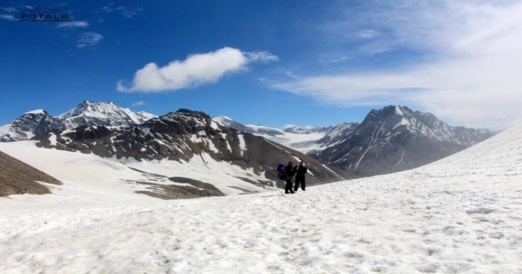
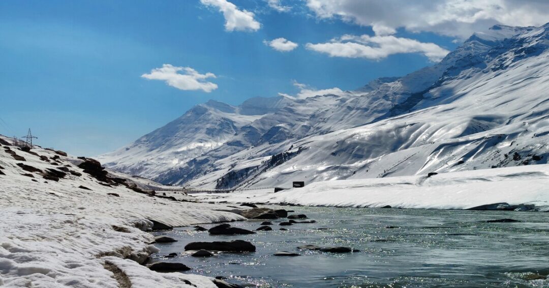
A few landmarks are worth knowing about before you go: Kheerganga’s natural hot springs are a genuine reward after a long trekking day and popular enough that people also trek there as a standalone short trip. Mantalai, the source of the Parvati River, isn’t a conventional lake—its boundary is ill-defined and the surrounding ground is marshy rather than a clean shoreline, which is worth knowing if you’re picturing something more like an alpine tarn. From the pass itself, on a clear day, you can pick out named peaks, including Parvati South Ridge, Snow Peak, Pyramid Peak, and Kullu Makalu, with Kinner Kailash and Shrikhand Mahadev visible further off if conditions allow. Wildlife sightings—blue sheep (bharal), marmots, and ibex—are possible but not guaranteed along the higher stretches.
Also read: Chandrashila Trek: The Complete Guide to Chopta, Tungnath & the Moon Stone Summit
Parvati Lake Trek: Mantalai Lake, Not a Separate Lake
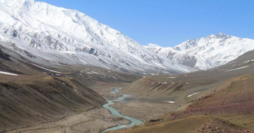
If you’ve seen “Parvati Lake” referenced as a destination, it’s worth clarifying: neither India Hikes nor Trek The Himalayas documents a separate lake by that name on this route. What’s commonly meant by the Parvati Lake trek is Mantalai Lake itself—the glacial lake, more accurately described as a marshy, ill-defined body of water, that marks the source of the Parvati River.
Pin Parvati Pass Altitude: The Numbers, Reconciled
Figures for the Pin Parvati Pass altitude cluster tightly: IndiaHikes documents 17,457 ft (5,321 m); Trek The Himalayas’ detailed itinerary lists 17,450 ft (5,300 m), while its summary infobox rounds up to 17,500 ft. All three numbers point to the same reality—a pass just above 17,400 feet, among the higher trekking passes attempted in India, with the broader trek ranging from around 12,000 ft at the Spiti-side towns up past 17,000 ft at the crossing itself.
Also read: Sar Pass Trek: The Complete Guide to Parvati Valley’s Most Popular Himalayan Adventure
Pin Parvati Pass Trek Cost: What to Budget?
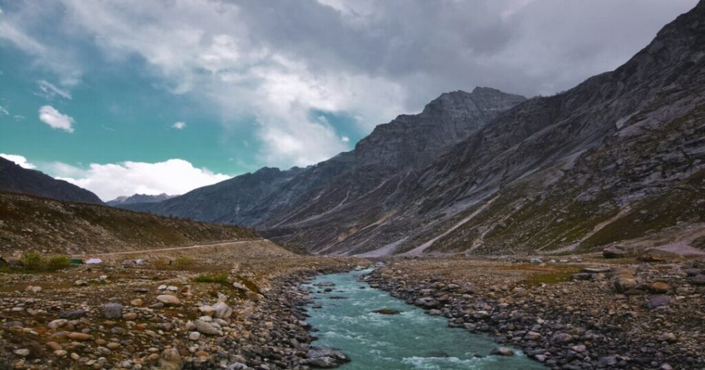
For the Pin Parvati trek cost, Trek The Himalayas currently lists the full 11-day package at ₹58,500 plus 5% GST per person, which includes accommodation (homestays and twin-sharing tents), meals, transportation between key points, trekking equipment, a first-aid kit, a support team of guides, a base camp manager, and a trek leader. That figure is notably higher than the ₹30,000-40,000 range sometimes quoted for shorter or budget versions of this trek—given the technical demands and the total absence of exit points, spending more for an experienced, well-equipped operator is a reasonable tradeoff rather than an upsell.
Pin Parvati Pass Trek Best Time: Why Monsoon Season Is the Answer?
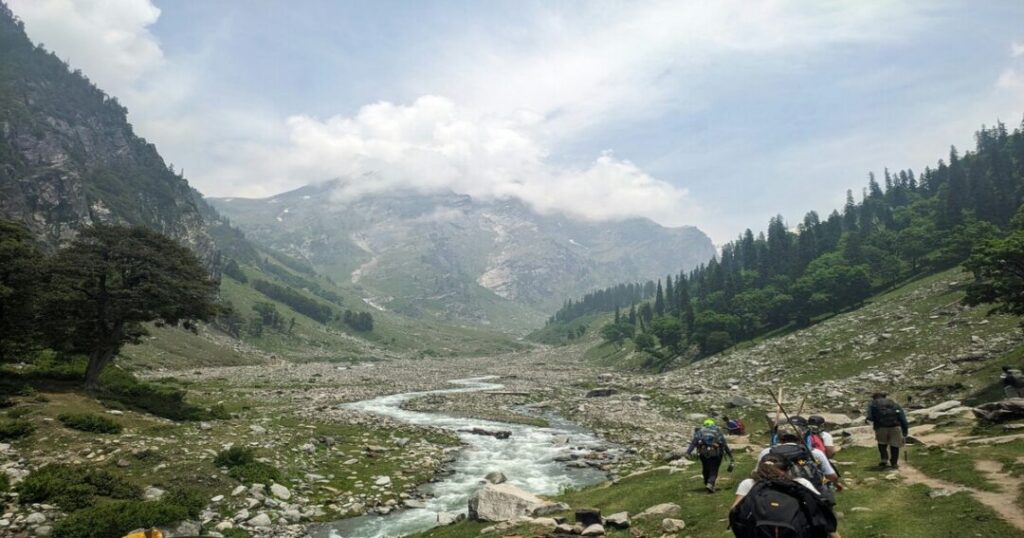
The Pin Parvati Pass trek’s best time is mid-July to mid-August—squarely inside India’s monsoon window, which runs against the advice given for most other Himalayan treks. The reasoning is specific to this route: at altitudes above 17,000 feet, the obstacle isn’t monsoon rain; it’s accumulated snow that needs the warmest weeks of the year to melt and stabilize enough for a safe crossing. Mid-July to mid-August is when that window opens—valleys turn lush and rivers run full, and while lower-altitude rain can occasionally affect the trail, it’s a fair trade-off for a pass that would otherwise still be under snow.
Conclusion: Pin Parvati Pass Trek
Between its glaciated pass, a 110km cross-valley route with no exit points, and a best season that runs against typical Himachal logic, the Pin Parvati Pass trek rewards serious preparation more than almost any other Himalayan crossing. Save it to your Explurger Bucket List, and let your Automatic Travelogue track the crossing once you’ve made it to the other side. Let the Explurger App help you plan a Pin Parvati Pass attempt with the right operator, direction, and timing.
FAQs About Pin Parvati Pass Trek
2. How long is the Pin Parvati Pass trek?
Approximately 110 km, typically completed over 11-12 days depending on the operator and direction.
3. Why is Pin Parvati Pass called India's toughest trek?
Long daily distances, sustained high altitude above 17,000 ft, technical glacier and crevasse sections requiring ropes and crampons, and no exit points once the trek is underway.
4. When is the best time for the Pin Parvati Pass trek?
Mid-July to mid-August—monsoon season, chosen because that's when snow at extreme altitude has melted enough for a passable crossing.
5. How much does the Pin Parvati Pass trek cost?
Trek The Himalayas' current package runs ₹58,500 plus 5% GST for the full 11-day crossing, including accommodation, meals, transport, and a support team.
6. Is the Pin Parvati Pass trek suitable for beginners?
No—operators require prior experience of at least two high-altitude treks in the 4,500-5,000 m range, and it's explicitly not recommended for first-timers.
7. Are there exit points on the Pin Parvati Pass trek?
No—once past the early days, the only way out is to continue to either Kaza or Barshaini; there's no shortcut off the route.
8. What is Mantalai Lake?
The marshy, ill-defined glacial lake at the source of the Parvati River—commonly what people mean when searching for a "Parvati Lake trek."