
664 Total Views
The Garhwal Himalayas have no shortage of treks that will humble you, exhaust you, and leave you wondering why you ever thought a weekend in Goa was a good idea. But the Har Ki Dun trek occupies a specific, brilliant niche: it’s the one where the views are genuinely Himalayan, the villages feel genuinely ancient, and the trail is genuinely accessible without being crowded or commercial. A cradle-shaped hanging valley at 3,566 meters in the Govind Wildlife Sanctuary, Uttarakhand—snow-capped peaks, an ancient Duryodhana temple, the Supin River as your constant companion, and not a single overpriced café in sight. This guide is for independent trekkers who want the full picture before they commit to the trail.
Har Ki Dun Trek Best Time — Season by Season
Getting the Har Ki Dun trek’s best time right matters more than most guides admit.
March to June—Spring & Pre-Monsoon (Best for flowers)
- Temperatures: 10–20°C at valley floor; nights can drop to 0°C at higher camps
- The meadows explode with wildflowers from April onwards—rhododendrons, alpine asters, Himalayan blue poppy
- Snow on higher sections in March–April; trail is passable but crampons may be needed early season
- Clear views of Swargarohini massif, Kala Nag (Black Peak), and Bandarpoonch range
- Recommended: April–June is the sweet spot—snow has reduced, flowers are out, skies are clear
September to November—Post-Monsoon (Best for views)
- Post-monsoon clarity gives the sharpest mountain views of the year
- Temperatures drop sharply from October; November brings snow to upper sections
- The trail is clean and settled after the rains; forest is lush and green
- Recommended: September–October is the best window for photography and views
December to February — Winter (Snow trek)
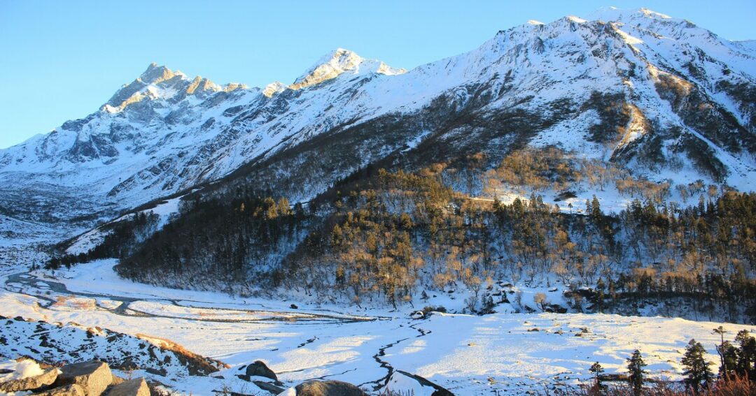
- The valley receives heavy snowfall; the trail becomes a white desert
- Temperatures drop to -15°C at night at higher camps
- Suitable only for experienced winter trekkers with proper gear and a local guide
- The valley is snow-covered from October to March
June to August — Monsoon (Avoid)
- Heavy rainfall makes trails slippery and dangerous
- Landslide risk on the Sankri–Taluka road is high—the road is extremely prone to closures
- Leeches throughout the forest section; river crossings become hazardous
- Most organised groups suspend operations during monsoon
Also read: Hampta Pass Trek 2026: The Most Famous Himalayan Crossover Adventure
About Har Ki Dun Trek- A Complete Guide 2026
“Har Ki Dun” translates to “Valley of the Gods”—”Har” meaning “God” or “Lord Shiva” and “Dun” meaning “valley.” A second interpretation holds the name means “Sound of Shiva”—local legend says a drummer (Dhaki) once disappeared into the valley and can still be heard playing during festival season. Both meanings point to the same thing: this is sacred ground.
According to local legend rooted in the Mahabharata, the Pandavas passed through this valley on their final journey to Swargarohini peak, believed to be the pathway to heaven. Only Yudhishthira, the eldest Pandava, is said to have completed the ascent.
The most culturally fascinating detail on the Har Ki Dun trek is the village of Osla, which worships Duryodhana—the primary antagonist of the Mahabharata—at an ancient three-chambered wooden temple adorned with bells and prayer flags. This is one of the rare Duryodhana temples in India—the most well-known other being Poruvazhy Peruviruthy Malanada in Kollam, Kerala, considered the only Duryodhana temple in South India. In the isolation of the upper Tons River basin, the villagers developed a distinct tradition of worshipping both Pandavas and Kauravas, reflecting a cultural complexity that no other trek in India offers. The temple has been officially renamed Someshwar Temple, but the traditional Duryodhana worship continues.
Har Ki Dun Trek — Key Facts
| Detail | Info |
| Maximum altitude | 3,566 m (11,700 ft) — valley floor |
| Trek distance | ~47 km round trip (Taluka to Har Ki Dun and back) |
| Duration | 6–7 days, including travel from Dehradun |
| Difficulty level | Easy to Moderate |
| Base camp | Sankri village, Uttarkashi district |
| Trek start point | Taluka (12 km drive from Sankri) |
| Located in | Govind Wildlife Sanctuary & National Park, Uttarakhand |
| Permits required | Yes—forest department permit for Govind Wildlife Sanctuary |
| Best season | March–June & September–November |
| Network | Last reliable signal at Sankri; Purola has last ATM |
How to Reach Har Ki Dun (Base Camp — Sankri)?
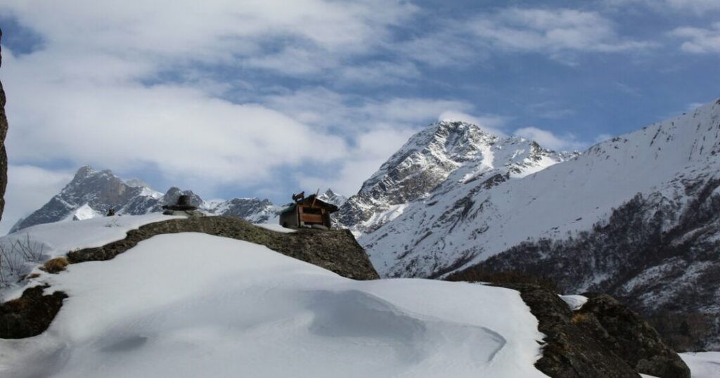
Dehradun → Sankri (~200 km | 8–10 hours)
- By road: Dehradun → Mussoorie → Purola → Mori → Netwar → Sankri via the Tons Valley road
- Shared jeeps and buses available from Dehradun’s ISBT Parade Ground to Sankri; check current schedules as timings vary seasonally
- Nearest railway station: Dehradun Railway Station (~200 km from Sankri)
- Nearest airport: Jolly Grant Airport, Dehradun (~25 km from the city)
- Note: Purola is the last reliable ATM point before Sankri. Withdraw sufficient cash — there are no ATMs beyond this point.
Sankri → Taluka (~12 km | 30–45 min)
- Shared jeeps run from Sankri to Taluka in the morning; the road is rough and landslide-prone in monsoon
- If the road is blocked, you trek the 12 km from Sankri to Taluka (adds a full day to the itinerary)
Also read: Dzukou Valley Trek: The Complete Guide to Nagaland’s Most Beautiful Trail
Har Ki Dun Trek Itinerary — Full Day-by-Day Breakdown
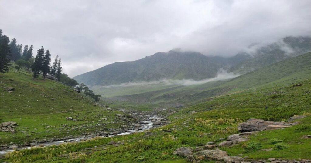
This is the standard 6-day Har Ki Dun trek itinerary used by most independent trekkers. Distances are one-way unless stated.
Day 1: Dehradun to Sankri
- Mode: Drive (~200 km | 8–10 hours)
- Altitude: Arrive Sankri at 1,950 m (6,400 ft)
- Stay: Homestay or guesthouse at Sankri
- A long but beautiful drive through the Tons Valley—the road follows the Yamuna and then the Tons River all the way up
- Sankri is your base: acclimatize, sort permits, check gear, eat well
- Note: Last mobile network. The last ATM was in Purola.
Day 2: Drive Sankri to Taluka + Trek to Seema/Puani Garat
- Drive: Sankri to Taluka (12 km | ~45 min by jeep)
- Trek: Taluka to Seema or Puani Garat (~14 km | 5–6 hours)
- Altitude: Taluka 2,102 m → Seema ~2,460 m (8,071 ft)
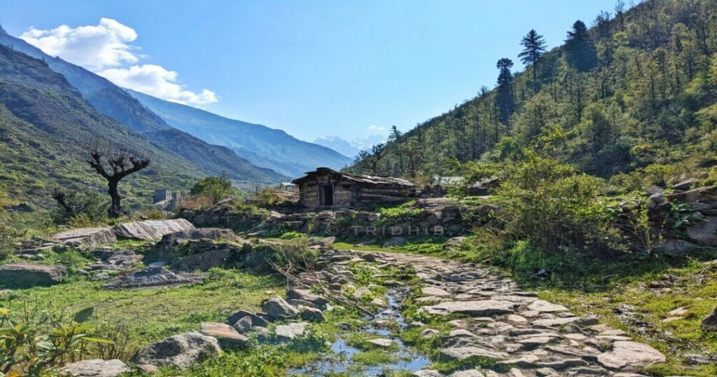
- The real trek begins at Taluka. The trail follows the Supin River through dense forests of chestnut, walnut, deodar, and pine
- Cross wooden bridges over streams; the trail stays on the right bank of the Supin for most of this section
- Puani Garat is a riverside campsite with good views; Seema is a small settlement with basic guesthouses
- Highlight: Your first proper Himalayan forest walking day—the river noise is constant and the canopy is outstanding
Day 3: Seema to Osla/Kalkatiyadhar
- Trek: ~12 km | 5–6 hours
- Altitude: Seema ~2,460 m → Osla ~2,600 m (8,530 ft) → Kalkatiyadhar ~3,050 m (10,007 ft)
- Cross the giant bridge over the Supin River after Seema—this is the steepest section of the entire Har Ki Dun trek
- Pass through terraced farms and get your first views of the Swargarohini massif
- Osla village: Stop here. The Duryodhana/Someshwar Temple is one of the most culturally significant stops on the entire route — a three-chambered wooden temple with intricate carved pillars and bells. Don’t rush past it.
- Kalkatiyadhar is a ridge-top campsite—wind can be significant; stake tents well
- Highlight: Best views of Swargarohini massif open up from Kalkatiyadhar
Day 4: Kalkatiyadhar to Har Ki Dun Valley
- Trek: ~12 km | 4–5 hours
- Altitude: Kalkatiyadhar ~3,050 m → Har Ki Dun Valley 3,566 m (11,700 ft)
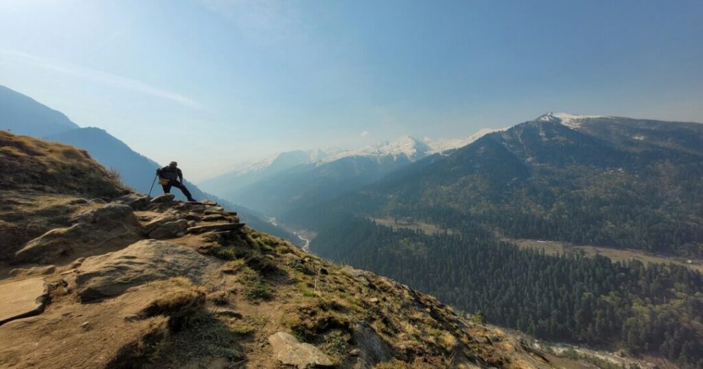
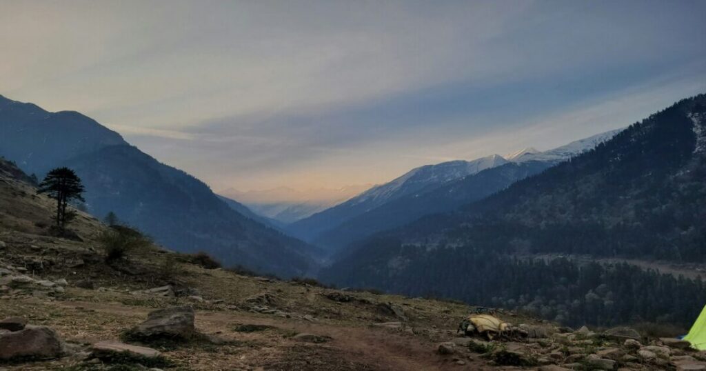
- The trail opens into the cradle-shaped valley—the transition from forest to alpine meadow to snow-ringed bowl is dramatic and sudden
- Forest department guesthouse at the valley—the only permanent structure
- Permit check at the forest post; have your documents ready
- Optional exploration: Maninda Tal (glacial lake at ~3,950 m) is ~3 km from the valley floor—a rewarding extension on the same day if you arrive early
- Jaundhar Glacier (at ~4,300 m) is a full-day excursion from Har Ki Dun—7–8 hours round trip over rocky, steep terrain
- Highlight: North face of Swargarohini peak fills the entire skyline; Kala Nag and Bandarpoonch visible on clear days
Day 5: Har Ki Dun to Osla/Seema (Return)
- Trek: ~12 km | 5–6 hours
- Altitude: Descent to Seema ~2,460 m
- Return on the same trail—descents reveal what ascents hide; the valley views on the way down are different and equally rewarding
- Stop at Osla again if you rushed past it on Day 3
- Stay at Seema or Osla village; most basic meal options available here
- Highlight: The Supin River gorge on the return is stunning in afternoon light
Day 6: Seema to Taluka + Drive to Sankri
- Trek: Seema to Taluka (~14 km | 5–6 hours)
- Drive: Taluka to Sankri (12 km | ~45 min)
- Altitude: Descent to Sankri, 1,950 m
- A long descent back through the forest; mostly flat and riverside—easier than it sounds
- Jeep from Taluka back to Sankri; celebrate with a hot meal and a functioning shower
- Network returns at Sankri. The outside world will have many opinions about where you’ve been.
Day 7: Sankri to Dehradun
- Drive: ~200 km | 8–10 hours
- Reach Dehradun by evening; book onward trains/flights after 9 PM to be safe
Har Ki Dun Trek Difficulty Level — Honest Assessment
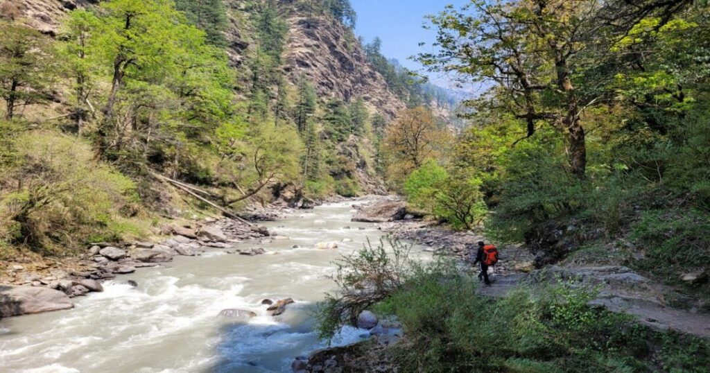
The Har Ki Dun trek difficulty level is officially rated easy to moderate—and this is accurate, with nuance:
What makes it manageable:
- No technical climbing; no glacier crossings on the standard route
- Gradual altitude gain—the valley sits at 3,566 m, giving your body time to adjust
- Well-marked trail with villages at regular intervals
- Forest department guesthouses at key points provide backup shelter
What makes it demanding:
- Long daily distances—12–14 km days are standard; legs accumulate fatigue fast
- Day 3 has the steepest section (Seema to Kalkatiyadhar) — sustained climb for 2+ hours
- AMS (Acute Mountain Sickness) is a real risk above 3,000 m—the India Hikes Har Ki Dun page explicitly warns that “at altitudes above 10,000 ft, the chances of being hit by AMS are real” for all trekkers, experienced or not
- Weather changes rapidly—the valley can go from sunny to snowfall in two hours
Fitness benchmark: You should be able to walk 15 km in a day on flat terrain before attempting this. Stair climbing and loaded backpack training for 4–6 weeks beforehand is the standard preparation for the Har Ki Dun trek.
Also read: Rupin Pass Trek: The Wildest High-Altitude Adventure in the Indian Himalayas
Permits, Gear & Practical Tips
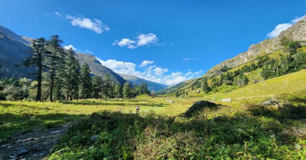
Permits
- A forest department permit is mandatory for entry into Govind Wildlife Sanctuary—the entire Har Ki Dun trek route falls within the sanctuary
- Permits can be obtained through a local trek operator in Sankri or directly from the Forest Department office in Uttarkashi
- Carry 2 copies of your ID (Aadhaar/Passport) and passport-sized photos—checkposts on the trail will verify documents
- Foreign nationals and OCI holders should confirm current permit requirements before travel—regulations for border-area sanctuaries can change
Gear List
- Footwear: Waterproof trekking boots with ankle support — non-negotiable
- Layering: Base layer (thermal), mid layer (fleece), outer shell (waterproof jacket + pants); minimum 2 sets
- Sleeping bag: Rated to -10°C for spring/autumn; -20°C for winter treks
- Trekking poles: Highly recommended for the Seema–Kalkatiyadhar ascent and return descents
- Backpack: 50–60 litres; rain cover included or separate
- Sun protection: SPF 50+ sunscreen, UV-protective sunglasses, and a brimmed hat—alpine UV is intense
- First aid: Personal kit including altitude sickness medication (Diamox — consult a doctor before carrying); blister care; electrolyte sachets
- Water: 2-litre capacity minimum; water purification tablets or filter
- Cash: Carry sufficient for the entire trek—the last ATM is at Purola
Altitude & AMS
- Har Ki Dun valley sits at 3,566 m; Kalkatiyadhar at ~3,050 m
- Acclimatize properly at Sankri before starting—at least one night
- Symptoms of AMS: headache, nausea, dizziness, fatigue, loss of appetite
- Golden rule: If symptoms worsen, descend immediately—do not push through AMS at altitude
- Stay hydrated; avoid alcohol for the first 48 hours on the trail.
Conclusion About Har Ki Dun Trek
The Har Ki Dun trek delivers everything a serious trekker wants from a Himalayan route: a valley that earns its “Valley of Gods” name, a cultural layer that most Himalayan treks simply don’t have, long forest days beside a river that sounds like it’s been running since the Mahabharata, and a summit view of Swargarohini that genuinely stops you mid-step.
FAQs About Har Ki Dun Trek
2. What is the best time for the Har Ki Dun trek?
The two best windows for the Har Ki Dun trek best time are April to June (spring — wildflowers, snow reducing, clear skies) and September to October (post-monsoon — sharpest mountain views, green forest, settled trail). April–June is recommended for first-timers. September–October is the best window for photography. Avoid June to August (monsoon — slippery trails, landslides, leeches) and check conditions before winter treks (November–February requires full winter gear and experience).
3. What is the Har Ki Dun trek difficulty level?
The Har Ki Dun trek difficulty level is easy to moderate. There is no technical climbing and the altitude gain is gradual. The challenges are the long daily distances (12–14 km per day), the steep section between Seema and Kalkatiyadhar, and the real risk of AMS above 3,000 m. The trek is suitable for first-time Himalayan trekkers with adequate fitness — practice walking 15+ km days with a loaded pack before you go.
4. Do I need a permit for the Har Ki Dun trek?
Yes. The entire Har Ki Dun trek route falls within Govind Wildlife Sanctuary, and a forest department permit is mandatory. Permits can be arranged through local trek operators in Sankri or directly at the Forest Department office in Uttarkashi. Carry 2 copies of government-issued ID (Aadhaar or Passport) and passport-sized photos — permit checkposts on the trail will verify documents at multiple points.
5. How long does the Har Ki Dun trek take?
The standard Har Ki Dun trek itinerary is 6–7 days total: Day 1 is the Dehradun–Sankri drive, Days 2–6 cover the trek itself (Taluka → Seema → Osla/Kalkatiyadhar → Har Ki Dun → return), and Day 7 is the drive back to Dehradun. Some trekkers add a day for valley exploration or the Jaundhar Glacier excursion, making it 7–8 days. Budget for travel to/from Dehradun separately.
6. What is the cultural significance of Har Ki Dun?
Har Ki Dun is deeply connected to the Mahabharata — local legend holds that the Pandavas passed through this valley on their final journey to heaven via the Swargarohini peak. The village of Osla on the Har Ki Dun trek route is home to one of the rare Duryodhana temples in India — the most well-known other being Poruvazhy Peruviruthy Malanada in Kollam, Kerala, considered the only Duryodhana temple in South India. This reflects the distinct cultural isolation of the upper Tons river basin.