
257 Total Views
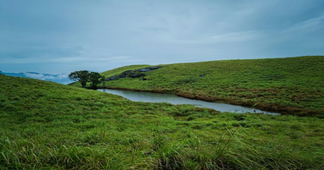
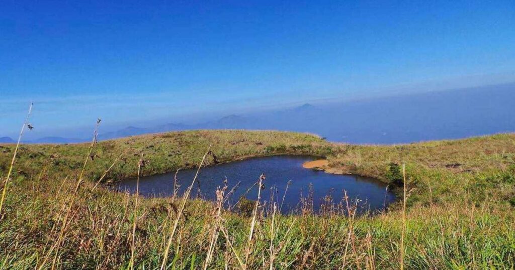
At 2,100 metres (6,890 feet) above sea level, Chembra Peak is the highest peak in the Wayanad district of Kerala — and one of the most rewarding treks in the entire Western Ghats. But it is not the summit that most trekkers talk about. It is the heart-shaped lake (Hridayathadakam) that sits midway along the trail — a naturally formed lake whose shape is so perfectly cardiac that it looks designed. The lake never dries up, even in summer. It is surrounded by rolling green meadows, misty shola forest, and the kind of Wayanad silence that only exists above the tea plantations. Most trekkers stop here. The summit itself currently has restricted access due to wildlife activity.
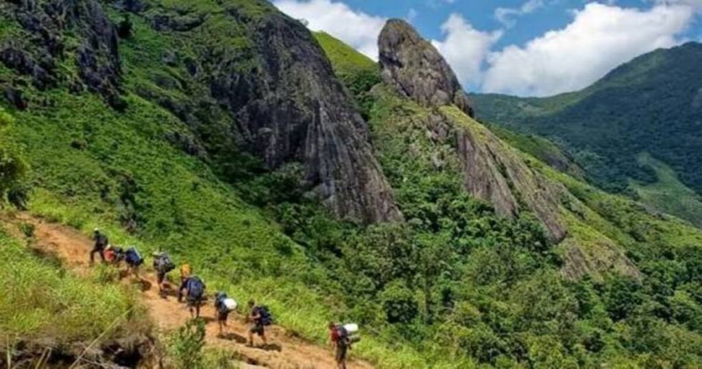
The Chembra Peak trek is rated moderate to challenging, covers approximately 9–10 km round trip, and takes between 4–6 hours depending on pace and conditions. The trail begins at the Meppadi Forest Office, passes through tea estates, enters dense forest, and opens into the grassland that frames the heart lake. This guide covers everything — the start point, the full itinerary, the trekking time, the permits, and the tourist places near Chembra Peak.
Chembra Peak — Key Facts
| Detail | Info |
| Chembra Peak height | 2,100 m (6,890 ft) — highest peak in Wayanad |
| Location | Wayanad district, Kerala; near Meppadi town |
| Trek starting point | Meppadi Forest Office (~8 km south of Kalpetta) |
| Trek distance | ~9–10 km round trip |
| Chembra Peak trekking time | 4–6 hours total (depending on pace) |
| Difficulty | Moderate to challenging |
| Current access | Summit access restricted due to wildlife; trek permitted up to heart-shaped lake (~1.5 km below summit) |
| Daily trekker limit | 200 trekkers per day |
| Trek timings | 7:00 AM – 5:00 PM; no new permits issued after 2:00 PM |
| Guide | Mandatory — provided by Chempra Peak VSS / South Wayanad Forest Department |
| Permit | Required from Meppadi Forest Office |
| Nearest airport | Calicut International Airport (Kozhikode/CCJ) — ~92 km |
| Nearest city | Kalpetta (~8 km from Meppadi); Kozhikode (~95 km) |
What Makes Chembra Peak Special?
Three things make the Chembra Peak trek genuinely worth planning around:
The heart-shaped lake (Hridayathadakam): The most photographed feature of the entire trek — a naturally formed lake whose heart shape is visible from the surrounding grassland. The lake sits approximately 2 km from the starting point and 1.5 km below the summit. It never dries up, even during the driest summer months, fed by underground springs and the surrounding watershed. On clear mornings, the lake reflects the sky and the surrounding green hills in a way that has made it one of the most photographed natural features in Kerala.
The tea plantation approach: The first section of the Chembra trek passes through sprawling tea estates — neatly trimmed rows of tea plants on the sloping hillside, the aroma of fresh leaves, and the occasional view of plantation workers. It is one of the most distinctive and photogenic beginnings of any South Indian trek.
The Western Ghats panorama: From the heart lake level and above, the complete Wayanad range opens — tea and coffee estates stretching to every horizon, with the peaks of Tamil Nadu and Karnataka visible on clear days. On really clear mornings, the mist rises from the valley below while the lake surface catches the first light.
Chembra Peak Trekking Start Point & How to Reach
The Trekking Start Point
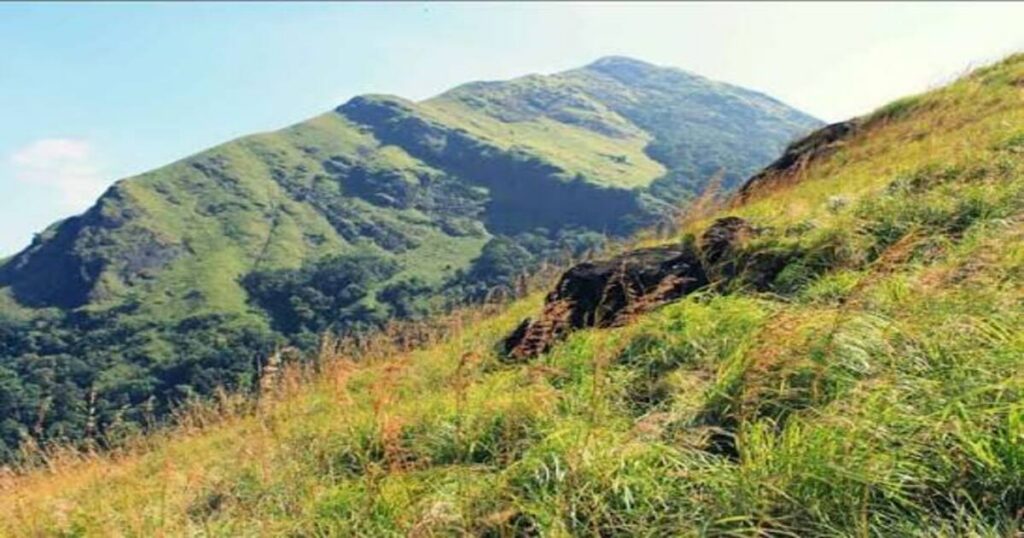
The Chembra Peak trekking start point is the Meppadi Forest Office — located near Meppadi town, approximately 8 km south of Kalpetta in Wayanad district. This is where permits are obtained, guides are assigned, and the trek officially begins.
Getting to the Meppadi Forest Office:
- From Kalpetta (~8 km): local auto-rickshaws or taxis run to Meppadi; take a vehicle to the forest office at the base of the hill
- From Meppadi town itself, the forest office is approximately 1 km further — accessible on foot or by vehicle
From major cities:
- From Kozhikode (~95 km | 2.5–3 hours): Most trekkers from outside Kerala arrive via Calicut International Airport; Kozhikode to Kalpetta by road, then Meppadi
- From Bengaluru (~280 km | 5–6 hours): By road via Mysore and the Mananthavady/Kalpetta road — one of the finest drives in South India
- From Kochi (~250 km | 5 hours): By road via Palakkad and Mananthavady
- By bus: KSRTC and private buses connect Kozhikode, Kochi, and Bengaluru to Kalpetta; local buses run from Kalpetta to Meppadi
Also Read: Brahmagiri Trek: The Complete Guide to Coorg’s Wildlife Sanctuary Summit
Chembra Peak Trek Itinerary — Full Day Guide
Standard Single-Day Trek
Recommended departure from Kalpetta/accommodation: 6:00–6:30 AM to reach the forest office by 7:00 AM when it opens.
Stage 1: Meppadi Forest Office — Permit & Guide Collection
- Time: Arrive by 7:00 AM (opens at 7 AM; no permits after 2 PM)
- Collect permit, pay entry and guide fees
- The guide is provided by the Chempra Peak VSS / South Wayanad Forest Department
- Only 200 trekkers permitted per day — arrive early, especially on weekends and holidays
Stage 2: Forest Office to Watchtower (~1 km | ~40 minutes by walk; 15 minutes by vehicle)
- Altitude at forest office: ~1,050 m | Watchtower altitude: ~1,150 m
- This initial section passes through the tea estates — wide, gradual path through lush green plantation
- Vehicles (jeeps) can cover this section; many trekkers walk for the full plantation experience
- The watchtower at ~1 km is the last vehicle access point — the trek on foot continues from here
Stage 3: Watchtower to Heart-Shaped Lake (~2 km | ~2 hours)
- Ending altitude: Heart lake ~1,650 m (approximately 1.5 km below the summit)
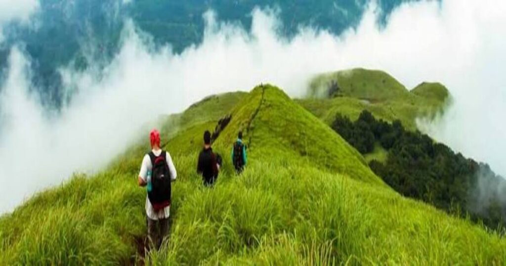
- This is the core trekking section — the trail enters dense shola forest after the watchtower, climbs steadily through the canopy, and emerges onto open grassland
- Approximately 30 minutes into the forest section, a small pond with a lone tree appears — this is not the heart lake; continue past it
- The trail steepens in the grassland section — tall grass almost 5 feet high lines the path; rocky patches require careful footing
- The heart-shaped lake appears after approximately 2 hours of walking from the watchtower — an open grassland clearing with the lake centred in it
At Hridayathadakam (Heart Lake):
- The lake is the official trekking endpoint for most visitors — summit access is currently restricted due to wildlife activity
- Rest, photograph, and take in the panoramic view of Wayanad
- The guide will indicate current rules regarding further ascent at the time of your visit
Stage 4: Heart Lake to Chembra Peak Summit (currently restricted)
- Trekking to the summit is currently not permitted due to wildlife activity on the upper trail; the heart-shaped lake ~1.5 km below the peak is the authorised endpoint for most visits
- Always verify current regulations with the Meppadi Forest Office before your trek — access rules may change seasonally
Stage 5: Descent — Heart Lake to Watchtower to Forest Office (~3 km | ~1.5–2 hours)
- The descent follows the same route as the ascent
- The grassland and forest sections are easier going down but require care on the rocky patches
- Return to the forest office by approximately 1:00–2:00 PM if you started at 7 AM
- All trekkers must return before 5:00 PM
Permits & Fees
- Permit: Required from the Meppadi Forest Office; issued on the day of trekking
- Guide: Mandatory; provided by the forest department as part of the permit process
- Daily limit: 200 trekkers per day — on peak season weekends, the limit fills early; arrive at 7 AM or plan a weekday visit
- Entry fee: Applicable for Indians and foreign nationals (separate rates); verify current fees directly with the Meppadi Forest Office or South Wayanad Forest Department before visiting as fees are subject to revision
- Trek timings: 7:00 AM to 5:00 PM; no permits issued after 2:00 PM
Note: All fees are subject to change — verify current rates before planning.
Also Read: Places to Visit in Ernakulam: 15 Heritage Sites, Beaches & Day Trips in Kerala’s Port City
What is the Best Time for the Chembra Peak Trek?
| Season | Conditions | Recommended? |
| October to February | Post-monsoon; clear skies; lush green; cool temperatures; best views | ✅ Best overall |
| March to May | Dry; warmer; less cloud cover; heart lake still full | ✅ Good — carry extra water |
| June to September | Monsoon; heavy rain; extremely slippery trail; dangerous on grassland sections | ❌ Not recommended |
The best window: October to December — the post-monsoon vegetation makes the tea estates and grasslands vivid, the trail is wet enough to be lush but not dangerously slippery, and the morning views from the heart lake are at their clearest.
Practical Tips — Gear & Safety
Gear list:
- Footwear: Proper trekking shoes with grip — the grassland and rocky sections are not manageable in sandals or casual shoes
- Water: Carry at least 2 litres from Meppadi — there are no reliable water sources on the trail after the forest office
- Snacks: Carry your own — no food stalls on the trail
- Clothing: Light layers; the peak area is significantly cooler than Meppadi base; a light jacket for the heart lake area
- Sun protection: The grassland section above the forest is fully exposed; sunscreen and a hat are essential
Trekking time tips:
- The best Chembra Peak trekking time to start is at 7:00 AM when the forest office opens — this ensures you reach the heart lake by 9:30–10:00 AM for the best light and have time to descend comfortably before the 5 PM cutoff
- Do not start after 2 PM — permits are not issued after this time
- Weekday visits recommended for the 200-person daily limit
Also Read: Places to Visit in Calicut: 15 Best Tourist Spots You Can’t Miss
Tourist Places Near Chembra Peak
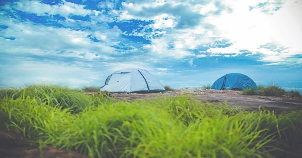
1. Soochipara Falls (Sentinel Rock Waterfall) — ~20 km from Meppadi
Soochipara Falls — also known as Sentinel Rock Waterfall — is a three-tiered waterfall surrounded by dense shola forest and rocky terrain in Wayanad. The falls drop approximately 200 metres in three distinct stages, with the base pool accessible for swimming. One of the most beautiful waterfalls in Wayanad and an excellent half-day excursion after the Chembra trek.
2. Meenmutty Falls — ~29 km from Meppadi
Meenmutty Falls is one of the largest waterfalls in Wayanad — a three-tiered waterfall with a total height of approximately 300 metres. The approach requires a 2 km trek through forest from the road. Best visited post-monsoon when the flow is at its peak.
3. Edakkal Caves — ~35 km from Meppadi
Edakkal Caves near Ambalavayal are a pair of natural caves containing Neolithic and Mesolithic petroglyphs — rock carvings estimated to be over 8,000 years old, among the oldest rock art in India. The caves are located on Ambukuthi Mala at approximately 1,200 metres and require a short but steep trek. The carvings — human figures, animals, and geometric patterns — are one of the most extraordinary tourist places near Chembra Peak for the culturally curious.
4. Pookode Lake — ~15 km from Meppadi
Pookode Lake is a natural freshwater lake in Vythiri, surrounded by subtropical forest. The lake supports boating facilities, has a children’s park, and is one of the most visited natural attractions in Wayanad. The forest surrounding the lake has significant birdwatching potential.
5. Banasura Sagar Dam — ~30 km from Meppadi
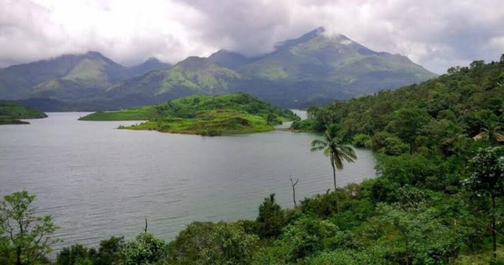
Banasura Sagar Dam is India’s largest earth dam and Asia’s second largest earth dam, built across the Karamanathodu tributary of the Kabini River at the foot of Banasura Hills. The reservoir creates a series of small islands as the surrounding land submerges — the island-dotted water with the Banasura Hills as backdrop is one of Wayanad’s most distinctive landscapes. Boating through the reservoir is available.
6. Wayanad Wildlife Sanctuary — within ~20 km
Wayanad Wildlife Sanctuary is part of the Nilgiri Biosphere Reserve — one of India’s most significant wildlife corridors, contiguous with Nagarhole, Bandipur, Mudumalai, and Silent Valley. The sanctuary is home to elephants, tigers, leopards, gaur, sambar, bonnet macaques, and over 200 bird species. Jeep safaris and trekking in designated areas are available from the Muthanga and Tholpetty ranges.
7. Thirunelli Temple — ~70 km from Meppadi
Thirunelli Temple — the “Kashi of Kerala” — is an ancient Vishnu temple nestled in the Brahmagiri hills at the foot of the Western Ghats. Surrounded by dense forest and accessible via a winding road through the jungle, the temple is one of the most atmospheric and most significant religious sites in Wayanad. The nearby Papanasini stream is sacred for performing ancestral rites.
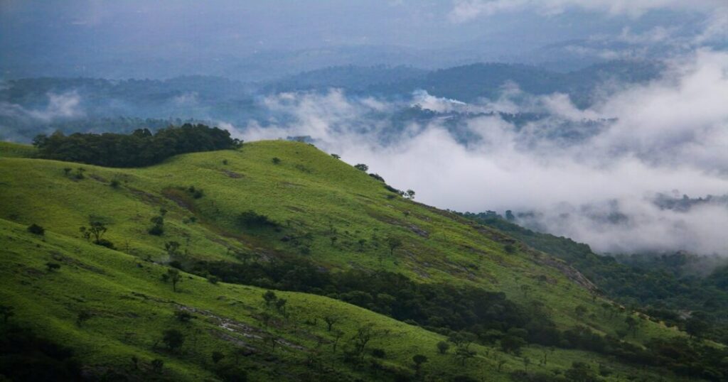
Bonus — Lakkidi Viewpoint (~10 km from Kalpetta)
Lakkidi is where the main road from Kozhikode to Kalpetta crests the ghats — one of the most dramatic ghat passes in Kerala, with a chain-tree shrine (a ghost legend attached to an old iron chain) and panoramic views of the Wayanad plateau. The view on a clear morning — the mist rising from the forest below as you come over the pass — is one of the finest arrival moments in all of Kerala.
How to Reach Chembra Peak — Summary
- Nearest airport: Calicut International Airport (Kozhikode, CCJ) — ~92 km; taxis and buses connect to Kalpetta (~3 hours)
- Nearest railway station: Kozhikode (Calicut) railway station — ~95 km; connect by bus or taxi to Kalpetta and Meppadi
- From Bengaluru by road: ~280 km via Mysore–Mananthavady–Kalpetta route (5–6 hours)
- From Kochi by road: ~250 km via Palakkad–Mananthavady route (5 hours)
Also Read: Places to Visit in Coorg: The Complete Guide to Kodagu’s Best Experiences
Conclusion About Chembra Peak
Chembra Peak is one of Kerala’s finest trekking experiences — not because of the summit (which is currently restricted) but because of the journey: the tea estate dawn walk, the forest canopy, the dramatic grassland emergence, and the heart-shaped lake that makes every trekker stop and stare. The Chembra Peak trek is the finest single day you can spend outdoors in Wayanad.
Quick recap:
- Height: 2,100 m (6,890 ft) — highest peak in Wayanad
- Trekking start point: Meppadi Forest Office (~8 km south of Kalpetta)
- Trek distance: ~9–10 km round trip | Trekking time: 4–6 hours
- Current endpoint: Heart-shaped lake (Hridayathadakam) — summit access restricted
- Daily limit: 200 trekkers; guide mandatory; no permits after 2 PM
- Best time: October to February
- Nearest airport: Calicut/Kozhikode (~92 km)
- Tourist places near Chembra Peak: Soochipara Falls, Meenmutty Falls, Edakkal Caves, Pookode Lake, Banasura Sagar Dam, Wayanad Wildlife Sanctuary
Download the Explurger app to log your Chembra Peak trek, discover what other trekkers recommend for current trail and Heart Lake conditions, and plan your complete Wayanad adventure.
The tea estates are already green in the morning light. The Heart Lake is already full. Chembra is waiting.
FAQs About Chembra Peak
2. What is the Chembra Peak trekking time?
The total Chembra Peak trekking time is approximately 4–6 hours for the full round trip (forest office to heart-shaped lake and back), depending on pace. Broken down: forest office to watchtower (~40 minutes on foot or 15 minutes by vehicle), watchtower to heart-shaped lake (~2 hours), at the lake (~30–45 minutes), descent (~1.5–2 hours). The best time to start is 7:00 AM when the forest office opens; all trekkers must return by 5:00 PM.
3. Can you trek to the summit of Chembra Peak?
Currently, trekking to the Chembra Peak summit is not permitted due to wildlife activity on the upper trail. The authorised endpoint for most visits is the heart-shaped lake (Hridayathadakam), which sits approximately 1.5 km below the peak at around 1,650 m. This is where most trekkers spend their time — the lake, the panoramic views, and the surrounding grassland are the centrepiece of the Chembra trek experience. Always verify current regulations with the Meppadi Forest Office before your visit as access rules may change seasonally.
4. What is the heart-shaped lake at Chembra Peak?
The heart-shaped lake at Chembra Peak is called Hridayathadakam (also written Hridaya Saras or Hridayathadakam) — a naturally formed lake approximately 2 km from the trekking start point whose shape is a near-perfect heart. The lake never dries up even in summer, fed by underground springs and the surrounding watershed. It sits in an open grassland clearing at approximately 1,650 m elevation and is the primary attraction of the Chembra Peak trek. The lake is visible from the surrounding grassland and is the standard endpoint for the day's trek.
5. What are the best tourist places near Chembra Peak?
The best tourist places near Chembra Peak: 1. Soochipara Falls (~20 km — three-tiered waterfall, swimming possible), 2. Meenmutty Falls (~29 km — 300 m three-tiered waterfall, 2 km forest trek to base), 3. Edakkal Caves (~35 km — 8,000-year-old Neolithic petroglyphs), 4. Pookode Lake (~15 km — freshwater lake, boating, birding), 5. Banasura Sagar Dam (~30 km — India's largest earth dam, island-dotted reservoir), 6. Wayanad Wildlife Sanctuary (~20 km — part of Nilgiri Biosphere Reserve, elephants, tigers), 7. Thirunelli Temple (~70 km — ancient Vishnu temple in the jungle, "Kashi of Kerala").