
779 Total Views
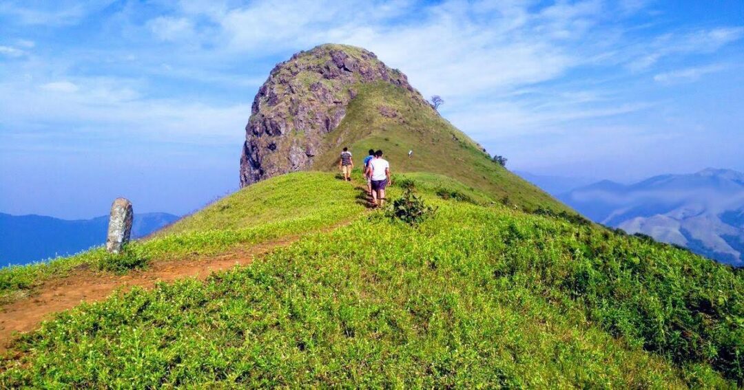
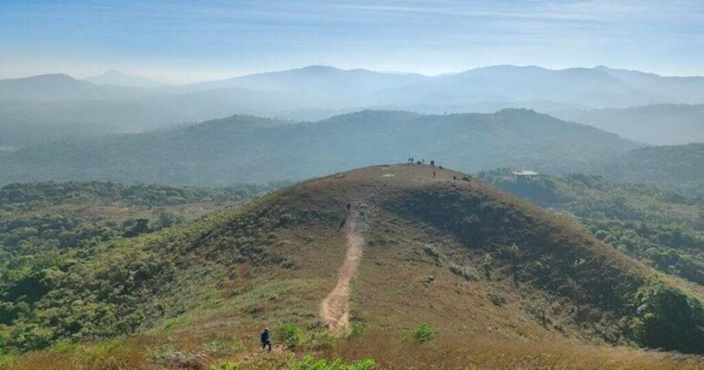
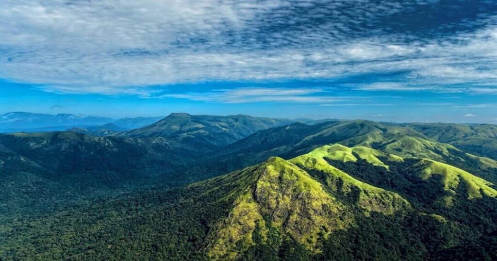
When you first see Ettina Bhuja from the trail, you stop. The peak rises from the Charmadi range in a clean, distinctive curve — broad at the top, narrowing toward the base — and it looks exactly like what its name says: an ox’s shoulder. Ettina means “ox,” and Bhuja means “shoulder” in Kannada. The mountain is named for its shape, and the shape is unmistakable.
This guide covers everything: the trek route and distance up and down, the booking process, entry fees, permissions, packages, difficulty level, and best time.
Ettina Bhuja Trek – Key Facts You Should Know
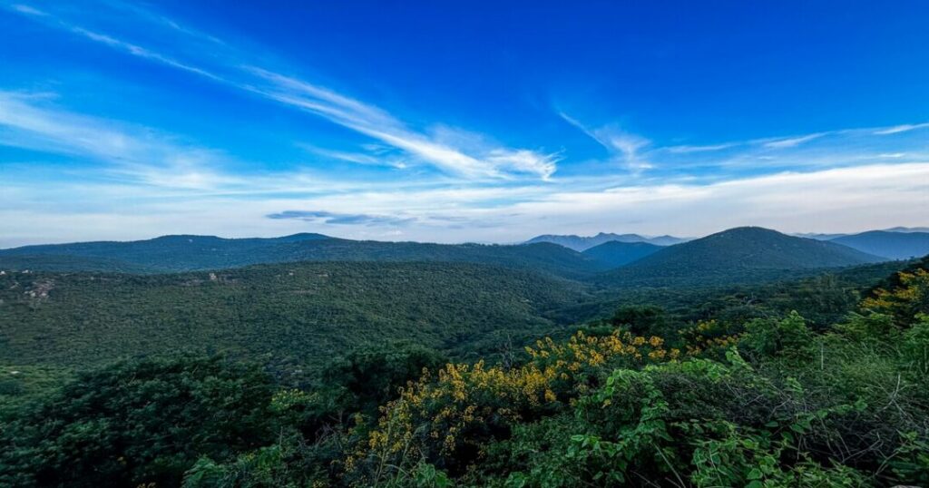
The Ettina Bhuja Trek is one of Karnataka’s most rewarding short treks, offering a perfect mix of scenic grasslands, rocky climbs, and panoramic views of the Western Ghats. Standing at 1,300 m (4,265 ft), the peak derives its name from the Kannada words Ettina (ox) and Bhuja (shoulder), as its distinctive shape resembles an ox’s shoulder. Located in the Charmadi range of the Chikmagalur district, the trek typically begins from Sri Nanya Bhairaveshwara Temple in Byrapura village and covers around 4–5 km round trip, making it ideal for beginners and weekend hikers. With a trekking duration of 3–4 hours, easy-to-moderate difficulty, and forest-managed entry through the Karnataka Forest Department, the Ettina Bhuja Trek is an excellent choice for anyone looking to experience the rich biodiversity of the UNESCO-listed Western Ghats.
Ettina Bhuja Trek at a Glance
| Detail | Information |
|---|---|
| Altitude | 1,300 m (4,265 ft) |
| Location | Charmadi Range, Chikmagalur, Karnataka |
| Trek Distance | 4–5 km round trip |
| Duration | 3–4 hours |
| Difficulty | Easy to Moderate |
| Entry Fee | ₹250 (Weekdays), ₹300 (Weekends) for adults |
| Best Time to Visit | October to February |
What Makes Ettina Bhuja Special?
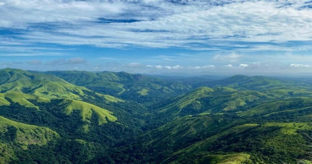
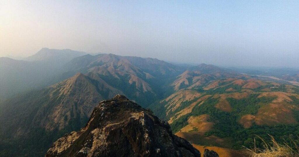
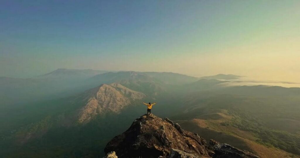
The shape: Ettina Bhuja’s defining quality is its visual distinctiveness—the peak’s ox-shoulder silhouette is visible from the trail well before you reach it, and it becomes more dramatic as you approach. The summit itself is an open rocky platform with no trees blocking the view—a 360° panorama of the Charmadi range, Shishila valley, and the rolling green Western Ghats hills spreading in every direction.
The sunrise: A pre-dawn start (arriving at the summit by 5:30–6:00 AM) delivers one of the finest sunrise experiences on any short Karnataka trek—the valley below fills with cloud at night, and at first light the Ettina Bhuja summit sits above the cloud layer, the Charmadi and Shishila valleys visible below as a sea of white. The light changes from grey to gold in minutes.
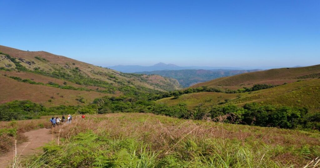
The ecosystem: The trail passes through one of the finest short-distance examples of the Western Ghats’ ecological diversity — bamboo and cane plantations at the base, shola forest in the middle section (the specific mossy, dense, ancient-feeling forest of the Western Ghats highlands), and open grassland at the top. The Charmadi range, in which Ettina Bhuja sits, is part of the UNESCO-recognized Western Ghats biodiversity hotspot.
The temple: The trek begins at the Sri Nanya Bhairaveshwara Temple—a 13th-century Hoysala-era temple built as part of a fort complex, where the temple bell is said to produce a resonant Om sound. The temple is an atmospheric starting point for the trek.
The local name, Ettina Bhuja, is also called Shishila Gudda by local Kannada speakers—the Shishila valley below the peak gives it this alternate name, and the two names are used interchangeably in different sources.
Also read: Dzongri Trek: The Complete Guide to Sikkim’s Finest Kanchenjunga Viewpoint Trek
How to Reach Ettina Bhuja?
From Bengaluru (~250–280 km | ~5–6 hours)
Route: Bengaluru → NH75 → Hassan → Sakleshpur → Mudigere → Byrapura village → Sri Nanya Bhairaveshwara Temple (trek start)
- The drive to Byrapura via NH75 through Hassan and Sakleshpur is one of the finest Karnataka Ghats drives—the Charmadi Ghat section after Sakleshpur is particularly scenic
- Last fuel: Fill up at Sakleshpur or Mudigere town—no petrol pump at Byrapura
- Last ATM: Mudigere or Sakleshpur — carry cash for any local expenses
By overnight bus from Bengaluru:
- Direct overnight buses run from Bengaluru’s KSRTC Bus Stand or Shivajinagar to Mudigere (depart ~10–11 PM; arrive ~4–5 AM)
- From Mudigere to Byrapura: local auto-rickshaw (~₹150–200 one way); shared vehicles occasionally available
From Mangaluru (~90 km | ~2.5 hours)
- Road via Charmadi Ghat (the same ghat that the trek overlooks); the approach from the coastal side is spectacular but involves more winding ghat road
Ettina Bhuja Trek Route — Distance Up and Down
The standard Ettina Bhuja trek begins at the Sri Nanya Bhairaveshwara Temple in Byrapura and follows a well-marked trail to the summit. Here is the route breakdown:
Stage 1: Temple to First Viewpoint (~800 m | ~15 minutes)
- From: Sri Nanya Bhairaveshwara Temple, Byrapura
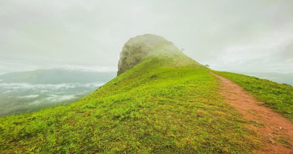
- The trail begins with an open path through tall grassland and bamboo; the Ettina Bhuja peak is visible almost immediately from this first section—turn to your right after approximately 5 minutes to see the distinctive ox-shoulder profile
- Signboards at every forked path keep you on the correct trail
- The first viewpoint opens after approximately 800 m—a clearing with the full Charmadi range visible ahead
Stage 2: First Viewpoint to Forest Entrance (~600 m | ~15–20 minutes)
- Moderate ascent through open grassland; trail becomes steeper in this section
- The trail can become slippery after rain—exercise caution on this section in the post-monsoon period (October–November)
- Enter the forest after approximately 600 m from the first viewpoint
Stage 3: Forest Section (~1 km | ~30–40 minutes)
- The trail enters dense shola forest—the atmosphere changes immediately; the canopy closes, the temperature drops, and the sound of birds fills the air
- Rich biodiversity: leeches (especially post-monsoon), various bird species, occasional sambar deer and barking deer
- The forest section is the most atmospheric part of the Ettina Bhuja trek—mossy trees, ferns, and the specific green darkness of a Western Ghats shola
- Emerge from the forest into open grassland above the treeline
Stage 4: Open Grassland to Summit (~200–300 m | ~20–30 minutes)
- The final section above the treeline: open, exposed, with increasing gradient
- The last 100–200 metres is a steep rocky scramble—requires using hands for balance; the only technically demanding section of the trek
- Summit: The flat rocky platform at 1,300 m with full 360° views
Ettina Bhuja trek distance up and down:
- Ascent: ~2–2.5 km | ~1–1.5 hours
- At summit: Allow 30–60 minutes for views and rest
- Descent: ~2–2.5 km | ~45–60 minutes
- Total round trip distance: ~4–5 km
- Total Ettina Bhuja trekking time: ~3–4 hours
Also read: Dodital Trek: The Complete Guide to Lord Ganesha’s Sacred Lake & Darwa Pass Circuit
Ettina Bhuja Trek Booking, Permission & Entry Fee
Why Booking Is Required?
The Ettina Bhuja trek permission is mandatory — the trail passes through protected forest under the jurisdiction of the Karnataka Forest Department, and trekking without a valid permit is not allowed. A daily quota limits the number of trekkers to protect the Shola ecosystem.
How to Book?
Official booking portal: aranyavihaara.karnataka.gov.in (Karnataka Forest Department’s Aranyavihaara eco-tourism portal)
Step-by-step Ettina Bhuja trek booking:
- Visit aranyavihaara.karnataka.gov.in
- Select “Ettina Bhuja” or search under Chikmagalur/Mudigere Forest Range
- Select your trekking date
- Enter the number of trekkers and personal details
- Pay the Ettina Bhuja trek entry fee online
- Download/screenshot the booking confirmation—carry it to the checkpost
Documents required at the checkpost:
- Booking confirmation (printed or digital)
- Valid government photo ID (Aadhaar card, passport, or driver’s license)
- One photocopy of photo ID (carry physical copies — digital may not be accepted at some checkposts)
Ettina Bhuja Trek Entry Fee (Current Rates)
| Age Group | Weekday Fee | Weekend/Holiday Fee |
| Above 18 years | ₹250 | ₹300 |
| Ages 12–18 | ₹100 | ₹150 |
| Children below 12 | Verify at time of booking | Verify at time of booking |
Note: Fees are subject to change — verify current rates on the aranyavihaara portal before booking.
Trek Timings
- Entry: 6:00 AM to 3:00 PM
- No trekkers permitted to begin after 3:00 PM — plan your arrival at the base accordingly
- For sunrise visits (recommended), arrive at the base by 5:00–5:30 AM and check with the forest checkpost about early entry procedures
Ettina Bhuja Trek Permission — Important Rules
- Solo trekking: Solo trekking is permitted on the Byrapura route (no mandatory guide for this route); the Shishila village route requires a mandatory guide
- No camping: Overnight camping at the peak is not permitted
- No littering: Carry all waste back; strict no-littering rules enforced
- No fire: No campfires or smoking on the trail
- No off-trail walking: Stay on the marked trail at all times; off-trail walking is prohibited
- Leeches: Post-monsoon (October–November) is peak leech season — carry salt, Dettol, or leech-specific repellent
Also read: Kolukkumalai Peak: Sunrise Trek, Ticket Price & Best Time to Visit
Ettina Bhuja Trek Package & Cost
Organised Trek Packages
Self-organised (independent trekking):
- Entry fee: ₹250–300 per person
- Transport from Bengaluru: ₹800–1,200 per person (shared vehicle/bus)
- Accommodation in Mudigere/Sakleshpur: ₹600–2,000 per night
- Total estimate: ₹2,000–4,000 per person (2-day weekend trip from Bengaluru)
Organised Ettina Bhuja trek packages from Bengaluru:
- Standard weekend packages: approximately ₹2,500–5,000 per person (Bengaluru to Bengaluru)
- Premium packages with better accommodation and smaller groups: ₹4,000–7,000 per person
What Organised Packages Typically Include
- Transport from Bengaluru and back (overnight bus or private vehicle)
- Forest department entry fee and permit arrangements
- Trek leader and guide
- Basic meals (dinner at base camp; breakfast before trek)
- Accommodation for one night (guesthouse or homestay near Mudigere/Sakleshpur)
What Packages Typically Exclude
- Personal trekking gear
- Personal snacks and water on the trail
- Travel insurance
- Tips for trek leader
All costs are approximate and subject to change — verify with operators before booking.
Ettina Bhuja Trek Difficulty Level
The Ettina Bhuja trek difficulty level is rated Easy to Moderate — the most beginner-friendly classification among Karnataka’s Western Ghats treks:
What makes it easy:
- Short distance (~4–5 km round trip)
- Well-marked trail with signboards at every fork
- No technical climbing equipment required
- Short trekking time (3–4 hours)
What makes it moderate:
- The final 100–200 metres to the summit involve a steep rocky scramble — using hands for balance is necessary; wet rocks after rain are slippery
- The forest section is steep and can be slippery post-monsoon
- Leeches are common in the post-monsoon period — can be an issue for first-time trekkers
Fitness requirement: Comfortable with a 2–2.5 km walk with some steep sections; suitable for first-time trekkers, families (children 12+), and those returning to trekking after a break. Trekking shoes with good grip are strongly recommended — sandals or casual shoes are not adequate for the summit scramble.
Also read: Chembra Peak: The Complete Trekking Guide to Wayanad’s Highest Peak
Best Time for the Ettina Bhuja Trek
| Season | Conditions | Best For |
| October to February | Cool (12–22°C); clear skies; post-monsoon green; best sunrise views | ✅ Best overall |
| March to May | Hot; less green; clear but warm; avoid midday | ⚠️ Early morning start essential |
| June to September (Monsoon) | Heavy rain; extremely slippery trail; leeches; poor visibility | ❌ Not recommended |
The best single window: October to November — post-monsoon, the valley is at its greenest and most dramatic, fog lies in the valley for the sunrise cloud-sea effect, and the trail is fully accessible. The leeches are present but manageable with preparation.
Practical Tips for the Ettina Bhuja Trek
What to carry:
- 2 litres of water minimum (no water source on the trail or at the Byrapura temple; last fill point is Sattiganahalli village on the approach road — fill there before proceeding to the temple)
- Snacks — the trail takes 3–4 hours; energy bars, biscuits, dry fruits
- Trekking shoes with grip — mandatory for the rocky summit section
- Rain jacket/poncho — Western Ghats weather changes fast
- Leech repellent (salt, Dettol, or commercial leech-off spray) — especially October to November
Photography tips:
- The pre-dawn start (5:00–5:30 AM at base) positions you for sunrise at the summit (~6:00–6:30 AM depending on season)
- The ox-shoulder peak profile is best photographed from the first viewpoint (~800 m from the temple) — turn right on the trail for the classic shot
- The cloud-sea effect below the summit is most consistent from October to December, before 8:00 AM
Conclusion About Ettina Bhuja Trek
The Ettina Bhuja trek is the best answer to a very specific question: Where in Karnataka can I do a proper Western Ghats mountain experience in a single day that is accessible, dramatic, well-organized, and returns me to Bengaluru by evening? Short distance. Clear booking system. Distinctive summit. Sunrise cloud sea. Ancient Hoysala temple at the start. The ox-shoulder peak is waiting at the top.
Quick recap:
- Altitude: 1,300 m (4,265 ft) | Location: Charmadi range, Chikmagalur district
- Trek start: Sri Nanya Bhairaveshwara Temple, Byrapura village (~25 km from Mudigere)
- Ettina Bhuja trek distance up and down: ~2–2.5 km each way; ~4–5 km round trip
- Ettina Bhuja trekking time: 3–4 hours total
- Ettina Bhuja trek difficulty level: Easy to Moderate; beginner-friendly; steep rocky summit
- Ettina Bhuja trek booking: aranyavihaara.karnataka.gov.in
- Ettina Bhuja trek entry fee: ₹250 weekday / ₹300 weekend (above 18); ₹100/₹150 (ages 12–18)
- Trek timings: 6:00 AM to 3:00 PM
- Best time: October to February
- From Bengaluru: ~250–280 km; ~5–6 hours via NH75
Download the Explurger app to discover what Western Ghats trekkers actually recommend for Ettina Bhuja, find the best Mudigere and Sakleshpur homestays, and log every cloud-sea sunrise, shola forest trail, and ox-shoulder summit view on your Karnataka trekking journey.
The bamboo is already rustling at Byrapura. The cloud is already settling in the Shishila valley. Ettina Bhuja is already waiting in the morning mist.
FAQs About Ettina Bhuja Trek
2. How to do Ettina Bhuja trek booking?
The Ettina Bhuja trek booking is done through the Karnataka Forest Department's official ecotourism portal: aranyavihaara.karnataka.gov.in. Select the trekking date, enter trekker details, and pay the Ettina Bhuja trek entry fee (₹250 weekday / ₹300 weekend for adults above 18; ₹100/₹150 for ages 12–18). Carry the booking confirmation and a valid government photo ID (Aadhaar, passport, or driver's license) to the forest checkpost. Trek timings are 6:00 AM to 3:00 PM — no entries permitted after 3:00 PM.
3. What is the Ettina Bhuja trek entry fee?
The Ettina Bhuja trek entry fee is ₹250 on weekdays and ₹300 on weekends/holidays for trekkers above 18 years of age. For ages 12–18, the fee is ₹100 weekday / ₹150 weekend. The fee is paid at the time of online booking via aranyavihaara.karnataka.gov.in. Ettina Bhuja trek permission is obtained through the same portal—walk-in entry without advance booking may not be available during peak season (October to February) as daily trekker quotas apply.
4. What is the Ettina Bhuja trek difficulty level?
The Ettina Bhuja trek difficulty level is Easy to Moderate — one of the most beginner-friendly Western Ghats treks. The trail is well-marked with signboards at every fork, the total distance is short (~4–5 km round trip), and no technical equipment is required. The only challenging section is the final 100–200 meters to the summit—a steep rocky scramble requiring hands for balance. The trail becomes slippery after rain (post-monsoon October–November), and leeches are present in this period. Trekking shoes with good grip are essential; sandals are not sufficient.
5. What is the best time for the Ettina Bhuja trek?
The best time for the Ettina Bhuja trek is October to February. The post-monsoon period (October–November) offers the most dramatic landscape—valley fog at sunrise, lush green forests, and clear Charmadi range views. December to February is cooler and drier with excellent visibility. Avoid the monsoon (June–September)—the trail becomes dangerously slippery, and leeches are abundant. March to May is possible with an early morning start, but the heat reduces the enjoyment significantly.