
896 Total Views
There are hundreds of forts within a 200 km radius of Bengaluru. Most of them appear on every trekking list, every weekend group plan, and every travel blog. Channarayana Durga is not one of those. Tucked into the Tumakuru district approximately 100 km from Bengaluru—on the state highway linking Madhugiri and Dabbaspet—it is the kind of fort that rewards trekkers who go looking rather than those who go where everyone else goes. A 17th-century hilltop fort at approximately 3,734 feet (1,138 meters), it is one of the nine Navadurgas (nine forts) in the Madhugiri-Tumkur region—and while its neighbor Madhugiri Fort gets the crowds, Channarayana Durga offers the same granite, the same medieval layers, and the same sweeping Deccan plateau views in relative solitude.
The Channarayana Durga trek is rated moderate, covers approximately 4–5 km one way, and is one of the finest single-day fort treks accessible from Bengaluru. This guide covers everything — the history, the route, the terrain, the entry fee, and the practical details.
Channarayana Durga Trek: Key Facts at a Glance
If you’re planning the Channarayana Durga Trek, knowing the essential details beforehand can help you prepare better. From the trek distance and difficulty level to the best season and nearby cities, here’s a quick overview to make your trekking experience smooth and enjoyable.
| Detail | Information |
|---|---|
| Trek Height | ~3,734 ft (1,138–1,188 m) |
| Location | Tumakuru district, Karnataka |
| Trek Distance | 4–5 km (one way) |
| Difficulty | Moderate |
| Duration | 4–6 hours |
| Entry Fee | No official fee (nominal local charges may apply) |
| From Bengaluru | ~100 km |
| From Madhugiri | ~10 km |
| From Tumakuru | ~36 km |
| Best Time to Visit | September–February |
| Fort History | 17th-century hill fort |
The History — A Fort That Changed Many Hands
Channarayana Durga was originally built in the 17th century by Channapa Gouda (also referred to as Chikkappa Gowda), a feudal lord who ruled Madhugiri and its surrounding areas. The fort was a strategic stronghold on the Deccan plateau, and its control became a prize contested by the major powers of the era.
The fort changed hands multiple times: from its original Palegara (feudal) rulers, it passed to the Marathas, then became a point of contention between the Marathas and the Mysore Wodeyars—passing back and forth between the two kingdoms over several decades. The British eventually took control of the fort during the Third Anglo-Mysore War (1790–1792) and subsequently abandoned it, as they did with many interior Karnataka forts that served no strategic purpose under British administration.
The fort’s abandonment is, in a way, the reason it rewards trekkers today—the ruins are genuinely atmospheric rather than over-restored, the rain-harvesting ponds still hold water in season, and the granaries cut into the bedrock are among the most interesting structural details of any Karnataka fort trek.
The Navadurgas’ connection: Channarayana Durga is one of the nine Navadurgas—a group of nine significant forts in the Madhugiri-Tumkur region. The collective name carries mythological weight; “Durga” in this context refers both to a fortress and to the Goddess, and the nine forts were historically considered sacred as well as strategic.
How to Reach Channarayana Durga Trek?
From Bengaluru (~100 km | 2.5–3 hours):
By road (recommended):
- Take Bengaluru-Tumkur Highway (NH75) toward Tumkur, then continue toward Madhugiri via Koratagere
- From Koratagere, take a left deviation approximately 2 km before Madhugiri to reach the Channarayana Durga village at the base of the hill
- A private vehicle is the most convenient option—the Channarayana Durga village road is not well-served by public transport beyond Koratagere
By public transport (budget option):
- KSRTC buses from Kempegowda Bus Station (Majestic), Bengaluru to Pavagada pass through the area; deboard at Tumbadi
- From Tumbadi, shared auto-rickshaws can be arranged to the Channarayana Durga base village
- Confirm bus timings and auto availability before relying on this option
Key logistics note: The base village — a small settlement at the foot of the hill — is where the trek formally begins. There are no facilities beyond the village — no restaurants, no shops on the trail. Stock up on food and water in Bengaluru, Tumkur, or Koratagere before arriving.
Also read: Brahmagiri Trek: The Complete Guide to Coorg’s Wildlife Sanctuary Summit
Channarayana Durga Trek Route — Full Day Itinerary
Standard Single-Day Trek
Morning departure from Bengaluru: Most trekkers depart Bengaluru by 6:00–6:30 AM to reach the base village by approximately 9:00–9:30 AM, allowing time for the full trek and exploration before the afternoon heat builds.
Stage 1: Base Village to Fort First Gateway (~1–1.5 km | ~45–60 minutes)
- Starting altitude: ~880 m (base village) | Ending altitude: ~990 m
- The trek begins at the main lane of the Channarayana Durga village, just after the water tank—the last reliable water refill point on the entire route
- From the water tank, follow the painted arrow marks on the granite rocks toward the hill
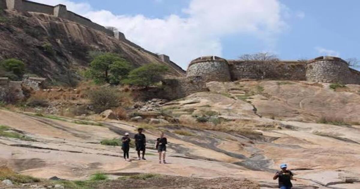
- The trail begins almost immediately with a steep climb over bare granite—no tree cover in this section means full sun exposure; start early
- The lower granite section is the most physically demanding part of the entire trek—steep, open, and requiring careful footing on the smooth rock
- Arrow marks on the rock guide the route; follow them carefully, as there is no formal trail
Stage 2: First Gateway to Second Fort Level (~1.5–2 km | ~45–60 minutes)
- Altitude: ~990 m to ~1,060 m
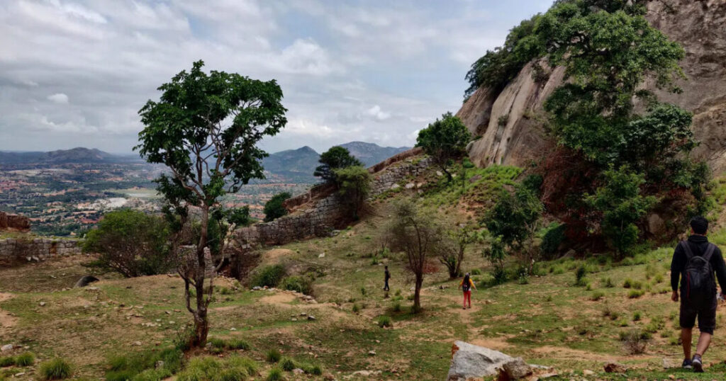
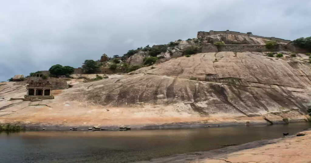
- Above the lower granite section, the trail passes through the first of the fort’s multiple defensive layers—stone archways, crumbling fort walls, and the first views of the surrounding Deccan plateau open here
- The fort’s design becomes visible: multiple concentric layers of defence, each requiring passage through a gateway before the next level begins
- False doors—decoy entrances built to confuse attacking forces—are encountered on this section; one of the most interesting structural elements of the fort’s military design
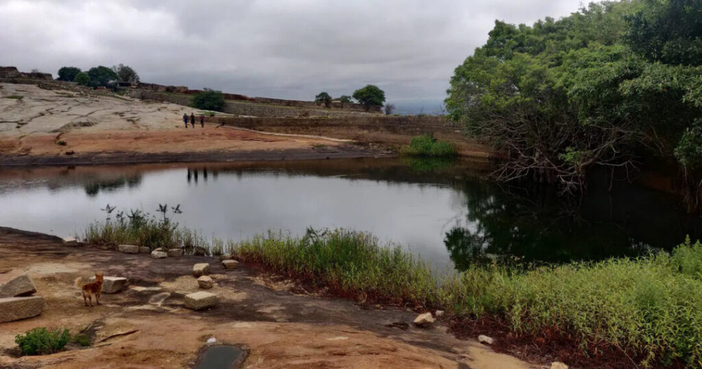
- Rain-harvesting ponds: The first of several ancient water tanks cut into the bedrock appears here; remarkable engineering for a hilltop fort—these ponds collected rainwater and provided the garrison with water during sieges
Stage 3: Second Level to Summit (~1–1.5 km | ~45–60 minutes)
- Altitude: ~1,060 m to ~1,138 m (summit)
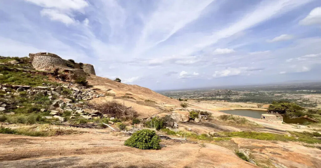
- The final section involves the narrowest and most exposed section of the entire Channarayana Durga trek—a ridgeline traverse to the summit plateau
- The ridge is narrow with drops on both sides; it’s not technically difficult but requires calm movement and care, particularly in wet conditions
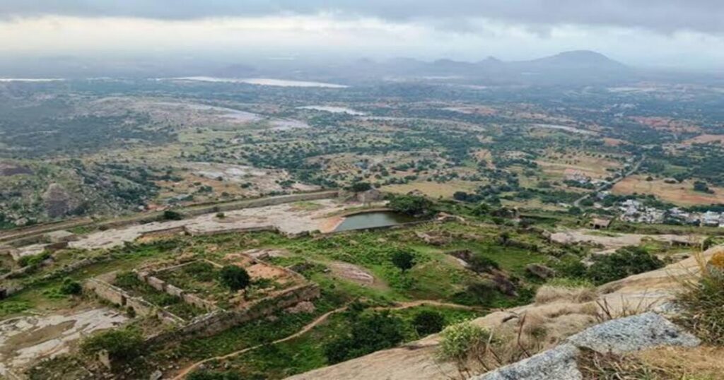
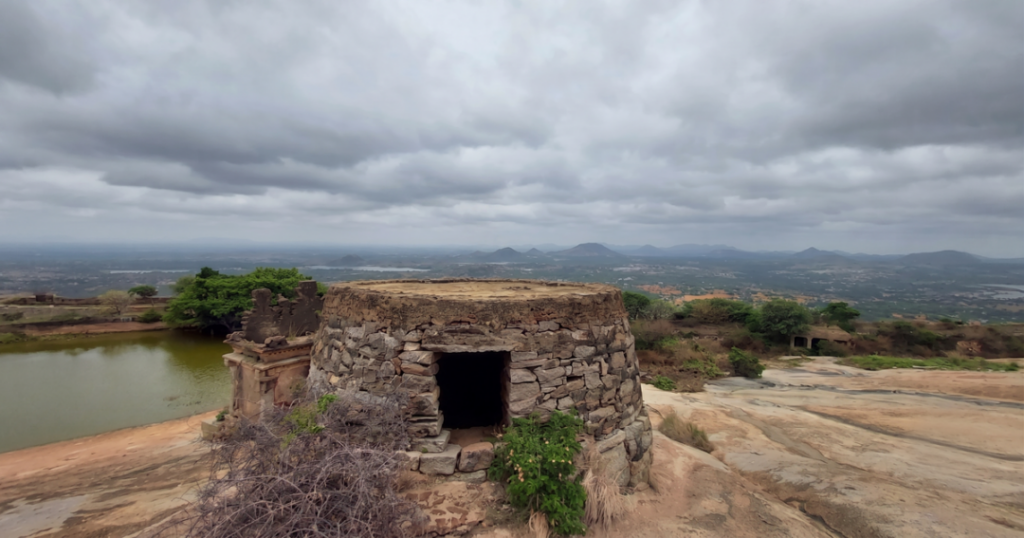
- At the summit: The inner citadel ruins and a small temple occupy the summit plateau. The 360–degree view from the top includes:
- Madhugiri Fort to the south — the massive granite monolith that dominates the local landscape
- Dry Deccan plateau valleys stretching in all directions
- Rolling hillocks and agricultural patchwork of the Tumakuru region
- On clear mornings, the distant outline of the Western Ghats is occasionally visible
Summit exploration: Allow 30–45 minutes at the top to explore the inner citadel ruins, the watchtower remnants, the granaries cut into the bedrock, and the small temple. The summit is flat and open — pleasant for a rest and lunch before the descent.
Stage 4: Descent (Reverse route | ~4–5 km | ~1.5–2 hours)
- The descent follows the same route as the ascent
- The smooth granite sections on the lower part of the descent require particular care—more knee-intensive than the ascent; trekking poles are very helpful here
- Return to the base village by approximately 1:30–2:00 PM
- Drive back to Bengaluru — reach by approximately 5:00–5:30 PM
Also read: Bhrigu Lake Trek: Complete Guide to Trek Distance, Height, Best Time & Packages
Channarayana Durga Trek Entry Fee — What You Need to Know
The Channarayana Durga trek entry fee situation is straightforward: there is no officially designated government-imposed entry fee for the Channarayana Durga trek as of 2025. Unlike some Karnataka forest department treks that require permits and fees, Channarayana Durga does not have a formal permit system.
However, note the following:
- Local nominal charges: Some local authorities or village representatives occasionally collect a small maintenance contribution — typically a nominal amount — from trekkers. This is not a government fee but a community arrangement. If asked, paying this voluntarily is respectful of the local community that maintains access to the hill.
- Guide hire: Villagers at the base can be hired as guides for a negotiated fee. Given that the trail has painted arrow marks but no formal signage, a local guide adds significant value—particularly for first-time visitors.
- Parking: If arriving by private vehicle, a nominal parking charge may be collected at the base village.
- Organized operator packages: If trekking with an organized operator, their package price typically includes any applicable permissions, guide fees, and transport. Verify what is included before booking.
Channarayana Durga Trek Difficulty — An Honest Review
The Channarayana Durga trek’s difficulty is rated moderate—but the specific character of the difficulty is worth understanding before you go.
What is easy:
- The total distance (~4–5 km one way) is manageable for fit beginners
- The altitude (~3,734 ft / 1,138 m) is low enough that altitude sickness is not a concern
- The trail is a half-day commitment—not an overnight or multi-day effort
What is challenging:
- The lower granite section is steep and exposed—no shade, steep gradient, smooth rock requiring careful footing. This is the most physically demanding section and catches many casual trekkers off guard
- No tree cover on the lower section means significant heat exposure in summer and midday
- The ridgeline approach to the summit is narrow and exposed—not technically difficult but requires confidence with exposure
- The smooth granite in wet conditions is genuinely dangerous—the rock becomes extremely slick after rain, and hidden patches of moss make the steep sections prone to slips. Monsoon trekking (June–August) is strongly discouraged.
Who can do it: Anyone with basic fitness who is comfortable walking on uneven terrain and does not have vertigo. Prior trekking experience is helpful but not mandatory. Children and senior trekkers should exercise caution on the lower granite section.
Also read: Anthargange Trek: The Ultimate Guide to Night Trekking, Caves & Camping
Best Time for the Channarayana Durga Trek
| Season | Conditions | Recommended? |
| September to December | Post-monsoon: greenery at its best; water in the fort ponds; clear views, and comfortable temperatures | ✅ Best overall |
| January to February | Cool, dry, clear; the fort ruins most atmospheric in winter light | ✅ Excellent |
| March to May | Hot; no shade on lower granite section makes this exhausting | ⚠️ Manageable with very early start; carry extra water |
| June to August | Monsoon: granite becomes extremely slippery and dangerous on steep sections | ❌ Not recommended |
The single best window is October to December—the post-monsoon vegetation makes the surrounding Deccan landscape vivid green, the fort’s rain-harvesting ponds are full, and the morning temperatures are ideal for the open granite sections.
Practical Tips
Gear List
- Footwear: Trekking shoes with good grip—essential for the lower granite section; sandals or flat-soled shoes are not suitable
- Water: Carry at least 2 litres from the base village—there are no reliable water sources on the trail beyond the base water tank
- Food: Carry snacks and a light lunch — no food available on the trail or at the summit
- Headlamp: If doing a sunrise trek (many operators offer pre-dawn departures), the approach in darkness requires a reliable light
- Sun protection: Hat, sunscreen, and UV sunglasses—the lower granite section is fully exposed
- Trekking poles: Recommended for the descent; the smooth granite is significantly harder on knees without poles
Also read: Bhimashankar Trek: Complete Guide to Ganesh Ghat, Shidi Ghat & Khandas Routes
What to Expect — An Honest Channarayana Durga Trek Review
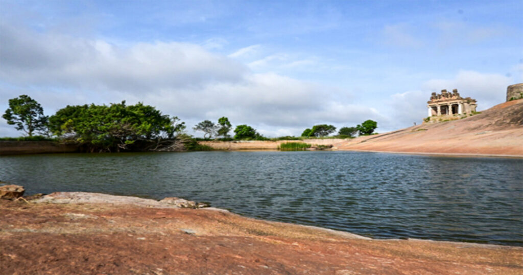
The good: The fort ruins are genuinely atmospheric — false doors, rain-harvesting ponds, granaries in the bedrock, and the inner citadel create a multi-layered historical experience that most weekend fort treks cannot match. The view of Madhugiri Fort from the summit—a massive granite monolith that looms over the landscape—is one of the finest views of any Karnataka fort trek.
The challenge: The lack of tree cover on the lower section makes this a demanding trek in any season other than post-monsoon and winter. The narrow ridgeline at the top requires calm movement. The trail is marked but not formalized—first-time visitors benefit significantly from a local guide.
The overall verdict: Channarayana Durga is one of the most rewarding fort treks within 100 km of Bengaluru — less crowded than Madhugiri, more historically interesting than many of its Navadurga siblings, and entirely accessible as a weekend half-day. It is the kind of fort that makes you want to know what happened here.
Conclusion About Channarayana Durga Trek
The Channarayana Durga trek is the kind of fort trek that rewards trekkers who have moved past the standard Karnataka circuit. It is not the most famous, the highest, or the most dramatic, but it is one of the most honest. The granite is real, the ruins are unrestored, the false doors and bedrock granaries are genuinely from the 17th century, and the view of Madhugiri from the ridgeline is extraordinary.
Quick recap:
- Channarayana Durga height: ~3,734 ft (~1,138 m) | Tumakuru district, Karnataka
- Trek distance: ~4–5 km one way; 8–10 km round trip
- Difficulty: Moderate; lower granite section is steepest; no shade
- Entry fee: No official fee; local nominal charges may apply; guide fee negotiated locally
- Best time: September to February; avoid monsoon (June–August)
- From Bengaluru: ~100 km, ~2.5–3 hours by road
- What to see: Multiple fort layers, false doors, rain-harvesting ponds, bedrock granaries, inner citadel, small temple; 360° views, including Madhugiri Fort
Download the Explurger app to log your Channarayana Durga trek, discover what other trekkers recommend for current trail conditions, and plan your next Karnataka fort adventure.
The granite is already warm in the morning sun. The arrow marks are already on the rocks. Channarayana Durga is ready when you are.
FAQs About Channarayana Durga Trek
2. What is the Channarayana Durga trek distance?
The Channarayana Durga trek distance is approximately 4–5 km one way from the base village to the summit—making the full round trip approximately 8–10 km. The trek takes approximately 4–6 hours total, including summit exploration, making it a comfortable half-day to full-day outing. The trail covers rocky terrain, granite monolith sections, fort gateways, and a final ridgeline approach to the summit.
3. What is the Channarayana Durga trek entry fee?
The Channarayana Durga trek entry fee—as of 2025—is no official government-imposed fee. There is no formal permit system for this trek. However, local village representatives may collect a small nominal maintenance contribution from trekkers, and parking charges may apply at the base village. If trekking with an organized operator, their package typically includes any applicable local charges. Guide hire from the base village is recommended and involves a separately negotiated fee.
4. What is the Channarayana Durga trek difficulty?
The Channarayana Durga trek difficulty is rated moderate — suitable for beginners with basic fitness. The most challenging section is the lower granite face: steep, exposed, with no tree cover and smooth rock requiring careful footing. The ridgeline approach to the summit is narrow and exposed but not technically difficult. The trek is not recommended during monsoon (June–August) when the granite becomes dangerously slippery. Best done in post-monsoon (September–December) or winter (January–February) for the most comfortable conditions.
5. How do I reach Channarayana Durga from Bengaluru?
Channarayana Durga is approximately 100 km from Bengaluru (~2.5–3 hours by road). By private vehicle: take NH75 toward Tumkur, continue to Koratagere, then take a left deviation approximately 2 km before Madhugiri to reach the base village. By public transport: KSRTC buses from Majestic to Pavagada pass through Tumbadi; from Tumbadi, shared autos can be arranged to the base village. Confirm auto availability in advance. Most trekkers depart Bengaluru by 6:00–6:30 AM to reach the base by 9:00 AM.