
267 Total Views
There are treks that give you views, treks that give you temples, and treks that give you both. The Chandrashila trek gives you both and finishes with one of the finest 360-degree Himalayan panoramas accessible on any moderate trek in Uttarakhand.
Chandrashila literally means “Moon Stone” (Chandra = moon, Shila = stone/rock)—a name that comes from the legend that the moon god Chandra spent time here in penance. At approximately 3,690 meters (12,110 ft) according to Wikipedia—with many operator sources citing 4,000 m—it is the summit above the Tungnath Temple, the highest Shiva temple in the world at 3,680 m (12,073 ft). The trek from Chopta (~2,680 m) covers approximately 5 km one way — 3.5 km to Tungnath and a further 1.5 km to the Chandrashila summit. This makes it one of the finest short summit treks in the Indian Himalayas: just enough distance to feel like a proper climb, with a temple at the midpoint and a summit that delivers Nanda Devi, Trishul, Kedarnath, Chaukhamba, and Bandarpunch simultaneously on a clear morning.
This guide covers the complete Chopta, Tungnath, and Chandrashila trek—including the extended Deoriatal circuit—with a full day-by-day itinerary, distances, altitudes, and practical details.
Chandrashila Trek – Key Facts at a Glance
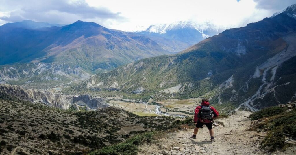
If you’re planning the Chandrashila trek, knowing the essential details beforehand can help you prepare better. From its breathtaking summit elevation to the trek distance, difficulty level, and best time to visit, here’s a quick overview of everything you need to know before starting your adventure.
| Detail | Information |
|---|---|
| Chandrashila Trek Height | ~3,690 m (12,110 ft); often cited as ~4,000 m |
| Tungnath Altitude | 3,680 m (12,073 ft) |
| Meaning of Chandrashila | “Moon Stone” (Chandra = Moon, Shila = Rock) |
| Trek Starting Point | Chopta, Uttarakhand |
| Trek Distance | ~5 km one way (10 km round trip) |
| Duration | 1 day (or 2–3 days with stay) |
| Difficulty Level | Easy to Moderate |
| Nearest Airport | Jolly Grant Airport, Dehradun |
| Nearest Railway Station | Rishikesh |
| Best Time for Chandrashila Trek | April–June & September–November |
The Chandrashila trek is one of Uttarakhand’s most rewarding Himalayan hikes, offering a perfect mix of scenic beauty, spiritual significance, and beginner-friendly trails. Whether you’re trekking to witness the sunrise from the summit or visiting the ancient Tungnath Temple, these key facts will help you plan a safe and memorable journey.
What Makes the Chandrashila Trek Special?
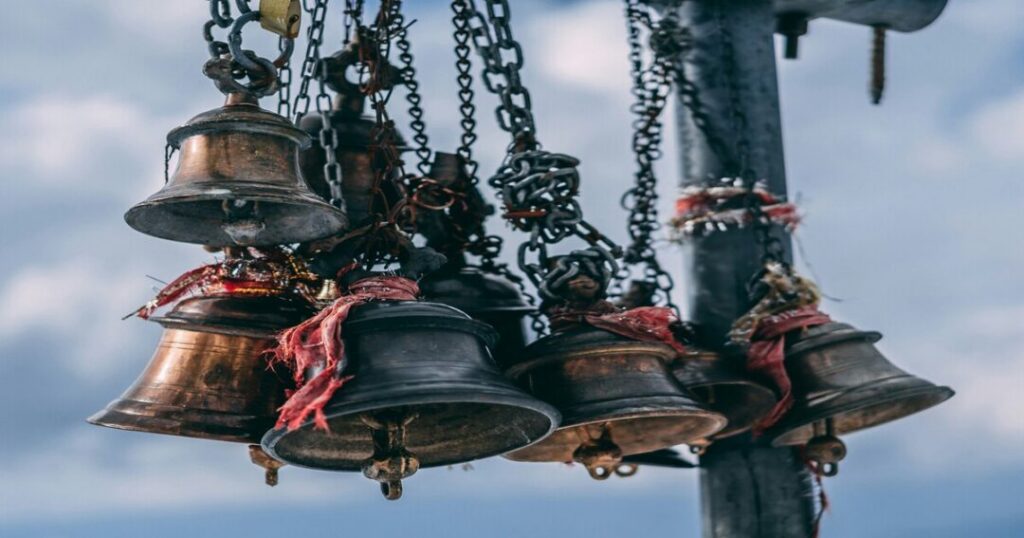
Three things make the Chopta Chandrashila trek genuinely extraordinary:
The world’s highest Shiva temple at the midpoint: The Tungnath Temple at 3,680 m is the highest of the five Panch Kedar temples—an ancient stone structure associated with the Pandavas of the Mahabharata, where the arms of Lord Shiva are said to have appeared when he disappeared into the earth to avoid the Pandavas. The temple is built in the Katyuri architectural style, with multiple subsidiary shrines dedicated to Parvati, the Pandava brothers, Kunti, Draupadi, Ganesha, and Kubera. It is the 3rd Kedar of Panch Kedar, and for pilgrims, reaching it involves a climb through some of the finest Himalayan landscape in Uttarakhand.
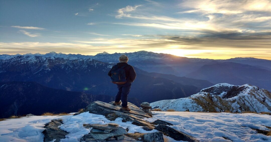
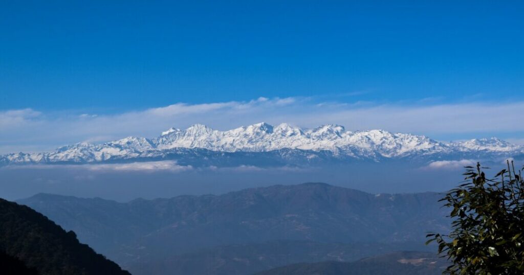
The Chandrashila view: From the summit, the Chandrashila view encompasses Nanda Devi (7,816 m), Trishul (7,120 m), Kedarnath (6,940 m), Chaukhamba (7,138 m), Bandarpunch (6,316 m), Neelkanth (6,596 m), and Panch Chuli—a 360-degree panorama of the Garhwal and Kumaon Himalayan ranges that is among the finest accessible from any moderate trek in India.
The mythological weight: The Chandrashila mountain is one of the few peaks in the Garhwal Himalayas with legends from both the Ramayana and the Puranas; according to tradition, Lord Rama meditated here after defeating Ravana to seek release from the sin of Brahmahatya (killing a Brahmin—Ravana was a Brahmin), and the moon god Chandra is said to have performed penance here, giving the peak its name.
Tungnath Temple — The Heart of the Trek
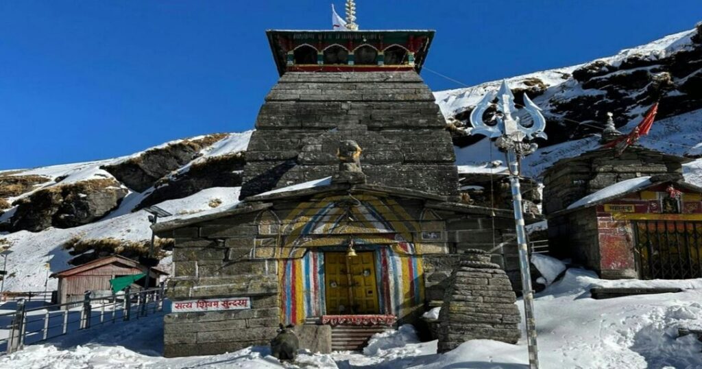
The Tungnath Temple is the finest element of the Chandrashila Tungnath experience and deserves its own section. Wikipedia confirms, “Tungnath Temple is one of the highest Shiva temples in the world and is the highest of the five Panch Kedar temples located in the Rudraprayag district, in the Indian state of Uttarakhand.”
The Panch Kedar and Tungnath’s positions: The Panch Kedar—the five sacred Shiva temples of the Garhwal Himalayas—are Kedarnath, Tungnath, Rudranath, Madhyamaheshwar, and Kalpeshwar. According to the Mahabharata, when the Pandavas sought Lord Shiva to seek forgiveness after the Kurukshetra War, Shiva evaded them by taking the form of a bull and disappearing into the earth at different points — his hump appearing at Kedarnath, his arms at Tungnath, his face at Rudranath, his navel at Madhyamaheshwar, and his hair at Kalpeshwar. Tungnath is the 3rd Kedar.
The Chandrashila temple: Directly at the Chandrashila summit is a small temple where, according to legend, Lord Rama meditated. This is the Chandrashila temple—a compact stone shrine visible from the final approach to the peak. The temple gives the summit a specific sacred quality that is unlike most Himalayan peaks.
Temple timings and season: The Tungnath temple opens each year in late April or early May (dates determined by the priests based on the Hindu calendar) and closes around Diwali (October/November). During winter, the deity is moved to Markandeshwar Temple in Makkumath village, approximately 19 km away. The temple closure also effectively marks the end of the standard Chopta-Tungnath-Chandrashila season for most visitors.
Also read: Rudranath Trek: The Complete Guide to the Most Remote Panch Kedar
How to Reach Chopta for the Chandrashila Trek (Trek Base)?
Chopta is a small meadow settlement in the Rudraprayag district at approximately 2,680 meters—the base for the Chandrashila trek and one of the most accessible high-altitude starting points in Uttarakhand.
From Delhi (~430–450 km | 12–14 hours):
- By road: Delhi → Haridwar/Rishikesh → Devprayag → Rudraprayag → Ukhimath → Chopta
- Most trekkers depart Delhi overnight, reaching Chopta by morning via Rishikesh
From Rishikesh (~220–240 km | 8–9 hours):
- By road via Devprayag, Srinagar (Garhwal), Rudraprayag, Augustmuni, Kund, Ukhimath
- This is the standard route for all Chopta-bound traffic from the plains
By public transport:
- Buses from Rishikesh/Haridwar to Ukhimath/Kund; shared jeeps or taxis from Ukhimath to Chopta (~28 km)
- No direct bus service to Chopta—the last reliable shared transport is typically from Ukhimath
Key logistics note: Chopta has basic guesthouses and dharamshalas—simple accommodation with blankets and basic meals (Maggi, parathas, and chai). Confirm accommodation availability before winter treks when most facilities close.
Chandrashila Trek Itinerary — Full Day-by-Day
Standard 2-Day Itinerary (Chopta base)
Day 1: Arrival at Chopta — Acclimatisation
- Arrive Chopta (~2,680–2,709 m) — by vehicle from Rishikesh/Haridwar
- Short acclimatisation walk through the Chopta bugyal (meadow)—the rhododendron and deodar forest immediately around Chopta is worth exploring even without the summit
- Dinner and overnight at Chopta guesthouse/tent
- Rest well—the next day’s summit push benefits enormously from a good night’s sleep at altitude
About Chopta: The meadows around Chopta are part of the Kedarnath Wildlife Sanctuary—one of the most biodiverse protected areas in the Garhwal Himalayas. The sanctuary is home to musk deer, Himalayan black bears, snow leopards, bharal, and over 240 species of birds—including the Himalayan monal (the state bird of Uttarakhand), koklass pheasant, and various species of finches and warblers.
Day 2: Chopta → Tungnath → Chandrashila → Chopta (Summit Day)
- Pre-dawn start: 4:30–5:00 AM for sunrise at the summit
- Total distance: ~10 km round trip
- Total trekking time: 5–6 hours
Stage 1: Chopta to Tungnath Temple (~3.5 km | ~2–2.5 hours)
- Starting altitude: Chopta ~2,680–2,709 m | Ending altitude: Tungnath ~3,680 m
- The trail begins at the Chopta meadow (~2,680–2,709 m) and immediately enters a dense forest of rhododendron and deodar—the path is a well-maintained stone staircase (thousands of steps have been laid over decades of pilgrimage traffic)
- The rhododendron forest is spectacular in April when the entire canopy turns red; the deodar becomes more prominent as altitude increases
- Approximately halfway, the first views of the Kedarnath range appear above the treeline
- At Tungnath (~3,680 m): temple darshan, photography, rest before the final ascent to Chandrashila. The temple priests (when open) conduct morning puja from approximately 7–8 AM
Stage 2: Tungnath to Chandrashila Summit (~1.5 km | ~45–60 minutes)
- Starting altitude: Tungnath ~3,680 m | Ending altitude: Chandrashila ~3,690 m (Wikipedia) / ~4,000 m (operators)
- The final 1.5 km from the temple to the summit is steep—the gradient increases sharply above the Tungnath plateau; rocky terrain requiring hands in certain sections
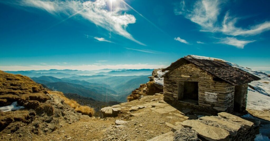
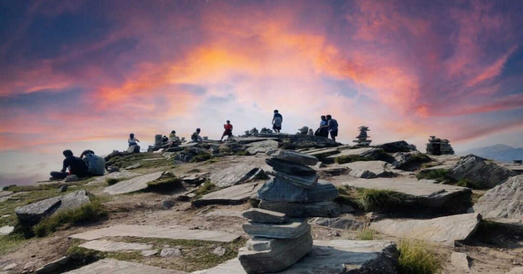
- The trail emerges onto an open ridge with the Chandrashila temple (small stone shrine) at the summit
- The Chandrashila view: On a clear morning, the full 360-degree panorama opens—Nanda Devi, Trishul, Kedarnath, Chaukhamba, Bandarpunch, Neelkanth, Panch Chuli
At the summit:
- No accommodation; no camping permitted at the peak
- Wind at the summit is significant—carry a windproof jacket regardless of lower altitude temperatures
- The best light for photography is at sunrise (4:30–6:00 AM)
Stage 3: Descent — Chandrashila to Chopta (~5 km | ~2–2.5 hours)
- Descent follows the same route
- Take care on the stone steps—wet or frosty steps are a common cause of slips
- Return to Chopta by approximately 9:30–10:30 AM if started pre-dawn
Also read: Chembra Peak: The Complete Trekking Guide to Wayanad’s Highest Peak
Day 3: Chopta → Departure
- Drive back to Rishikesh/Haridwar/Delhi
- For those extending to the Deoriatal circuit—see the dedicated section below
Deoriatal Chandrashila Trek — The Extended Circuit
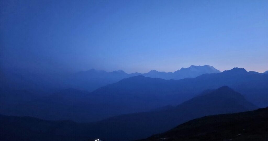
The Deoriatal-Chandrashila trek is the complete circuit that combines Deoriatal lake with the Chopta-Tungnath-Chandrashila route—one of the most satisfying multi-day Himalayan circuits in Uttarakhand.
What Is Deoriatal?
Deoriatal is a high-altitude lake at approximately 2,438 meters (7,999 ft) in Ukhimath tehsil, Rudraprayag district—approximately 3 km from Sari village by trekking trail. The lake is famous for its extraordinary reflection: on clear mornings, the Chaukhamba massif (four peaks of the Gangotri group) reflects perfectly in the still water, creating one of the most photographed Himalayan mirror images in India.
Deoriatal is also one of the finest high-altitude birdwatching destinations in Uttarakhand—the lake and surrounding forest support rare species, including the khalij pheasant, various species of thrush and warbler, and the extremely rare Himalayan owl.
Also read: Bhrigu Lake Trek: Complete Guide to Trek Distance, Height, Best Time & Packages
Deoriatal Chandrashila — Full 4-Day Circuit Itinerary
Day 1: Sari Village → Deoriatal
- Distance: ~3 km | Altitude gain: ~600 m | Time: ~1.5–2 hours
- Depart from Sari village; steep trail through forest to Deoriatal lake (~2,438 m)
- Campsite at the lake edge; evening reflection photography
- Camp: Deoriatal (~2,438 m)
Day 2: Deoriatal → Rohini Bugyal → Chopta
- Distance: ~8–10 km | Time: ~4–5 hours
- The trail from Deoriatal drops into forest before climbing to the Rohini Bugyal—one of the finest alpine meadows in the Chopta-Deoriatal corridor
- Passes through dense rhododendron and mixed forest before emerging at Chopta
- Camp/Night: Chopta (~2,680 m)
Day 3: Chopta → Tungnath → Chandrashila → Chopta
- Summit day as described above
- Return to Chopta for the second night
- Camp/Night: Chopta (~2,680 m)
Day 4: Chopta → Departure
- Drive back via Ukhimath and Rishikesh
Best Time for the Chandrashila Trek
| Season | Conditions | Recommended? |
| April to June | Rhododendron in full bloom (April); clear skies; snow at summit in April; warm days, cold nights | ✅ Best for flowers and clear views |
| July to August | Monsoon; trail slippery; landslide risk on approach roads; mist covers views | ❌ Not recommended |
| September to November | Post-monsoon clarity; best 360° views; autumn colour; Tungnath closes in October/November | ✅ Best for summit panorama |
| December to March (Winter trek) | Snow-covered trail; road to Chopta often closed; requires alternative Deoriatal route; extraordinary winter landscape | ⚠️ Experienced winter trekkers with guide only |
The two best windows:
- April for the rhododendron bloom—the entire approach through Chopta turns red and pink; snow on the summit gives the classic Chandrashila winter look with warm approach conditions
- October for the clearest 360° views — post-monsoon clarity, golden autumn light, and the last weeks before Tungnath closes for winter
Also read: Bhimashankar Trek: Complete Guide to Ganesh Ghat, Shidi Ghat & Khandas Routes
Practical Tips for the Chandrashila Trek – Gear, Fitness & Safety
Gear List
- Footwear: Waterproof trekking boots—the stone steps are wet in early season and icy in winter
- Layers: Down jacket, fleece, thermal base layer, windproof shell—summit temperatures drop sharply
- Trekking poles: Strongly recommended—the steep stone steps on the Chopta-Tungnath section are significantly easier with poles on the descent
- Headlamp: Essential for pre-dawn summit starts
- Sun protection: UV intensity at 3,600+ m is severe even on cold days
Fitness
The Chandrashila trek difficulty is easy to moderate—one of the finest beginner Himalayan treks. The trail has well-maintained stone steps all the way to Tungnath; the 1.5 km from Tungnath to the summit is steeper and requires more effort. No prior Himalayan experience is required, but basic cardiovascular fitness (comfortable walking 8–10 km with elevation gain) is necessary.
Conclusion About Chandrashila Trek
The Chandrashila trek is the perfect meeting of the spiritual and the spectacular—a trail that takes you through rhododendron forest and deodar canopy to the world’s highest Shiva temple and then a final 1.5 km to a summit with one of the finest Himalayan panoramas in India. For distance, effort, and reward, it is among the best-value treks in Uttarakhand.
Quick recap:
- Chandrashila height: ~3,690 m (Wikipedia) / ~4,000 m (operators); summit of Chandranath Parvat
- Chandrashila meaning: “Moon “Stone”—named for the moon god Chandra’s penance here
- Tungnath altitude: 3,680 m — highest Shiva temple in the world; 3rd Panch Kedar
- Trek distance: ~5 km one way (3.5 km Chopta-Tungnath + 1.5 km Tungnath-Summit)
- Difficulty: Easy to Moderate — suitable for beginners
- Chandrashila view: 360° — Nanda Devi, Trishul, Kedarnath, Chaukhamba, Bandarpunch
- Deoriatal circuit: 4 days — Sari → Deoriatal → Rohini Bugyal → Chopta → Chandrashila
- Best time: April (rhododendrons + snow); October (clearest views)
- Base: Chopta (~2,680 m), Rudraprayag district, Uttarakhand
Download the Explurger app to log your Chandrashila trek, discover what other trekkers recommend for current trail and snow conditions, and plan your complete Uttarakhand Himalayan adventure.
The rhododendrons are already flowering on the Chopta trail. The Tungnath bell is already ringing in the wind. The moonstone is waiting.
FAQs About Chandrashila Trek
2. What is the Chandrashila trek distance?
The Chandrashila trek distance from Chopta is approximately 5 km one way: 3.5 km from Chopta to Tungnath Temple, then a further 1.5 km from the temple to the Chandrashila summit. The total round trip is approximately 10 km. Trekking time is approximately 5–6 hours for the full round trip at a comfortable pace. For the extended Deoriatal Chandrashila trek, the total circuit distance is approximately 20–22 km over 3–4 days.
3. What is the Tungnath temple?
Tungnath Temple (3,680 m / 12,073 ft) is the highest Shiva temple in the world and the highest of the five Panch Kedar temples in the Garhwal Himalayas, Rudraprayag district, Uttarakhand. According to the Mahabharata, Lord Shiva's arms appeared here when he disappeared into the earth as a bull to evade the Pandavas. The temple is the 3rd Kedar of Panch Kedar. It opens annually in late April/early May and closes around Diwali (October/November), when the deity is moved to Markandeshwar Temple in Makkumath village (~19 km). The temple is 3.5 km from Chopta and 1.5 km below the Chandrashila summit.
4. What is the Chandrashila view from the summit?
The Chandrashila view from the summit is a 360-degree panorama of the Garhwal and Kumaon Himalayan ranges—one of the finest accessible from any moderate trek in India. Visible peaks include Nanda Devi (7,816 m), Trishul (7,120 m), Kedarnath (6,940 m), Chaukhamba (7,138 m), Bandarpunch (6,316 m), Neelkanth (6,596 m), Panch Chuli, and Dronagiri. On the opposite side, the Garhwal valley spreads below. The best light for the Chandrashila view is at sunrise—requiring a pre-dawn start from Chopta at approximately 4:30–5:00 AM.
5. What is the Deoriatal Chandrashila trek?
The Deoriatal Chandrashila trek is a 4-day circuit combining Deoriatal lake (~2,438 m, ~3 km trek from Sari Village) with the Chopta-Tungnath-Chandrashila route. Day 1: Sari → Deoriatal (~3 km trek from Sari village, Chaukhamba reflection in the lake); Day 2: Deoriatal → Rohini Bugyal → Chopta; Day 3: Chopta → Tungnath → Chandrashila summit → Chopta; Day 4: Departure. The circuit is considered one of the finest multi-day moderate treks in Uttarakhand, combining an extraordinary alpine lake, a high-altitude meadow traverse, the world's highest Shiva temple, and a 360-degree Himalayan summit.
6. What is the best time for the Chopta Chandrashila trek?
The two best windows for the Chopta, Tungnath, and Chandrashila trek are April—the rhododendron forest is in full bloom, snow at the summit gives spectacular conditions, and the Tungnath temple opens for the season; and October—post-monsoon clarity delivers the finest 360° views from the Chandrashila summit before the temple closes for winter. Avoid July–August (monsoon—slippery trails, landslide risk on approach roads). Winter (December–March) is possible for experienced trekkers with guides but requires the alternative Deoriatal approach as the Chopta road closes.