![]()
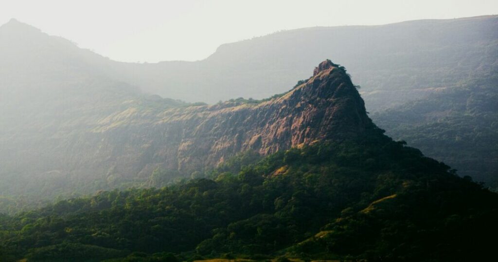
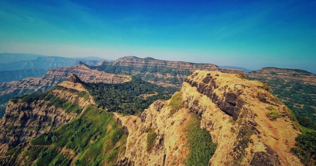
If someone tells you the Kalavantin Durg trek is just another weekend trek near Mumbai, they have either not done it or have a very different definition of “just another.” Kalavantin Durg is a near-vertical rock pinnacle rising to 686 metres (2,250 feet) in the Western Ghats of Raigad district — and the trail to its summit involves climbing ancient rock-cut steps carved directly into the sheer face of the cliff, some of them nearly two feet high, with no railings, no ropes, and a valley drop on both sides. It is not a hike. It is a climb. And the view from the top — the Sahyadri hills spreading in every direction, Prabalgad standing guard to one side, Matheran visible in the distance — is worth every single step.
This guide covers everything: the full route, the rock patches, the Prabalgad combination, camping at Prabalmachi, night trek logistics, and every practical detail you need before you go.
Kalavantin Durg — Key Facts
| Detail | Info |
| Height | 686 m (2,250 ft) above sea level |
| Location | Raigad district, Maharashtra — near Panvel |
| Also known as | Kalavantinicha Sulka, Kelve Teen, Kalavantin Pinnacle |
| Base village | Thakurwadi (also written Thakurvadi) |
| Trek distance | Approximately 3–3.5 km one way from Thakurwadi to summit |
| Trek time | Approximately 3–4 hours one way (including Prabalmachi to summit) |
| Difficulty | Moderate to Difficult |
| Best season | October to February (post-monsoon and winter) |
| District | Raigad, Maharashtra |
| Visible from | Mumbai-Pune Expressway |
Kalavantin Durg — Brief History
The name Kalavantin is believed to derive from a queen — Kalavantin — for whom the pinnacle was built, according to local tradition. Wikipedia notes that “according to local guides, it was built for a queen called Kalavantin in the 15th century, around the same time as the neighbouring Prabalgad.” The structure is generally attributed to the Bahmani Sultanate period — likely constructed around the same time as the adjacent Prabalgad Fort — and served as a watchtower and lookout point rather than a traditional fort. There are no fort walls or structures at the summit, only the rock-cut steps carved into the pinnacle’s face and a small idol of Chhatrapati Shivaji Maharaj at the top. The adjacent Prabalgad Fort was the true fortification; Kalavantin was its sentinel perch.
Durg means fort in Marathi — so Kalavantin Durg literally means Kalavantin’s Fort, named for the queen associated with this dramatic pinnacle. Historical records of her story are sparse and largely oral tradition.
How to Reach Kalavantin Durg
Base village: Thakurwadi (near Panvel, Raigad district)
From Mumbai (~60 km):
- By train: Take a train to Panvel station (Central or Harbour Line); from Panvel ST bus stand, take an ST bus toward Thakurwadi — the journey takes approximately 45 minutes to an hour
- By road: Mumbai → Panvel → Thakurwadi via the old Mumbai-Pune Highway; approximately 1.5–2 hours by car
From Pune (~120 km):
- By road: Pune → Mumbai-Pune Expressway → Panvel exit → Thakurwadi; approximately 2–2.5 hours
From Panvel (~17–20 km):
- ST buses run from Panvel ST bus stand toward Thakurwadi in the morning — verify timings before travelling as they vary seasonally
- Shared autos or private cabs from Panvel to Thakurwadi are also available
Key note: Thakurwadi is the base village. The trek begins from the parking area at the edge of the village. A nominal entry fee is typically collected at the trek entrance for trail maintenance.
Also Read: Harishchandragad Trek: The Complete Guide to Maharashtra’s Most Dramatic Fort Trek
Kalavantin Durg Trek Route — Full Stage Breakdown
Stage 1: Thakurwadi to Prabalmachi Plateau
Distance: Approximately 2.8 km
Time: Approximately 1.5 hours
Difficulty: Easy to Moderate
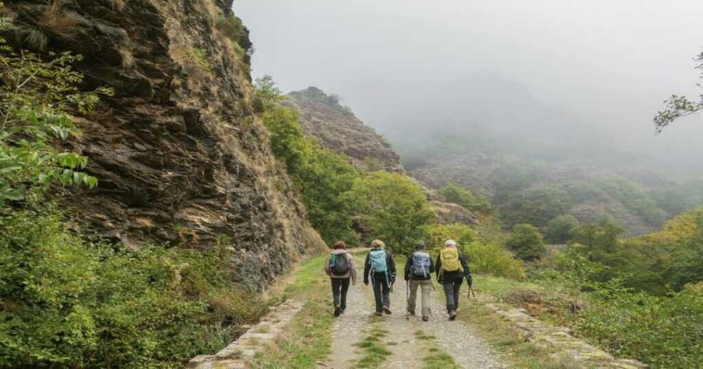
The trek begins at the parking area in Thakurwadi and follows a well-marked trail through the village and into the forest. The path climbs steadily through dense vegetation — a mix of scrub forest and open terrain — with the dramatic outline of the Kalavantin pinnacle coming into view progressively as you gain height. The trail is relatively straightforward on this section, involving no technical climbing.
- The path passes through small sections of the village before entering the forest; follow the painted rock markers and the well-worn trail
- Several small tea and snack stalls operate along the route — particularly useful for the return when energy levels are lower
- Prabalmachi is a small plateau village — this is where trekkers regroup, buy snacks, and where the camping area is located
Stage 2: Prabalmachi to the Base of Kalavantin
Distance: Approximately 630 metres from Prabalmachi
Time: Approximately 30–45 minutes
Difficulty: Moderate
From Prabalmachi, the trail splits: the left path leads toward Kalavantin Durg, the right toward Prabalgad Fort. The Kalavantin trail narrows as it approaches the base of the pinnacle — the terrain becomes rockier and steeper, and the full scale of what you’re about to climb becomes apparent.
- This section is where the dramatic profile of the pinnacle is seen up close for the first time — take a moment to look up at what awaits
- The trail from Prabalmachi to the base of the steps is a gradual but continuous ascent; nothing technical but the ground gets rocky
- Ensure all loose items are secured before beginning the step section
Stage 3: The Rock-Cut Steps — The Heart of the Kalavantin Durg Trek
Distance: ~200–300 metres vertical section
Time: 1–1.5 hours
Difficulty: Difficult
This is the section that defines the Kalavantin Durg trek — ancient rock-cut steps carved at approximately a 60-degree incline directly into the face of the pinnacle. Some steps are nearly two feet (60 cm) high. There are no railings, no fixed ropes, and no safety infrastructure on the standard route. The steps are narrow, the drop on either side is significant, and in wet conditions the rock becomes extremely slippery.
The ascent involves three key sections:
Lower Steps: The initial section of rock-cut stairs — steep from the outset but with slightly more footholds. The trail narrows progressively as you climb.
The Exposed Section: A mid-section where the steps become narrower and the valley drop becomes more visible on both sides. This is where most first-time trekkers pause to assess their comfort level — if heights cause significant anxiety, this is the point to make that call.
Upper Steps to Summit: The final section to the summit — the most exposed and the steepest. The steps here require careful hand and foot placement; three-point contact with the rock at all times is essential.
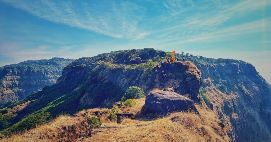
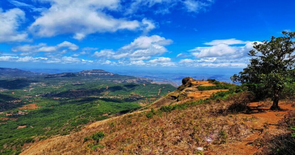
At the summit: A small flat area with a statue of Chhatrapati Shivaji Maharaj, and a 360-degree panorama that includes Prabalgad, Matheran, Irshalgad, Chanderi, Manikgad, and on clear days the Mumbai skyline.
Critical safety note: The descent is significantly more challenging than the ascent — going down steep exposed steps with no railing requires more care than going up. Take your time. Never rush the descent.
Prabalgad and Kalavantin Durg Trek — The Combination
The most rewarding way to experience the area is the Prabalgad and Kalavantin Durg trek combination — a single-day or overnight circuit that covers both the Kalavantin pinnacle and the adjacent Prabalgad Fort.
Prabalgad Fort rises to approximately 700 metres (2,300 feet) — slightly higher than Kalavantin — and is a proper plateau fort with ruins of walls, water cisterns, and a commanding view of the Western Ghats. It was originally built during the Bahmani Sultanate period and later captured by the Marathas under Chhatrapati Shivaji Maharaj. It is reached from Prabalmachi via the right fork at the junction.
The combination route:
- Thakurwadi → Prabalmachi (~2.8 km, approximately 1.5 hrs)
- Prabalmachi → Kalavantin Durg summit and back to Prabalmachi (approximately 2 hours round trip)
- Prabalmachi → Prabalgad Fort summit and back (approximately 2–2.5 hours round trip)
- Prabalmachi → Thakurwadi descent (approximately 1 hour)
Total time for the combination: Approximately 7–9 hours — a long but achievable day for fit trekkers who start early. The alternative is to camp overnight at Prabalmachi and do Kalavantin and Prabalgad across two mornings.
Important: The Prabalgad trail is longer and more sustained but less technically demanding than the Kalavantin steps. Both are worth doing; the combination gives you the full picture of this extraordinary section of the Western Ghats.
Kalavantin Durg Camping — Prabalmachi Overnight
Kalavantin Durg camping is centred on Prabalmachi — the plateau village at the base of both Kalavantin and Prabalgad. This is one of the most rewarding camping experiences near Mumbai.
What to expect:
- Local homestays and basic guesthouses in Prabalmachi village offer simple accommodation — meals (dal-bhat, simple Maharashtrian food) are typically included or available at nominal cost
- Tent camping is possible on the open plateau areas around the village — bring your own tent or check with local organisers
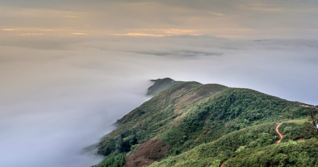
- The sunrise from Prabalmachi, with Kalavantin’s silhouette catching the first light and the valley filled with morning mist, is one of the most photographed scenes in Maharashtra trekking
Logistics:
- Carry sufficient water — the climb to Kalavantin from Prabalmachi in the early morning is the best time for the ascent (cooler, less crowded, better light)
- The village has basic facilities; don’t expect running hot water or charging points
- Mobile signal is limited to absent above Prabalmachi
Kalavantin Durg Night Trek — What You Need to Know
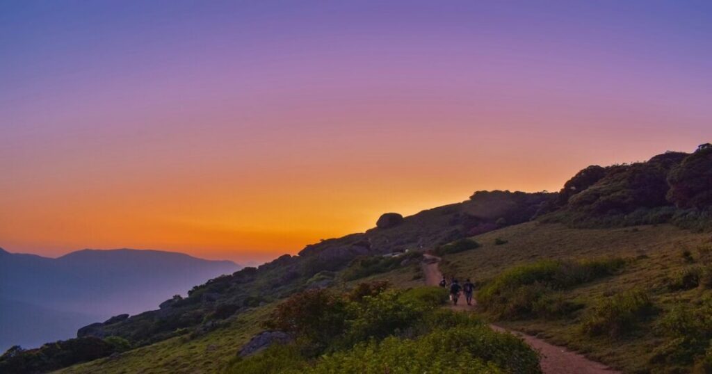
The Kalavantin Durg night trek is one of the most popular night trek experiences from Mumbai — typically a departure in the late night or early pre-dawn hours, reaching Thakurwadi in the early morning, and ascending for a sunrise view from the summit.
The standard approach:
- Depart Mumbai late at night
- Reach the Thakurwadi base in the early hours
- Begin the ascent before dawn to reach the summit for sunrise
- Descend and return to Mumbai by afternoon
Safety considerations for the night trek:
- The rock-cut step section of the Kalavantin Durg trek is significantly more challenging in the dark — headlamps are mandatory, not optional, and batteries must be fresh
- The Thakurwadi to Prabalmachi section is manageable in low light with a headlamp and a group; the step section should ideally be attempted only as dawn breaks and visibility improves
- Wet or dewy steps in the early morning hours are extremely slippery — extra caution is essential
- Going with an experienced local guide for a night trek is strongly recommended, particularly for first-time visitors
- Always inform someone of your itinerary and expected return time before departing
- Note: After a trekker fatality in 2018, the local administration instituted rules requiring registration and restricting entry during dark hours (approximately 5 PM to 6 AM). Always verify current regulations before planning a night trek
What makes it worth it: The Sahyadri hills at dawn from the Kalavantin summit — the valley mist clearing, the sun rising behind the Prabalgad plateau, the silence — is an experience that is genuinely difficult to replicate at any other time of day.
Best Time for the Kalavantin Durg Trek
| Season | Conditions | Recommended? |
| October to February (Post-monsoon & Winter) | Best overall — dry steps, clear views, comfortable temperatures (15–28°C) | ✅ Best |
| March to May (Summer) | Hot, dry; steps are safe but the climb in full sun is tiring | ⚠️ Manageable if starting early |
| June to September (Monsoon) | Hot, dry; steps are safe, but the climb in full sun is tiring | ⚠️ Check current advisories; not recommended for the step section |
Note on monsoon: The area around Prabalmachi is beautiful in monsoon — the greens are extraordinary and camping there in the rains is an experience many trekkers love. However, the rock-cut steps to the Kalavantin Durg summit are genuinely dangerous when wet, and bans on summit access during heavy monsoon periods are enforced and should be respected.
Also Read: Andharban Trek: The Complete Beginner’s Guide to Maharashtra’s Dark Forest
Practical Tips — Gear, Fitness & Booking
Kalavantin Durg Trek Difficulty
The Kalavantin Durg trek is officially rated moderate to difficult — and this rating is accurate. The Thakurwadi to Prabalmachi section is easy to moderate (suitable for most fit walkers); the rock-cut step section to the summit is genuinely difficult and requires:
- Comfort with exposed heights — the valley drops on either side of the narrow steps are significant
- Physical fitness to handle steep, sustained climbing with high steps
- Stable footwear with good grip — worn soles on wet rock are dangerous
- Three-point contact discipline on the exposed sections
Fitness benchmark: You should be comfortable walking 10 km with elevation gain before attempting Kalavantin. Stair climbing and core strength training are particularly relevant preparation.
Gear List
- Footwear: Trekking shoes with a strong grip — mandatory; do not attempt the step section in sandals, flip-flops, or smooth-soled shoes
- Headlamp: Essential for night treks; carry spare batteries
- Water: Minimum 2 litres from Thakurwadi; refill points are limited beyond Prabalmachi
- Snacks: Carry energy food — the combination trek is a full day
- Light layers: Early mornings at Prabalmachi can be cool; a light jacket for October–February
- Rain gear: If visiting in the shoulder season, a light rain jacket is recommended
- First aid: Basic personal kit including blister care and electrolytes
Kalavantin Durg Trek Booking
There is no formal permit required for the Kalavantin Durg trek — it is an open trail accessible from Thakurwadi. A nominal entry fee is typically collected at the trail entrance. However, many trekkers choose to join organised groups for safety, transport, and pre-arranged Prabalmachi accommodation. Check current advisories with local operators before visiting during or immediately after heavy rain — the trail condition changes significantly, and monsoon summit bans may be in effect.
Conclusion About Kalavantin Durg Trek
The Kalavantin Durg trek is one of those experiences that separates the people who say they like trekking from the people who actually do. The view from the top of that pinnacle — after climbing steps that were carved into a sheer cliff face in the 15th century with no railings and no safety net — is earned in a way that few other treks near Mumbai can match.
Quick recap:
- Height: 686 m (2,250 ft)
- Base: Thakurwadi, ~60 km from Mumbai
- Trek distance: ~3–3.5 km one way, 3–4 hours
- Difficulty: Moderate to difficult — 60-degree rock-cut steps, no railings
- Best time: October to February
- Camping: Prabalmachi village — base for both Kalavantin and Prabalgad (~700 m / 2,300 ft)
- Combination: Prabalgad and Kalavantin Durg trek — the best way to experience the full area
Download the Explurger app to log your Kalavantin Durg experience, discover real trekker reports on current trail conditions, and plan your next Western Ghats adventure.
The steps are already carved. The valley is already waiting. The question is when you’re getting on the train to Panvel.
FAQs About Kalavantin Durg Trek
2. How difficult is the Kalavantin Durg trek?
The Kalavantin Durg trek is rated moderate to difficult. The trail from Thakurwadi to Prabalmachi is easy to moderate and manageable for most fit walkers. The rock-cut steps from Prabalmachi to the summit — carved at approximately 60 degrees, some nearly two feet high, with no railings and exposed valley drops on both sides — are genuinely difficult and require comfort with heights and stable footwear. The descent is harder than the ascent. Not suitable for anyone with a significant fear of heights or in poor physical condition.
3. How to reach Kalavantin Durg?
Kalavantin Durg how to reach: The base village is Thakurwadi, approximately 17–20 km from Panvel in Raigad district, Maharashtra. From Mumbai (~60 km): train to Panvel station, then ST bus to Thakurwadi (approximately 45 minutes). From Pune (~120 km): by road via the Mumbai-Pune Expressway to Panvel, then to Thakurwadi. The trek begins at the parking area at the edge of Thakurwadi village.
4. Is there camping at Kalavantin Durg?
Yes — Kalavantin Durg camping is based at Prabalmachi village on the plateau, approximately 2.8 km from Thakurwadi. Local homestays offer basic accommodation with meals; tent camping is also possible on the open plateau. Overnight camping at Prabalmachi allows for an early morning ascent to the Kalavantin summit for sunrise — one of the finest trekking experiences near Mumbai. The camping area also serves as the base for the Prabalgad and Kalavantin Durg trek combination.
5. What is the best time to do the Kalavantin Durg trek?
October to February is the best window — dry steps, clear views, and comfortable temperatures. This is when the Kalavantin Durg trek is safest and most rewarding. Monsoon (June–September) is beautiful around Prabalmachi but the rock-cut steps become dangerously slippery and government bans on summit access may be in effect. Always check current trail advisories before a monsoon-season visit.
6. What is the Prabalgad and Kalavantin Durg trek?
The Prabalgad and Kalavantin Durg trek is the combination circuit covering both the Kalavantin pinnacle (686 m, rock-cut steps to summit) and the adjacent Prabalgad Fort (~700 m / 2,300 ft, plateau fort with historical ruins from the Bahmani Sultanate period) in a single day or overnight trip. Both are reached from Prabalmachi via separate fork trails. The combination takes approximately 7–9 hours for fit trekkers; overnight camping at Prabalmachi is recommended for a more relaxed experience.