
1,593 Total Views
If you want the one Maharashtra trek that gives you everything — a 6th-century fort, a concave cliff that produces circular rainbows, a Shiva linga surrounded by ice-cold water year-round, a 1,431-metre peak, a sacred stepped tank, and a canyon view that makes you question your life choices — the Harishchandragad trek is it. Located in the Ahilyanagar (Ahmednagar) district in the Western Ghats, approximately 218 km from Mumbai and 166 km from Pune, Harishchandragad fort sits at an elevation of approximately 1,424 metres (4,670 feet), with its highest point, Taramati peak, touching 1,431 metres (4,695 feet). It is one of the most complete trekking destinations in Maharashtra — history, architecture, mythology, and raw natural drama packed into a single plateau.
This guide is for trekkers who want the full picture: all routes, exact distances, the Kokankada experience, night trek logistics, and every practical detail before you leave.
Harishchandragad — Brief History & Cultural Significance
The Harishchandragad fort is ancient by any measure. References to Harishchandragad appear in the Matsyapurana, Agnipurana, and Skandapurana — some of Hinduism’s most important ancient scriptures. Its origins are traced to the 6th century CE during the rule of the Kalachuri dynasty. The various caves on the plateau were likely carved out in the 11th century AD, and the carvings on the Harishchandreshwar and Kedareshwar temples indicate strong Shaiva, Shakta, and Naath influences.
The great sage Changdev — revered yogi and author of the Tatvasaar — is said to have meditated here in the 14th century. The fort later came under Mughal control before the Marathas captured it in 1747 AD. Remnants of Microlithic man have been discovered here, making Harishchandragad one of the few sites in Maharashtra with a human habitation record stretching back to prehistory.
Also Read: Andharban Trek: The Complete Beginner’s Guide to Maharashtra’s Dark Forest
Key Facts — Harishchandragad Trek at a Glance
| Detail | Info |
| Fort altitude | ~1,424 m (4,670 ft) |
| Taramati peak altitude | 1,431 m (4,695 ft) — highest point |
| District | Ahilyanagar (Ahmednagar), Maharashtra |
| Distance from Mumbai | ~218 km |
| Distance from Pune | ~166 km |
| Difficulty | Medium to Difficult (route-dependent) |
| Best season | October to February; monsoon for greenery |
| Base villages | Khireshwar, Pachnai, Belpada |
| Trek duration | 1–2 days depending on route |
| Permits | No formal permit required; entry is free |
| Camping | Yes — plateau camping near Harishchandreshwar Temple |
Route Options — Full Harishchandragad Trek Distance Breakdown
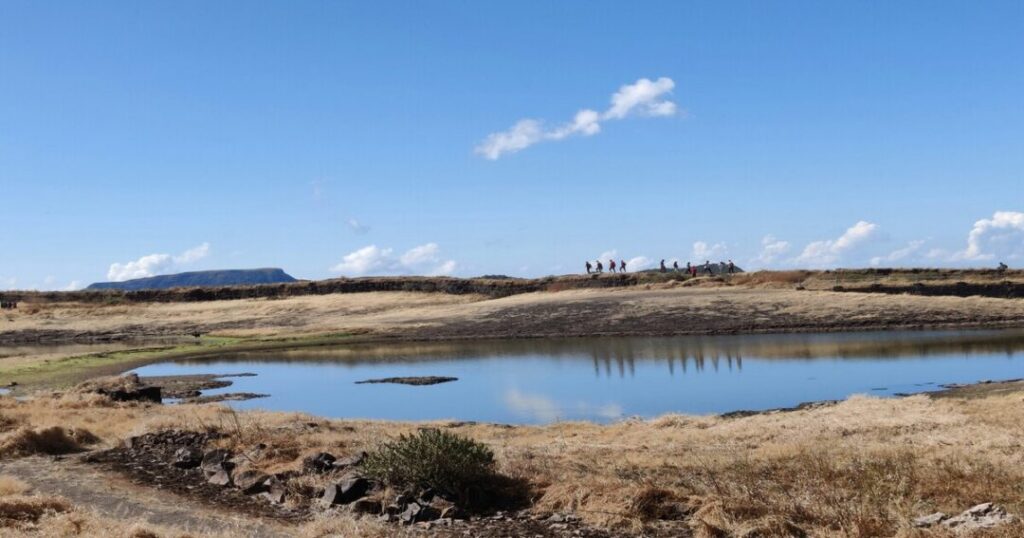
The Harishchandragad fort trek has four main routes, each with a different character, difficulty level, and approach. All routes converge on the fort plateau.
Route 1: Khireshwar Village — The Most Popular Route
Distance: ~7 km one way
Ascent time: 2–3 hours one way (6–7 hours including plateau exploration)
Difficulty: Moderate to Difficult
The Khireshwar route is the most popular and most scenic approach to Harishchandragad — starting from Khireshwar village (~7 km from Malshej Ghat), the trail heads toward Tolar Khind (the saddle between two ridges), then climbs steeply toward the plateau. At Tolar Khind, there is a 100-foot rock patch with iron railings fixed for safety — this is the most technical section of this route and the one that separates casual walkers from trekkers. After the rock patch, the trail flattens into a straight path leading to the Harishchandreshwar Temple.
- Harishchandragad trek distance (Khireshwar): 7 km one way; ~14 km round trip
- The Tolar Khind rock patch is exposed and requires care — wet conditions make it significantly harder
- The trail passes through dense forest with views opening dramatically at the saddle
Route 2: Pachnai Village — The Easiest Route
Distance: ~5 km one way
Time: 3–3.5 hours one way
Difficulty: Easy to Moderate
The Pachnai route is the shortest and easiest approach — a gentler ascent through open terrain with fewer technical sections. It is the recommended route for first-time visitors to Harishchandragad and for Harishchandragad night trek groups where trail navigation in low light requires simplicity.
- Harishchandragad trek distance (Pachnai): 5 km one way; ~10 km round trip
- 3 hours uphill one way — making it viable as a day trek
- The trail is relatively well-marked; it departs directly from Pachnai village
Route 3: Nalichi Vaat — The Most Challenging Route
Distance: ~8–9 km one way
Time: 7–9 hours
Difficulty: Difficult
Nalichi Vaat (meaning “narrow/slippery route” in Marathi) is the most challenging of the standard Harishchandragad trek approaches — a steep, technical trail starting from Belpada village, running parallel to the Kokankada cliff. It involves significant rock scrambling and narrow ridge traverses, recommended only for experienced trekkers with prior scrambling experience.
- Not recommended during or immediately after heavy rain
- Offers the most dramatic approach to the views of the fort
- Rarely crowded — one of the least-used routes to the plateau
Route 4: Sadhale Ghat / Belpada — The Seasonal Route
Distance: ~10 km one way
Difficulty: Moderate to Difficult
The Belpada/Sadhale Ghat route approaches from the northern side and is predominantly used during the post-monsoon season. It is longer than the Pachnai route but less exposed than Nalichi Vaat.
- Best combined with the Khirshwar descent for a traverse experience
- The route passes through some of the most pristine forest sections of the Harishchandragad fort trek
Also Read: Devkund Waterfall Trek: The Complete Guide to Maharashtra’s Secret Waterfall
What to See at Harishchandragad — The Fort’s Four Unmissable Highlights
Kokankada — The Cliff That Defines the Trek
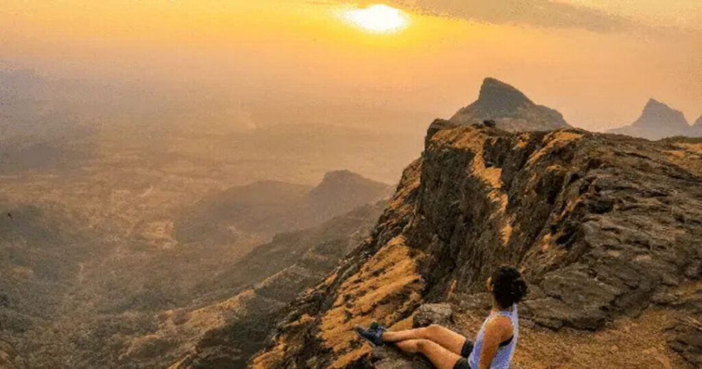
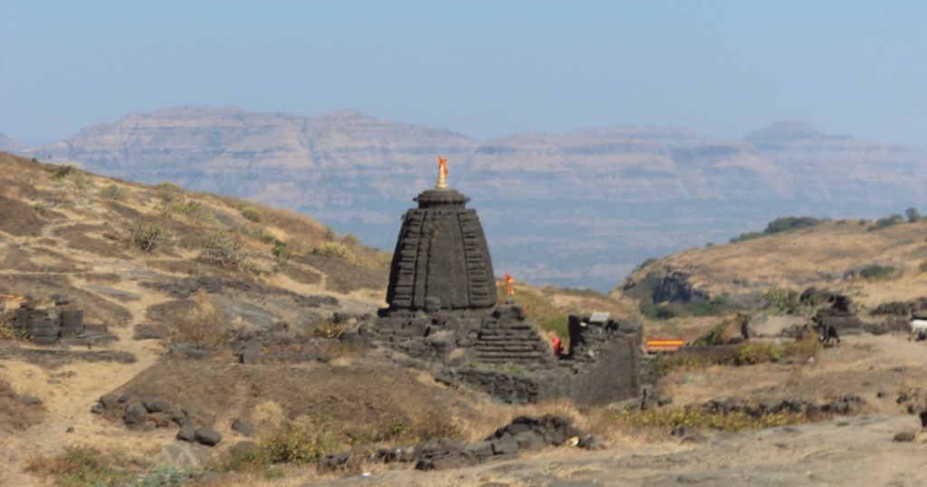
Harishchandragad Kokankada is the defining feature of the entire fort and the single reason most trekkers come. Kada means cliff in Marathi; Konkan refers to the coastal region it faces west toward. Kokankada is a massive concave overhanging cliff — curved inward like a cobra’s hood — that drops vertically for hundreds of feet into the valley below, overlooking the Konkan region. It is one of the most dramatic natural formations in the Western Ghats.
Two remarkable natural phenomena occur at Kokankada:
Brocken Spectre (Indravajra): When there is mist in the valley, and the sun is positioned directly behind the trekker facing the valley, the observer’s shadow is projected onto the clouds, surrounded by a circular rainbow halo. This phenomenon — known scientifically as the Brocken spectre, first observed and described by Johann Silberschlag in 1780 and named after Germany’s Brocken peak — is relatively rare and best observed during early monsoon or post-monsoon with partial cloud cover. Colonel Sykes recorded witnessing it at Kokankada in 1835.
Vertical Cloud Burst: Clouds approaching the cliff from the west get sucked into the concave hollow below and thrown vertically into the sky — rising more than 50 feet (15 m) — creating the striking impression of a wall of cloud rising straight up from the cliff edge without touching the plateau surface.
- Sunset from Kokankada is one of the finest viewpoints in Maharashtra — the sun drops directly into the Konkan horizon
- Do not approach the edge without a firm footing; the overhanging structure means the ground underfoot is not always visible below
- Best visited October–February for clear views; monsoon for the cloud phenomena
Kedareshwar Cave — The Ice-Cold Shiva Linga
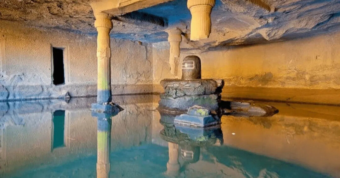
The Kedareshwar cave is one of the most atmospherically powerful sites on the Harishchandragad fort trek. Inside the cave stands a 5-foot Shiva linga — entirely surrounded by ice-cold water year-round. Water seeps into the cave from all four walls continuously. In winter, the water level stays ankle to knee height; in the monsoon, it can rise to waist level, making the cave inaccessible from within. The cave is the origin point of the Mangalganga River.
- Reaching the Shiva linga requires wading through the cold water, regardless of the season
- The cave ceiling is low; the space is cramped, but the atmosphere is extraordinary
- Monsoon access: not possible when the stream outside the cave is in full flow; plan for October–February visits to enter the cave
Saptatirtha Pushkarni — The Sacred Stepped Tank
The Saptatirtha Pushkarni is a constructed sacred stepped tank (pushkarni) located to the east of the Harishchandreshwar Temple — Saptatirtha meaning “seven sacred water bodies or tirthas” in Sanskrit. Along its banks are fourteen small shrines that once housed idols of Lord Vishnu; many of these idols have since been moved to the caves behind the temple for protection. The tank is referenced in the ancient Puranas and is considered sacred by pilgrims visiting the fort.
- The water remains remarkably cold year-round despite being open to the elements
- The area around the tank is the primary Harishchandragad camping zone on the plateau
- The combination of the ancient temple, the stepped tank, and the surrounding rock faces makes this the most serene part of the fort complex
Taramati Peak — The Summit
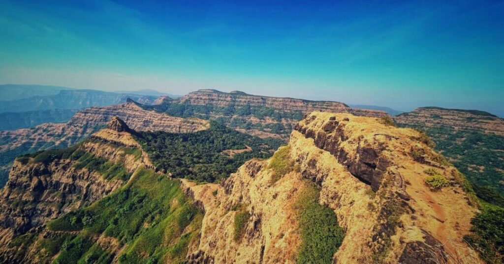
At 1,431 metres (4,695 feet), Taramati is the highest point of Harishchandragad — also known as Taramanchi. From the summit, on clear days, trekkers can see the forts of Alang, Madan, and Kulang; the Kalsubai range; the Naneghat valley; and the lights of Mumbai after dark. Leopards have been spotted in the forests beyond the peak.
- A steep and rocky trail leads from the plateau to the summit — approximately 45 minutes from the temple
- The peak offers the best stargazing on the fort plateau due to its elevation and unobstructed horizon
- Harishchandragad has three peaks: Taramati (highest, 1,431 m), Rohidas, and Harishchandra — though the cliffs named Taramati and Rohidas are not related to the Ayodhya mythology
Harishchandragad Camping — Where to Stay on the Plateau
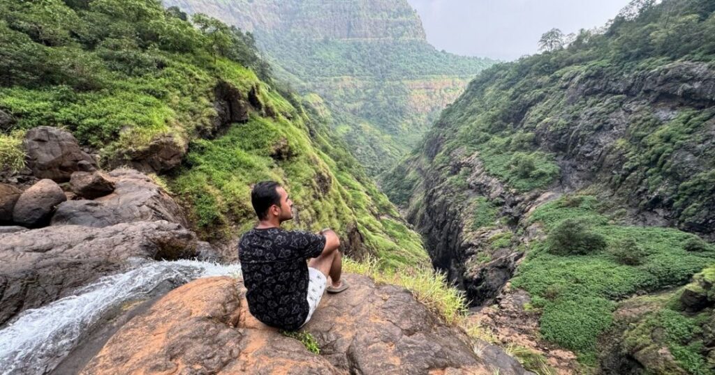
Harishchandragad camping on the plateau is one of the most rewarding experiences on any Maharashtra trek. The primary camping zones are:
- Near Harishchandreshwar Temple: The most popular camping spot — flat ground, proximity to water source (near Kedareshwar Temple), and shelter in the temple’s cave section during rain
- Near Kokankada: More exposed but offers the most dramatic sunset and night sky views
- Inside ancient caves: The plateau has several spacious natural caves at the foot of Taramati peak that have served as trekker shelters for decades; basic but wind-protected
Logistics:
- Local villagers at the plateau (particularly from Pachnai) provide basic meals — pithla-bhakri (gram flour curry with jowar flatbread) is the standard offering
- Tent hire is available through local operators at base villages; bring your own sleeping bag rated to at least 5°C (lower in December–January)
- Water: available near Kedareshwar Temple almost throughout the year — purify before drinking
- No formal infrastructure; carry all waste out
Harishchandragad Night Trek — What You Need to Know
The Harishchandragad night trek is one of the most popular night treks from Mumbai — typically organised as a Friday night departure, arriving at the base by midnight, trekking through the early hours, and reaching the plateau for sunrise. Here is what experienced trekkers need to know:
Route for night treks: The Pachnai route is the standard choice for night treks — shortest, best-marked, fewest technical sections. Nalichi Vaat and Khireshwar routes are not recommended in low visibility.
Logistics:
- Depart base village (Pachnai) by 12–1 AM to reach the plateau by 3–4 AM
- Headlamps with fresh batteries are mandatory — not optional; the trail has no lighting
- Move in groups; the trail is well-worn but disorientation in the dark is a genuine risk without a local guide
- Temperatures on the plateau drop significantly at night — carry an extra fleece layer and windproof jacket even in October
Safety:
- Night treks during or immediately after heavy rain are dangerous — trail becomes slippery and stream crossings are unpredictable
- Inform someone of your itinerary before departing
- No formal permits are required for night trekking but organise with a reputable local operator who knows the trail
The reward: Sunrise from Kokankada or Taramati peak on a clear morning is one of the finest experiences in Maharashtra trekking — the valley fills with light from below, the fog lifts, and the Konkan coast comes into view.
Best Time for the Harishchandragad Trek
| Season | Conditions | Recommended? |
| October to February | Best weather, clear views, accessible cave, cool temperatures (5–20°C) | ✅ Best overall |
| March to May | Hot, dry, reduced water on plateau | ⚠️ Manageable but hot |
| June to September (Monsoon) | Dramatic greenery, waterfalls, Brocken spectre possible | ⚠️ Experienced trekkers only — slippery, streams high |
| December to January | Cold nights (can drop to 3–5°C on plateau), best stargazing, clear views | ✅ Excellent for camping |
Practical Tips — Gear, Fitness & How to Reach
How to Reach Harishchandragad
From Mumbai (~218 km):
- By road: Mumbai → Kasara → Malshej Ghat → Khireshwar/Pachnai (for respective routes)
- By train: Train to Kasara from CSMT or Dadar (Central Line); shared jeeps from Kasara to Khireshwar or Pachnai
- Kasara is the most convenient rail access point; journey from Mumbai ~2.5 hours
From Pune (~166 km):
- By road: Pune → Ahmednagar → Rajur → Khireshwar/Pachnai
- Alternatively, via Malshej Ghat from Pune, the Malshej Ghat road itself is spectacular
- Shared transport available from Rajur to the base villages
Gear List
- Footwear: Waterproof trekking shoes with ankle support — mandatory for the Tolar Khind rock patch on the Khireshwar route
- Layers: Thermal base layer + fleece + windproof shell for October–February nights
- Headlamp: Mandatory for night treks and early morning starts; carry spare batteries
- Water: 2 litres minimum; purification tablets for plateau water
- Trekking poles: Recommended for the Khireshwar route descent and Nalichi Vaat
- Rain gear: Poncho or waterproof jacket for monsoon treks
- First aid: Basic kit; blister care; electrolyte sachets
Fitness Requirement
The Harishchandragad trek difficulty ranges from easy-moderate (Pachnai route) to difficult (Nalichi Vaat). For the Khirwar route — the most commonly used — you should be comfortable walking 12–14 km with a loaded backpack and have experience in rocky terrain. The Tolar Khind rock patch requires basic scrambling confidence. No technical climbing gear is needed for any standard route.
Also Read: Lohagad Trek: The Complete Guide to Routes, Difficulty & Night Trekking
Conclusion About Harishchandragad Trek
The Harishchandragad trek is not a single experience — it is four or five experiences stacked on top of each other. The Kokankada cliff that produces circular rainbows. The Kedareshwar cave, where ice-cold water surrounds a Shiva linga year-round. The Saptatirtha Pushkarni stepped tank, whose banks once held fourteen Vishnu shrines. The Taramati peak at 1,431 m, where you can see Mumbai’s lights from the Western Ghats. And the sunrise, from any point on the plateau, makes the night trek feel like the most sensible decision you ever made.
Quick recap:
- Altitude: ~1,424 m (fort), 1,431 m (Taramati peak)
- Best route: Khireshwar (scenic, 7 km, 2–3 hrs ascent) or Pachnai (easiest, 5 km, 3 hrs)
- Best time: October to February for overall experience; monsoon for drama
- Don’t miss: Kokankada sunset, Kedareshwar cave, Saptatirtha Pushkarni, Taramati summit
- Night trek: Via Pachnai — one of the best night treks from Mumbai
Download the Explurger app to log your Harishchandragad experience, discover real trekker reports on current trail conditions, and plan your next Western Ghats adventure.
The plateau is waiting. The cliff is already facing west. Leave Mumbai on a Friday night and arrive with time for sunrise.
FAQs About Harishchandragad Trek
2. What is the Harishchandragad trek difficulty?
The Harishchandragad trek difficulty is medium to difficult depending on route. The Pachnai route is easy to moderate — suitable for fit beginners. The Khireshwar route is moderate to difficult — the Tolar Khind rock patch requires confident scrambling. Nalichi Vaat is difficult and recommended only for experienced trekkers. Night treks follow the Pachnai route and are accessible for anyone with prior night trekking experience.
3. What is Kokankada at Harishchandragad?
Harishchandragad Kokankada is a massive concave overhanging cliff on the western face of the fort plateau that looks directly over the Konkan region. It is the most iconic feature of Harishchandragad — producing two rare natural phenomena: the Brocken spectre (a circular rainbow formed when sunlight projects the trekker's shadow into misty clouds below, first documented at this site in 1835 by Colonel Sykes) and vertical cloud bursts (clouds sucked into the concave hollow and thrown upward more than 50 feet). Sunset from Kokankada is considered one of the finest views in the Western Ghats.
4. Is Harishchandragad good for camping?
Harishchandragad camping on the plateau is one of the best camping experiences in Maharashtra. The area near the Harishchandreshwar Temple and Saptatirtha Pushkarni stepped tank is the main camping zone. Local villagers provide meals (pithla-bhakri). Tent hire is available at base villages. The plateau has natural caves for wind shelter. The combination of the ancient temple, sacred stepped tank, and Kokankada views at sunrise makes it one of the most rewarding overnight treks from Mumbai.
5. Can you do the Harishchandragad night trek?
Yes — the Harishchandragad night trek is one of the most popular night treks from Mumbai. The standard approach is via the Pachnai route (5 km, 3 hours), departing base at 12–1 AM to reach the plateau for sunrise. Headlamps and warm layers are mandatory. Night treks during or after heavy rain are not recommended. Organise with a local operator who knows the trail; the Pachnai route is well-worn but disorientation without a guide is a genuine risk.
6.What is the Kedareshwar cave at Harishchandragad?
The Kedareshwar cave is one of Harishchandragad's most remarkable sites — a cave temple housing a 5-foot Shiva linga entirely surrounded by ice-cold water year-round. Water seeps continuously from all four walls. The water level stays ankle to knee height in winter and can rise to waist level during monsoon, making the cave inaccessible from within in peak rains. The cave is the origin point of the Mangalganga River and is dated to the 11th century CE based on temple carvings.