

1,514 Total Views
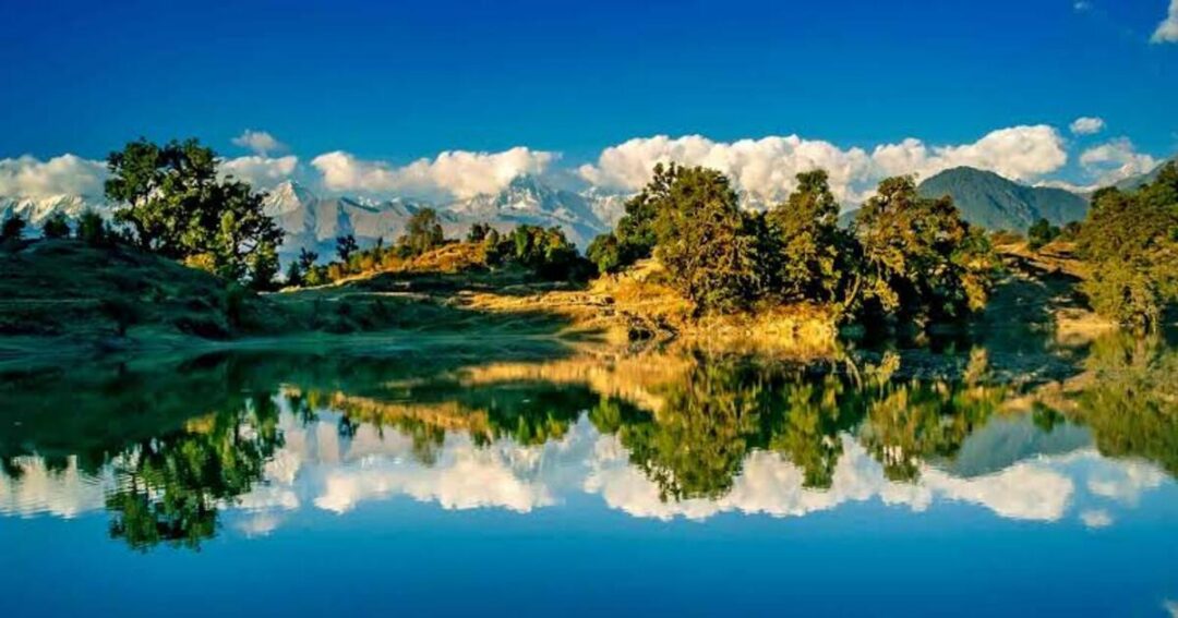
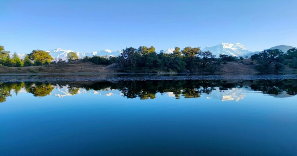
There is a moment — it happens at the lake’s edge, in the early morning, when the water is still and the Chaukhamba massif is reflected in the surface below — when Deoria Tal stops being a trekking destination and becomes something closer to a revelation. The four peaks of the Chaukhamba, rising to 7,138 meters at their highest, are there in the sky and there again in the water, and the forest around the lake is completely quiet, and you understand immediately why this place has been considered sacred since before anyone was keeping records.
Deoria Tal (also written Deoriatal, Devaria Tal, or Deoriya) is a high-altitude freshwater lake at 2,438 meters (7,999 feet) in the Rudraprayag district of Uttarakhand, nestled within the buffer zone of the Kedarnath Wildlife Sanctuary. It lies approximately 3 km from Sari village on the Ukhimath-Chopta road—a short but steep trek through dense oak and rhododendron forest that most fit walkers complete in 1.5 to 2 hours. The lake is the starting point for the complete Deoriatal-Chandrashila trek circuit—one of the finest multi-day Himalayan treks accessible from Delhi.
Deoria Tal Trek: Everything You Need to Know Before You Go
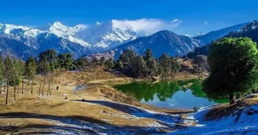
The Deoria Tal Trek is one of Uttarakhand’s most rewarding short hikes, combining an easy trail with spectacular Himalayan scenery. Located in the Rudraprayag district within the Kedarnath Wildlife Sanctuary, the trek begins from the picturesque village of Sari at an altitude of around 2,000 meters. Covering approximately 3 km, it takes about 1.5 to 2 hours to reach the crystal-clear lake, where a 300-degree panorama of the Chaukhamba massif, Nilkantha, Kedar Range, Bandarpunch, and Kalanag awaits. Sitting at an elevation of 2,438 meters (7,999 feet), Deoria Tal is famous for its mirror-like reflections of snow-covered peaks, making it a favorite among trekkers, photographers, and nature lovers. Although camping at the lakeside is currently restricted, the trek remains an ideal destination for beginners seeking a scenic Himalayan adventure.
Deoria Tal Trek at a Glance
| Detail | Information |
|---|---|
| Altitude | 2,438 m (7,999 ft) |
| Starting Point | Sari Village |
| Trek Distance | ~3 km (one way) |
| Duration | 1.5–2 hrs ascent |
| Difficulty | Easy to Moderate |
| Best View | Chaukhamba, Nilkantha & Kedar Range |
| Protected Area | Kedarnath Wildlife Sanctuary |
What Makes Deoria Tal Special?
The Chaukhamba Reflection
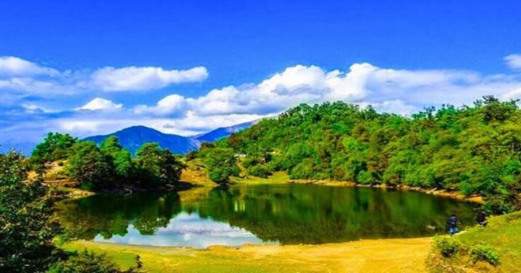
The defining feature of Deoria Tal Lake is its reflection. On clear mornings—typically in October-November and April-May, when the air is cleanest and the visibility greatest—the Chaukhamba massif (four peaks, highest at 7,138 m) appears perfectly inverted in the still surface of the lake. The reflection is so precise and so complete that photographs of it require a moment of reorientation: which is sky and which is water. This quality — the lake as a mirror for the Himalayas — is what has made Deoria Tal one of the most photographed natural features in Uttarakhand and one of the most sought-after locations on the Garhwal trekking circuit.
The 300° panorama from the lake’s edge extends beyond Chaukhamba to include Nilkantha, Bandarpunch, the Kedar Range, and Kalanag—a sweep of the Garhwal Himalayas that few lakes in the region can match at this modest altitude.
The Mythology — Indra Sarovar
Deoria Tal carries one of the richest mythological histories of any lake in the Garhwal Himalayas. According to Hindu tradition, the lake is identified with Indra Sarovar—the lake mentioned in the Puranas where the Devas (gods) bathed. The name “Deoria” derives from “Deva”—”divine” in Sanskrit—and the lake’s clarity and elevation were understood by local tradition as evidence of its divine nature.
The lake is also associated with the Mahabharata’s Yaksha Prashna episode — the famous scene in which a Yaksha (divine spirit) guards a lake and poses philosophical questions to the Pandavas, killing those who drink without answering. It is traditionally held that this confrontation took place at Deoria Tal, where Yudhishthira alone answered correctly and restored his brothers to life. The Omkar Ratneshwar Mahadev temple en route from Sari Village to the lake—an ancient structure dedicated to Nag Devta (the serpent deity)—is an additional sacred site on this approach.
The Wildlife
Deoria Tal lies within the buffer zone of the Kedarnath Wildlife Sanctuary, established in 1972 — one of the most significant protected areas in the Garhwal Himalayas. The forest between Sari village and the lake and the meadows above the lake toward Rohini Bugyal are habitats for
- Musk deer—most commonly spotted in the early morning hours near the lake’s edge
- Himalayan monal (Lophophorus impejanus) — the state bird of Uttarakhand; the iridescent plumage of the male is one of the finest wildlife sightings on the Deoria Tal trail
- Barking deer and sambar in the lower forest sections
- Multiple raptor species and Himalayan birds throughout the forest
Also read: Gaumukh Tapovan Trek: Complete Guide to Uttarakhand’s Most Iconic Himalayan Adventure
How to Reach Deoria Tal — Sari Village?
From Delhi (~415–430 km | 10–12 hours):
- By overnight bus or car to Rishikesh (~250 km from Delhi), then continue to Rudraprayag, Ukhimath, and Sari village
- Most trekkers depart Delhi overnight, reaching Sari by morning
From Rishikesh (~190–225 km | 6–7 hours):
- Road via Devprayag → Rudraprayag → Augustmuni → Kund → Ukhimath → Sari village
- The drive from Ukhimath to Sari village is approximately 12–14 km on a winding mountain road
By public transport:
- Buses from Rishikesh to Rudraprayag; shared taxis from Rudraprayag to Ukhimath; shared jeeps from Ukhimath to Sari village (~12 km)
- No direct public transport to Sari; the last reliable connection is from Ukhimath
From Chopta (~28 km from Sari):
- Sari village is approximately 28 km from Chopta on the Ukhimath-Chopta road—the two are often combined in the same circuit
Deoria Tal Trek — Route & Distance
The Deoria Tal trek from Sari village is one of the most accessible short treks in Uttarakhand:
Stage 1: Sari Village to Deoria Tal (~3 km | ~1.5–2 hours)
- Starting altitude: Sari village ~2,000 m | Ending altitude: Deoria Tal ~2,438 m
- The trail begins at the forest gate at the upper edge of Sari village—a concrete gate where a nominal registration fee and refundable plastic deposit are collected
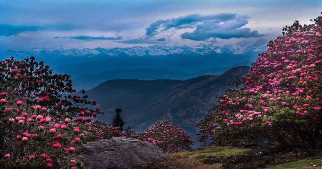
- The path climbs steeply through dense forest of oak (Quercus spp.) and rhododendron—the rhododendron is in full red bloom in April; the oak canopy is cool and green throughout summer
- The trail is well-marked and well-used; no guide required for the standard Sari-to-lake route
- A small Shiva temple appears approximately midway through the forest—a natural resting point and a genuinely atmospheric moment on the climb
- The forest opens abruptly at the lake’s edge—the transition from closed canopy to open lake is sudden and spectacular
At Deoria Tal:
- Allow at least 1–2 hours at the lake—the early morning reflection is at its finest in the first 1–2 hours after sunrise
- Tea and snacks available from small stalls near the lake edge (close at sundown)
- Camping note: Camping directly at the lake is currently not permitted; verify current regulations before planning an overnight at the lake. Forest Rest House accommodation may be available—check in advance with the forest department
Also read: Chandrashila Trek: The Complete Guide to Chopta, Tungnath & the Moon Stone Summit
Deoria Tal Trek: The Complete Day-by-Day Chandrashila Circuit
The Deoriatal-Chandrashila trek is the complete four-day circuit that combines Deoria Tal with the Chopta-Tungnath-Chandrashila route—widely considered one of the finest moderate multi-day treks in the Garhwal Himalayas.
Day 1: Sari Village → Deoria Tal
- Distance: ~3 km | Altitude gain: ~438 m | Trek time: ~1.5–2 hours
- Arrive Sari village; register at the forest gate; begin trek through oak-rhododendron forest
- Reach Deoria Tal by mid-morning; spend 1–2 hours at the lake for the Chaukhamba reflection and panoramic views
- Afternoon: explore the lake’s perimeter; birdwatching in the surrounding forest
- Night: Sari village homestay or Forest Rest House (check camping rules at lake)
Day 2: Deoria Tal → Rohini Bugyal → Chopta
- Distance: ~14–16 km | Trek time: ~7–8 hours
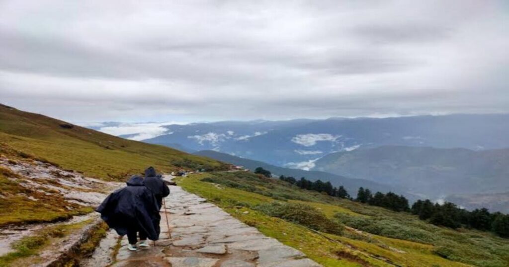
- This is the finest section of the entire Deoriatal Chandrashila trek—the trail climbs from Deoria Tal through progressively opening forest into the Rohini Bugyal (high-altitude meadow), one of the most beautiful alpine grasslands in the Chopta-Deoria corridor
- The Rohini Bugyal section (approximately mid-route) offers unobstructed views of the Kedarnath range and the surrounding peaks; the transition from forest to meadow is one of the most rewarding moments on this trail
- The trail descends from Rohini Bugyal toward Chopta through pine and deodar forest
- Night: Chopta (~2,680–2,709 m) guesthouse or tent
Day 3: Chopta → Tungnath → Chandrashila → Chopta (Summit Day)
- Distance: ~10 km round trip | Trek time: ~5–6 hours
- Pre-dawn start: 4:30–5:00 AM for sunrise at Chandrashila summit
- Trail climbs 3.5 km from Chopta through rhododendron and deodar forest to Tungnath Temple (3,680 m)—the highest Shiva temple in the world and the 3rd Panch Kedar (though some traditions list it as the 2nd; sequence varies)
- From Tungnath, a further 1.5 km steep ascent to Chandrashila summit (~3,690 m per Wikipedia)
- The view: Nanda Devi, Trishul, Kedarnath, Chaukhamba, Bandarpunch, Neelkanth in a 360° panorama
- Descend to Chopta by late morning
- Night: Chopta
Day 4: Chopta → Departure
- Drive back to Rishikesh/Haridwar/Delhi via Ukhimath
- Optional: extend with a visit to Kartik Swami Temple (~2 hours from Chopta) for an additional panoramic viewpoint
Deoria Tal in Winter — The Frozen Mirror
The Deoria Tal winter experience is entirely different from the summer or autumn visit—and, for the right trekker, entirely superior.
From November to March, Deoria Tal and the surrounding forest are covered in snow. The lake partially or fully freezes—the surface becomes a sheet of white, the forest a monochrome of snow-laden branches, and the Chaukhamba massif above takes on a starkness and intensity that the green months cannot match. Winter sunrise at the lake—the snow-covered Himalayas turning from steel-blue to gold to white in the first light—is one of the finest photography experiences in the Garhwal region.
What to expect trekking to Deoria Tal in winter:
- The Sari-to-lake trail is snow-covered from approximately December through February; microspikes or crampons are strongly recommended
- The trail is steeper and more demanding in snow—what takes 1.5 hours in summer can take 2.5–3 hours in deep snow
- Temperature: Sub-zero at the lake level from December–February; wind chill makes it significantly colder
- The village of Sari remains accessible by road in most winters—the road to Sari is fully blacktop and generally passable; heavy snowfall can temporarily block it
- The forest rest house and Sari village homestays remain open through winter; advance booking essential
Chopta in winter: The road to Chopta frequently closes due to snowfall from December to February. The Deoriatal Chandrashila winter trek is therefore most commonly done via the Sari route (entering from the Deoria Tal side rather than the Chopta side) when the Chopta road is blocked. Verify road conditions before departure.
Best months for Deoria Tal in winter: October–November (post-monsoon clarity + first snow at higher elevations—the finest combination) and March (winter snow still at the lake level but road access reliably open).
Also read: Dayara Bugyal Trek: Where the Himalayas Open Into Endless Green Meadows
Best Time to Visit Deoria Tal
| Season | Conditions | Best For |
| April to June | Rhododendron in bloom (April); green forest; clear morning views; 10–22°C at lake | ✅ Best for flowers and green landscape |
| July to August | Monsoon, leeches on trail, mist covers peaks, Chaukhamba reflection rarely visible | ❌ Not recommended |
| September to November | Post-monsoon clarity; finest Chaukhamba reflection; autumn colour begins; October is peak | ✅ Best overall — finest photography conditions |
| December to March | Snow, lake freezes, extraordinary winter landscape, microspikes essential | ✅ For experienced winter trekkers; road conditions variable |
The single best window is October—post-monsoon clarity delivers the sharpest Chaukhamba reflection, the autumn color in the surrounding forest is at its most vivid, and the trail conditions are ideal.
Also read: Places to Visit in Uttarakhand: 12 Stunning Destinations for Every Traveller
Practical Tips for the Deoria Tal Trek
Gear list:
- Trekking shoes with good grip (trail is steep with tree roots)
- Layers—the lake level is significantly cooler than Sari village
- Water bottle — fill at Sari village; limited sources on the trail
- Camera with wide-angle lens — the reflection requires the widest frame you have
- Winter additions: Microspikes/crampons, insulated jacket, thermal base layers, balaclava
Photography tips:
- Arrive at the lake by 6:30–7:00 AM for the finest reflection light
- The reflection is best when the wind is completely still—typically for the first 1–2 hours after sunrise
- Bring a graduated ND filter if shooting the reflection with the sky—the contrast between water and mountain is extreme
Permits and registration:
- Registration is compulsory at the forest gate at Sari village; a nominal fee and refundable plastic deposit are collected
- Verify current camping rules before planning an overnight at the lake—rules have changed and continue to evolve
Conclusion About Deoria Tal
Deoria Tal is not a difficult trek. It is not a high-altitude challenge. It is not an adventure of physical extremity. It is something more specific and harder to describe: a walk through a rhododendron forest to the edge of a lake that reflects the Himalayas, at an altitude where the air is clean and the morning is quiet and the mountains are large enough to make everything else feel appropriately small.
Quick recap:
- Altitude: 2,438 m (7,999 ft) — Rudraprayag district, Garhwal Himalayas
- Deoria Tal trek distance: ~3 km from Sari village; ~1.5–2 hours uphill
- Difficulty: Easy to moderate; suitable for beginners
- Best months: October (finest reflection), April (rhododendron bloom)
- Deoria Tal in winter: Partial/full freeze from December; microspikes required; extraordinary landscape
- Panorama: 300° — Chaukhamba (7,138 m), Nilkantha, Bandarpunch, Kedar Range, Kalanag
- Deoriatal Chandrashila circuit: 4 days — Sari → Deoria Tal → Rohini Bugyal → Chopta → Tungnath (3,680 m) → Chandrashila (~3,690 m) → departure
- Mythology: Indra Sarovar; Devas bathed here; Yaksha-Pandava Mahabharata episode
Download the Explurger app to discover what Deoria Tal trekkers actually recommend for current trail and reflection conditions, find the best Sari village homestays, and log every Chaukhamba reflection, snow-covered trail, and silent morning at the lake’s edge.
The lake is already still. The Chaukhamba is already reflected. The forest gate at Sari village is already open. Deoria Tal is waiting.
FAQs About Deoria Tal
2. What is the Deoria Tal altitude?
Deoria Tal is situated at an altitude of 2,438 meters (7,999 feet) above sea level in the Rudraprayag district of Uttarakhand. The lake lies within the buffer zone of the Kedarnath Wildlife Sanctuary in the Garhwal Himalayas. The starting point at Sari Village is at approximately 2,000 meters (6,600 feet).
3. What peaks are reflected in Deoria Tal?
Deoria Tal lake is famous for its reflection of the Chaukhamba massif—four peaks whose highest point reaches 7,138 meters. The lake offers a 300° panorama that also includes Nilkantha, Bandarpunch, the Kedar Range, and Kalanag. The Chaukhamba reflection is most clearly visible on still, clear mornings—typically in October-November and April-May.
4. What is the Deoriatal Chandrashila trek?
The Deoriatal Chandrashila trek is a 4-day circuit combining Deoria Tal with the Chopta-Tungnath-Chandrashila route: Day 1 (Sari → Deoria Tal), Day 2 (Deoria Tal → Rohini Bugyal → Chopta), Day 3 (Chopta → Tungnath temple 3,680 m → Chandrashila summit ~3,690 m → back to Chopta), and Day 4 (departure). The circuit is one of the finest moderate multi-day treks in Uttarakhand—combining a mirror lake, an alpine meadow traverse, the world's highest Shiva temple, and a 360° Himalayan summit.
5. What is Deoria Tal like in winter?
Deoria Tal in winter (November–March) is snow-covered, and the lake partially or fully freezes—the winter experience is an entirely different and, for many trekkers, more spectacular visit than the summer one. The snow-covered Chaukhamba massif reflected in the partly frozen lake surface is one of the finest winter photography subjects in Uttarakhand. Key considerations: the trail requires microspikes from December to February; temperature at the lake is sub-zero; the Sari village road is generally passable in most winters (fully blacktop); the Chopta road frequently closes from December to February. October-November and March are the finest winter-adjacent windows: first snow at altitude with reliable road access.